A full -wise forum, helping the entire chain satellite industry cluster landing crane wall
Author:Dahe Cai Cube Time:2022.09.27
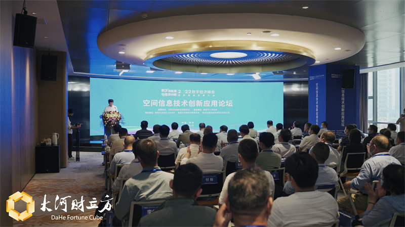
[Dahe Daily · Dahecai Cube] (Reporter Duan Weituo Intern Li Bo Photography) On the afternoon of September 27, the 2022 Digital Economic Summit and New Infrastructure Innovation Development Conference Space Information Technology Innovation Application Forum was held in Zhengzhou, focusing on space information technology Application to explore the new future of the digital economy.
The reporter learned that the forum was directed by the Henan Provincial Development and Reform Commission, hosted by the People's Government of Hebi City, and hosted by the People's Government of Qibin District, Hebi City, Hebi Development and Reform Commission, and Aerospace Hongu Information Technology Co., Ltd. The forum is committed to integrating the development concepts of innovation, green, openness, and sharing into the development process of the industrialization of satellite application, sharing results and experience with experts, scholars and enterprise representatives, and discussed new results, new theories, and new practice.

【on site】
A spatial information forum, full of wisdom content
Wang Jiayao, academician of the Chinese Academy of Engineering, Dean of the Henan Time and Space Big Data Industry Technology Research Institute, Yue Qingrui, academician of the Chinese Academy of Engineering, Dean of Urbanization and Urban Safety Research Institute of Beijing University of Science and Technology, and Song Chao Zhi, Chairman of the Chinese Institute of Surveying and Mapping, The field forum contributes wisdom.

The reporter learned that Wang Jiayao has been engaged in the theoretical research and technology development of independent controllable geographical information system for a long time. In terms of the "space -time big data platform", a series of technical problems have been exceeded, which effectively improves the modern level of urban management and governance. He said that the digital economy is a very extensive concept. It is an economy with numbers as the core and key elements. It is also a digital transformation of the traditional agricultural economy and industrial economy.
Yue Qingrui is a top expert in my country's engineering structure and urban public safety. He presided over more than 10 national R & D projects, compiled more than 20 industry standards, and obtained it Achievement. At the event, he shared how to strengthen digital empowerment and build tough cities through the form of video connection.
Song Chaozhi is committed to the development of the surveying and mapping industry and the geographical information industry, and has witnessed the development of the surveying and mapping industry since the reform and opening up. He said that Hebi can stand out in the field of satellite industry. Thanks to the good local digital economy industry foundation in Hebi, and thanks to the implementation of a number of industry head enterprises including aerospace macro maps, it has formed a strong power that attracts the landing of the satellite industry chain to land. magnetic field. "The Chinese Society of Surveying and Mapping continues to play a platform for scientific and technological innovation and academic exchanges to support the forum to run the characteristics."
【develop】
"One Constellation Two Center and Two Bases",
Hebi City wants to build a full -chain satellite industry cluster
"Recently, the Provincial Development and Reform Commission has issued the" Henan Provincial Satellite Industry Development Plan ", which supports the full -chain satellite industry cluster with the support of the construction of the construction of the two centers, two centers and the two bases, and satellite operation and application services to the whole country. It brings more opportunities for the development of Hebi. "Feng Fangxi, deputy secretary of the Hebi Municipal Party Committee, introduced that in recent years, under the strong leadership of the Provincial Party Committee and the Provincial Government, Hebi has grasped The new round of technological revolution and industrial change opportunities, actively cultivate the spatial geographical information industry chain, ecological chain, value chain, and introduced the implementation opinions of the development of geographical information and satellite remote sensing industry. Aerospace Hongtu Central Headquarters is built and operated, and the nation's first spatial geographical information and 5G fusion application experimental area jointly constructed with the Chinese Society of Surveying and Mapping is accelerating construction. Especially with the "Central Plains No. 1" and "Hebi 1, 2, and 3" satellite network that is about to launch, a faster, wider, more refined, and more efficient remote sensing satellite network will be completed in the crane wall. It will inject stronger momentum, expand wider space, and achieve greater progress into the development of the geographical information industry of Hebi.

Why does the space macro picture choose "holding hands" Hebi?
Aerospace macro is repeatedly mentioned at this forum.
Aerospace Hongu Information Technology Co., Ltd. is the leading domestic satellite operation and application service provider. It is the only remote sensing application company in the first batch of science and technology board listed companies. It is headquartered in Beijing. The company chose to set up the Central Headquarters in Hebi, which undoubtedly became a "accelerator" that boosted the rapid development of the Hebi satellite industry.
Why does the space macro picture choose "holding hands" Hebi?
Wang Yuxiang, chairman of Aerospace Hongu Information Technology Co., Ltd., said that Aerospace Hongu is one of the most developed private enterprises in the field of remote sensing. It actively responds to the country's work deployment and the development strategy of the digital economy has accelerated the safety monitoring The process of emergency and satellite application technology has achieved preliminary results.
On August 13, the Aerospace Hong Kong Map was established and established the Henan Aerospace Hongu Satellite Industry Research Institute to create a good start for the development of the satellite industry in Hebi City and even Henan Province. It is based on the advantages of Hebi's existing industrial advantages, surrounded by satellite manufacturing, operations and operations and operations and operations. The application industry has expanded a group of leading technology, products, and enterprises to form a certain scale of satellite industry clusters; the smart system for comprehensive emergency monitoring and early warning of urban urban comprehensive emergency monitoring and early warning system will take emergency management, water conservancy, ecological environment, and natural resources. , Forestry, Agriculture and Rural, Housing and Construction, etc., uniformly until the empty world to perceive the space -time big data integrated platform, and provide the government with scientific and effective dynamic data decision support.
"In the future, we will also lay out the upper and lower reaches of the whole industry ecology of the satellite remote sensing in Henan, integrate the advantages of the province in Henan, form a full chain The satellite industry ecosystems with complete talent training and financial services will be further developed and expanded to the satellite industry cluster. "Wang Yuxiang said that there is the following layout plan: First, the first batch of 4 radar remote sensing satellites was launched in the first quarter of 2023, and 4 will be 4 A radar remote sensing satellite name is "Central Plains No. 1", "Hebi No. 1", "Hebi No. 2", "Hebi No. 3"; the second is to build a satellite production and research and development base to achieve the design, simulation, integration, and test of satellite and key equipment. Carry out the research and development of card neck technology and product; the third is to build a satellite ground operation center, service and promotion center to achieve large -scale satellite real -time independent measurement and control, data receiving, processing and application service promotion; Satellite application demonstration scenarios in the fields of emergency management, water conservancy, natural resources, ecological environment, agricultural and rural areas and other fields have been promoted to the entire province of Henan to provide support for social governance, emergency disaster relief, urban management, and rural revitalization. 【release】
Focusing on the geographical information and satellite remote sensing industry around surveying and mapping,
Hebi determines 12 key tasks
The "Henan Provincial Satellite Industry Development Plan" mentioned that by 2025, the scale of the satellite industry in the province will reach 20 billion yuan, and the operating income of related industries such as surveying and mapping geographical information will exceed 100 billion yuan, which has initially formed a satellite manufacturing, application services, research and development innovation innovation Industrial system. By 2035, a new type of infrastructure of satellite constellations and satellite measurement and control and operation services with global service capabilities will be established, and the comprehensive strength of satellite and application industry will be ahead. The "Planning" proposes to promote Zhengzhou and Hebi to build a full -chain satellite industry cluster, support Luoyang, Xinxiang, Xinyang and other cities to strengthen satellite manufacturing supporting industries, encourage differentiated development of satellite application industries in various places, form a "2+N" satellite industry development pattern.
In this regard, what plan is the next step in Hebi City?
At the forum, the "Implementation Opinions of the People's Government of Hebi City on Further Promoting the Development of Geographical Information and Satellite Remote Sensing Industry" was officially released. Claiming around the surveying and mapping geographical information and satellite remote sensing industry, Hebi determined 12 key tasks.
The reporter learned that these 12 tasks are: promoting the construction of spatial geographical information and 5G fusion applications, accelerating the development of aerospace remote sensing technology and applications, promoting geographical information of surveying and mapping+5G deep integration development and application, vigorously develop satellite navigation and location services , Create a distinctive application scenario of the remote sensing satellite industry, consolidate the new type of smart crane wall time and space big data foundation, continue to promote the development of geographical information related to surveying and mapping geographical information, and build a multi -level natural resource survey and regulatory capacity of the cooperation operation of skylands, enrich the geographical information data of surveying and mapping geographic information Resources, continuous promotion of the opening and sharing of geographical information resources of surveying and mapping, promoting the innovation of geographical information of surveying and mapping, and establishing a working mechanism for the development of remote sensing satellites and application industry.
Among them, in terms of accelerating the development of aerospace remote sensing technology and applications, Hebi proposed that in accordance with the development of the era of big data, make full use of the booming aerospace and aviation -to -site observation systems, to use the industrial advantages of cranes in satellite remote sensing, drone surveying and mapping, and cultivate to cultivate to cultivate to cultivate to cultivate to cultivate. Develop the city's new types of multi -source aerospace and aviation remote sensing equipment, data acquisition, processing, processing and service industry. Focusing on the core technical link of remote sensing satellite manufacturing and manufacturing, innovation carriers such as equipment research and development centers, production assembly centers, industrial research institutes, and joint laboratories are created. Establish a promotion mechanism for satellite remote sensing application, accelerate the development and application system of satellite remote sensing application technology, and promote the widely used application of satellite remote sensing data. Study and build a low -altitude digital image acquisition and processing system with various drones as the platform.
In terms of building a distinctive application scenario of the remote sensing satellite industry, Hebi is clear, implementing the "satellite+" demonstration application project, and drives satellites in innovative applications such as emergency management, water conservancy flood prevention, ecological environment, forestry, agriculture and rural areas, housing and urban and rural construction industries Essence Carry out the application exploration of emergency disaster types and large areas, including natural resources, forest fire prevention, urban and rural construction, water conservancy, and geological disasters, and drive satellite applications to develop in various fields.
At the event site, Hebi City and related parts jointly released the smart system for comprehensive emergency monitoring and early warning of urban. Lu Xiaoping, a professor at Henan University of Technology, Wei Zheng, Secretary -General and Researcher of the China Remote Sensing Applied Association, Wang Dacheng, senior engineer of the National Remote Sensing Application Engineering Technology Research Center, and Guo Liang, experts from the State Council ’s first national natural disaster comprehensive risk census leadership group office The main report; Yang Zhengjun, vice president of Aerospace Hongu Information Technology Co., Ltd. shared the exploration of the application practice of aerospace macro maps in the application of the satellite remote sensing industry.
Responsible editor: Wang Shidan | Audit: Li Zhen | Director: Wan Junwei
- END -
Wei Xiao, who is "anxious", bets on the "summer file"

Author | Salad sauceOn the evening of June 15, Weilai released a new product -medi...
Agricultural issuance Shandong Branch held a mobilization deployment meeting to serve the economic market for a hundred -day tackling activity

Agricultural issuance Shandong Branch held a mobilization deployment meeting to se...