Just now, there is a big plan for Xinjiang and Tibet!
Author:Earth Knowledge Bureau Time:2022.07.13
(⊙_⊙)
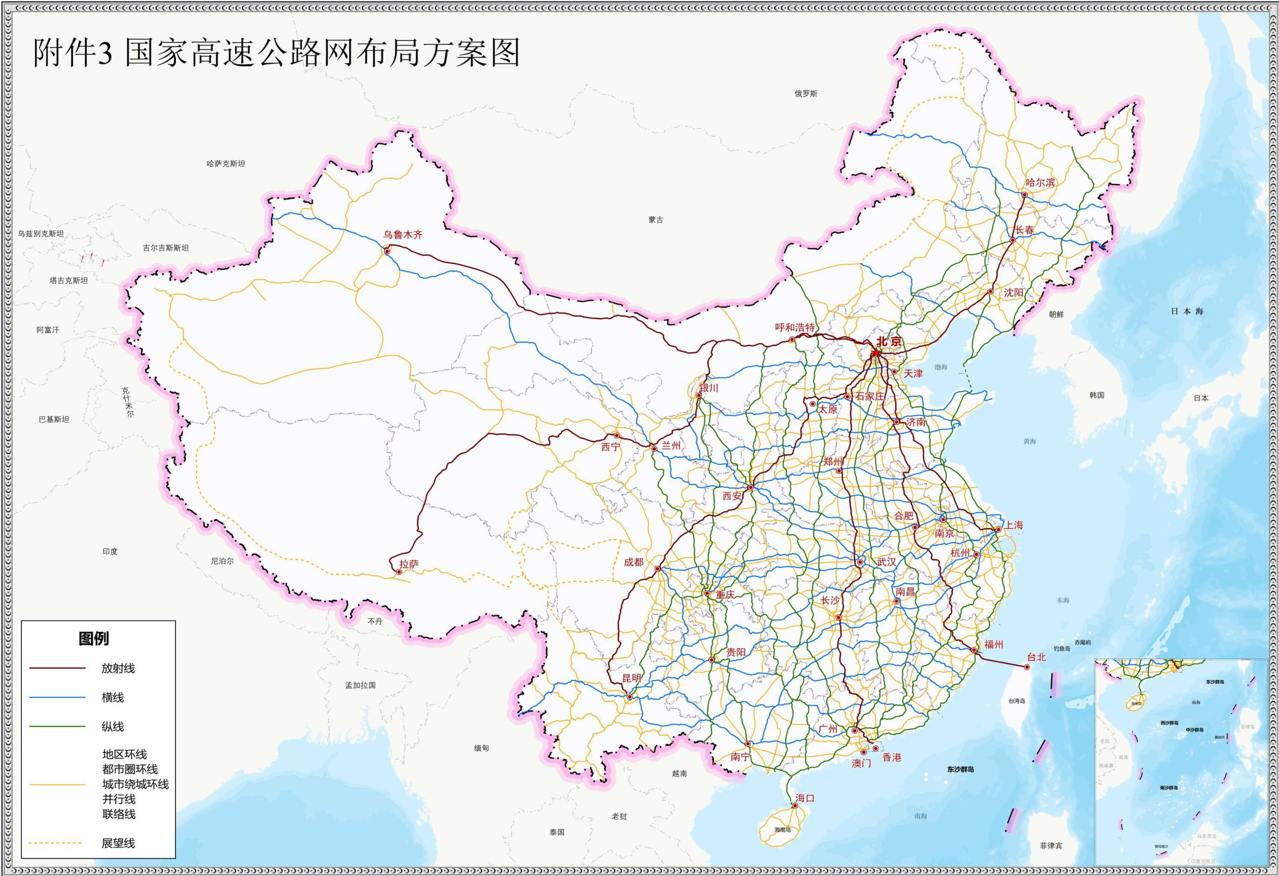
On July 12, 2022, the National Highway Network Plan was officially announced.
The previous version of the plan, which is the 2013 "National Highway Network Plan (2013-2030)" (referred to as "2013 Edition Plan"), has passed for nine years. Compared with the current status of China's highway network, the differences are very obvious compared with nine years ago. The introduction of new planning plans is the time.
In the 2013 version of the plan, a series of highway planning that many people regarded as "the night" have long been realized.
The 2013 version plan has accompanied people for nine years
Now it is going to be classified as a archive of history
(Figure: "China Highway") ▼
Today's new version of the plan is officially released, how much surprise it will bring to us? Not to mention anything else, the new plan of the China -India border is very interesting.
2022 version plan
It does not include the 2022 version of the plan. Since 1978, China has introduced four national -level trunk road planning.
The first was the "National Care Road Network (trial plan) issued in 1981." Due to the social environment and economic development factors at the time, the plan did not involve highways, and they were generally planned for ordinary national highways.
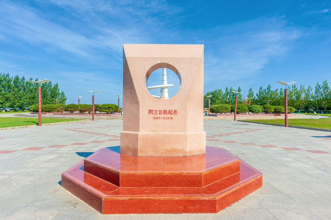
The second is the "five vertical and seven horizontal" national highway main line system planned in 1992. This plan is a mixed plan for ordinary national highway and national highway (main). Whether a certain trunk is a national road or a high -speed, such as the famous "Same Three Highways" is typical, which has influence in some regions.
It was the longest highway in China -the same three highways
The starting point monument is still at Sanjiangkou in Tongjiang
(Figure: Tuwa Creative) ▼
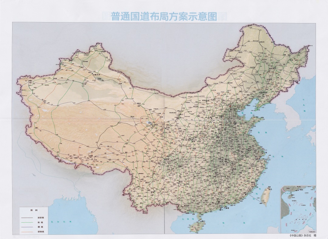
The third is the "National Highway Network Plan" issued in December 2004. This plan breaks the previous trunk high -mixed hybrid scheme, lists the highway planning schemes separately, and prepare the planning network.
The fourth is the "National Highway Network Plan (2013 -2030)" issued in May 2013, which is usually the 2013 version of the plan, which was adjusted in 2019. This is the first system planning for the classification of ordinary national highway and national highway at the same time. At present, China's national highway network operating system comes from the planning.
2013 Edition Plan-Ordinary National Highway
(Figure: "China Highway") ▼
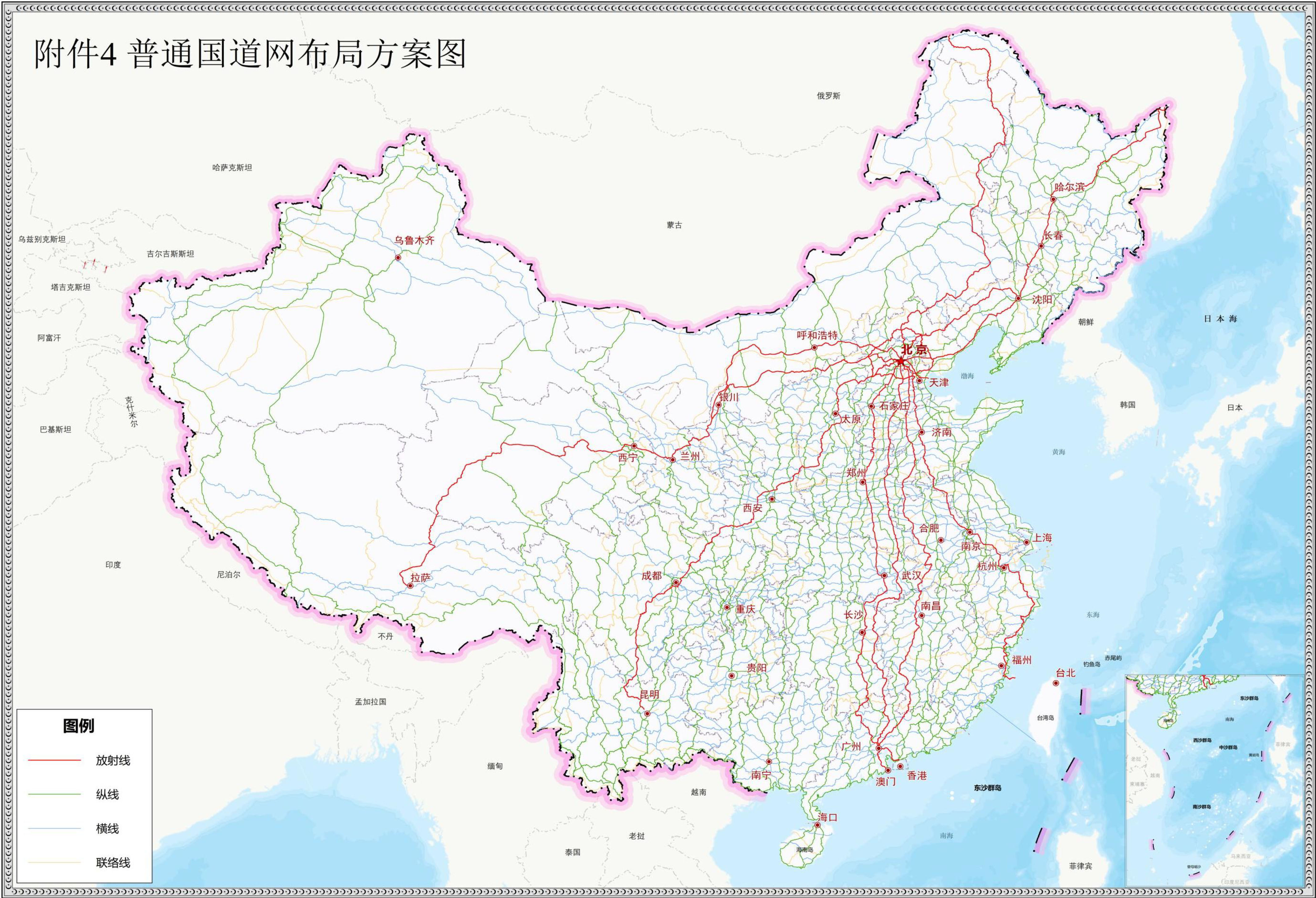
The National Highway Network Planning issued in July 2022 is the fifth national -level trunk road planner introduced in China. It can be found that almost every 10 years, a new version of the plan is released. 10 years is a major cycle of China's national highway development and planning.
China Highway zero kilometers
Located in Zhengyang Gate, Beijing (Figure: 杔)) ▼

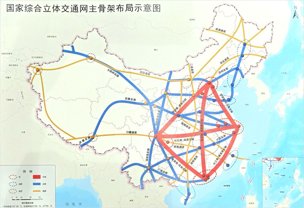
The 2013 version of the 2013 version of the 2013 version can be said to be an important foundation. In conjunction with the two major uplink plans issued in 2021 (the "National Comprehensive Stereo Traffic Network Planning Outline" and "14th Five -Year Plan" Modern Comprehensive Transportation System Development Plan " ), The position of the National Highway Network is an important part of the National Comprehensive Three -dimensional Transportation Network and the skeleton in the highway network.
The 2022 version plan is at the level of the main framework
Following the National Comprehensive Three -dimensional Transportation Network
"6 axis, 7 corridor, 8 channels" main skeleton
(Figure: "Outline of the National Comprehensive Three -dimensional Transportation Network Planning") ▼
The 2022 version of the plan is the programming document of the latest national highway development. After the planning is implemented, the national highway will still maintain two levels of "National Highway+ordinary national highway". Ordinary national roads will provide universal and non -charged basic public services. Highway provides efficient and fast transportation services.
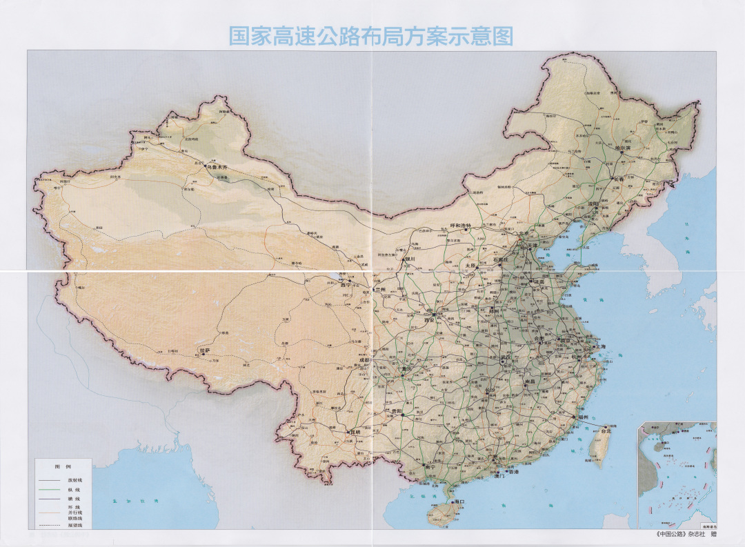
It proposes the layout plan of the National Highway Network by 2035. The total size is about 461,000 kilometers. It consists of the National Highway Network and the Ordinary National Highway Network. Among them, the national highway is about 162,000 kilometers. Ordinary national highway is about 299,000 kilometers.
Compared with the 2013 version of the plan, the total planned scale increased by about 60,000 kilometers. So, where is the new version of the plan added? What do you change the old version of the plan?
highway
The overall idea of the national highway network planned by the 2022 version is "maintaining overall stability, achieving effective connection, strengthening channel capabilities, and improving the efficiency of road networks."
2022 Planning (National Highway Network)
(Figure: "National Highway Network Plan") ▼
Maintain overall stability: maintain the overall stability of the original national highway network layout and framework, optimize the direction of some routes, and avoid ecological protection areas and environmental sensitive areas.
The Beijing -Taiwan Expressway belongs to the network layout and framework of the original country
Therefore, it is not a new key content of this plan
Yanta Bohai Strait cross -sea channel, Qiongzhou Strait cross -sea channel, Xinzang Expressway, etc. are all old planning content
(Figure: "2013 Edition Plan" ") ▼
Realize effective connection: Supplement the connection of 100,000 listed counties and important land border ports in the urban area.
Strengthening channel capabilities: Focusing on the main skeleton of the "6 -axis, 7 Corridor and 8 Corridor" of the National Comprehensive Three -dimensional Transportation Network, strengthen the channel capabilities between urban agglomerations and key cities.
Improve road network efficiency: strengthen the intercity channels inside the urban agglomeration, the fast -moving channels, add the urban ring rings, and increase some routes that improve the efficiency and toughness of the road network.
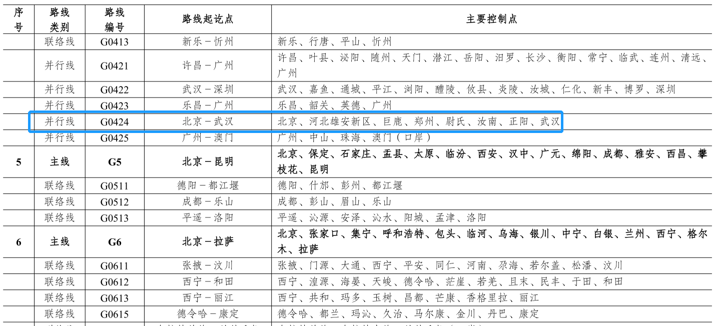
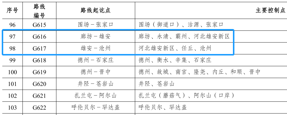
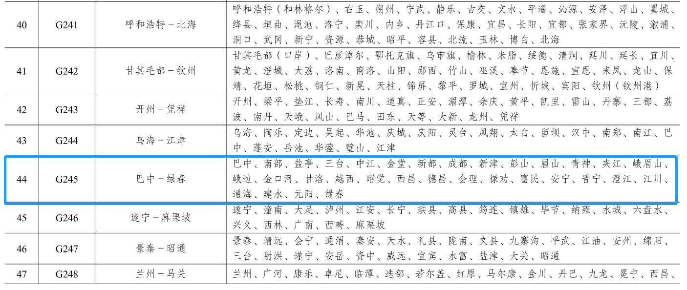
The new version of the national highway network has a total mileage of about 162,000 kilometers. , 31 parallel lines and 163 liaison lines. Compared with the 2013 version of the plan, the national highway has a net increase of about 26,000 kilometers, the 7 capital radiation, 11 north -south vertical lines, and 18 east -west horizontal lines (71118) have not changed. The urban ring rings, 11 parallel lines and 58 liaison lines have adjusted 6 existing planning routes.
The 12 metropolitan ring lines are the largest categories of the newly added national highway network planning. It is also the biggest highlight. Its line number is G99XX, involving a total of 12 metropolitan rings in Harbin, Changchun, Hangzhou, Nanjing, Zhengzhou, Wuhan, Changzhutan, Xi'an, Chongqing, Chengdu, Jinan, and Hefei.
At the sequence number classification level, the urban ring rings are ranked fifth, between the fourth regional ring line and the sixth around the city.
12 metropolitan ring rings
(Figure: "National Highway Network Plan") ▼
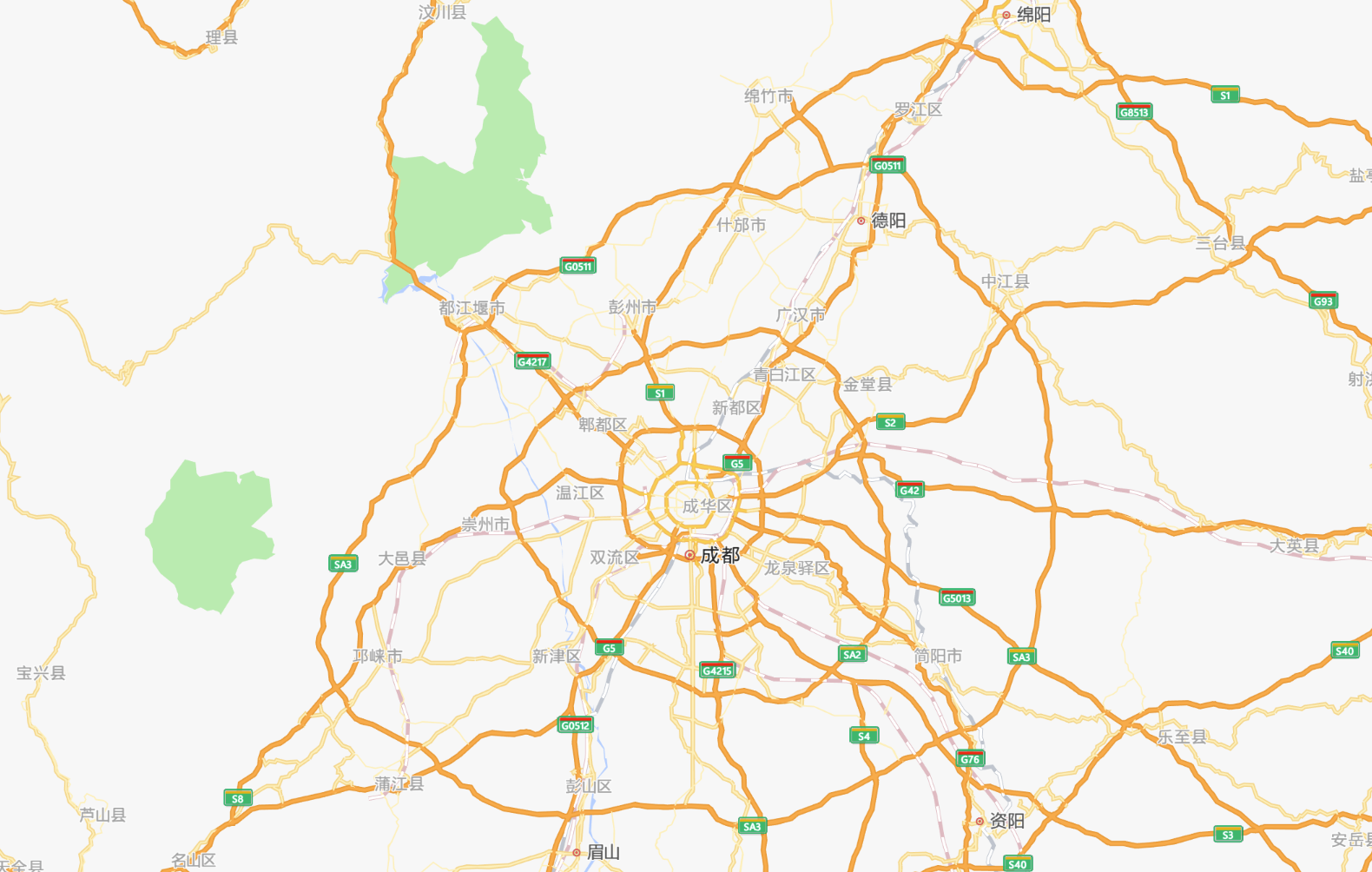
At the end of last year, the Chengdu Economic Zone Economic Zone Circle Expressway (also known as Chengdu "SA3 SA3), which was opened to traffic at the end of last year, is the newly planned Chengdu Metropolitan Ring Road. Its official name is about to be renamed G9910.

The highway that has been included in the new plan does not mean that all of them have not been built
There may be some of the provincial -level high -speed construction or completed
It is only included in the category of the national high -speed in the new version of the plan
Chengdu's "Three Winds" is an example. It is upgraded from a provincial -level high -speed to a national high -speed national high -speed
Other upgrades to the original line of national highway, the technical level is also possible
(Figure: AMAP) ▼
As for the other 11 parallel lines and 58 liaison lines and 6 adjustment lines, it can be roughly divided into five categories:
The first category is a variety of road network encryption functions, which is more common, including the frontier and the Mainland.
For example, G1 series
(Figure: "National Highway Network Plan") ▼
For example, G25 series
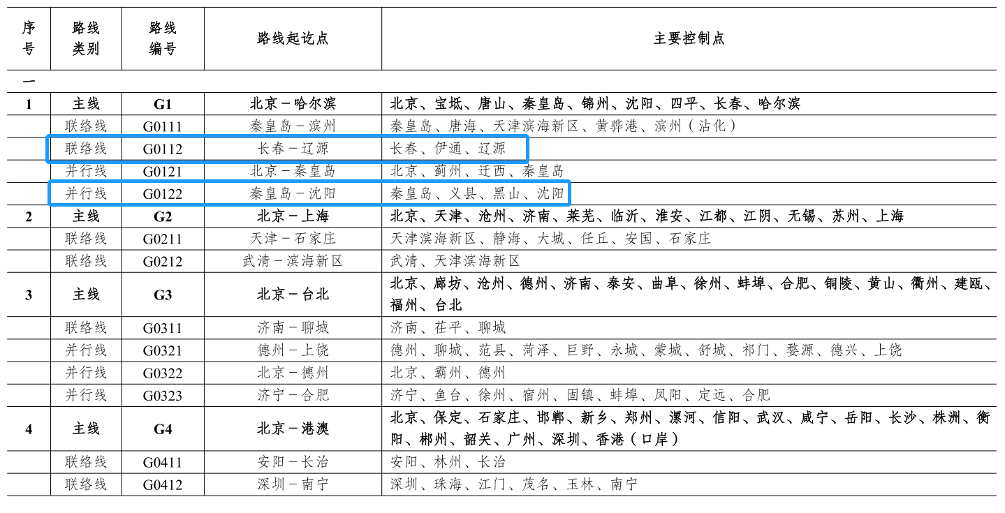
(Figure: "National Highway Network Plan") ▼
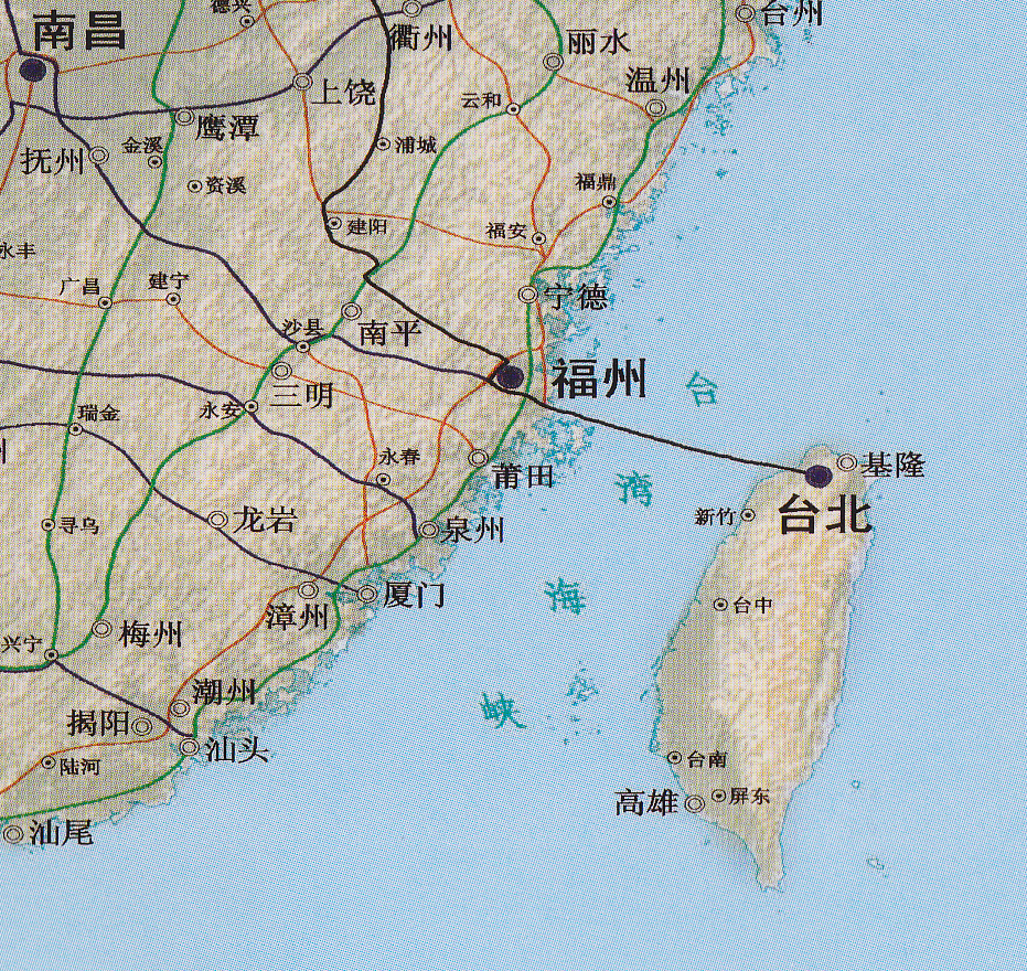
The second category is the highway to Kinmen.
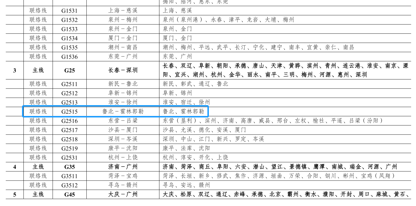
Quanzhou, Xiamen, and Golden Gate constitute the Golden Gate Ring Road
(Figure: "National Highway Network Plan") ▼
The third category is the connection line to the port border port.
For example, G6 and G7 related series
(Figure: "National Highway Network Plan") ▼
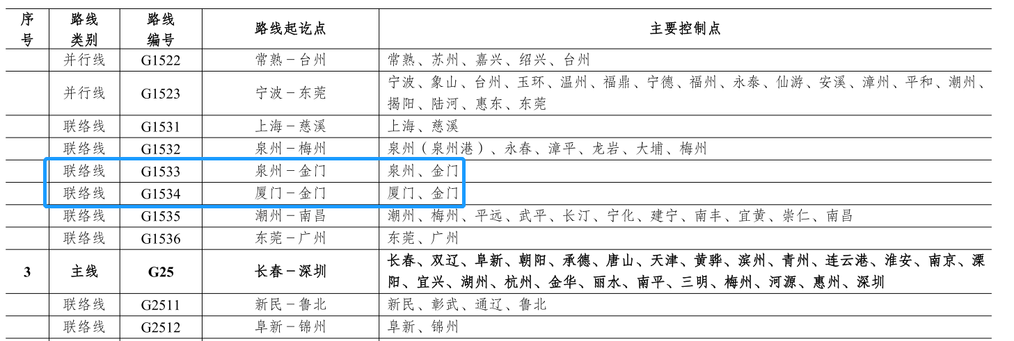
The fourth type is the connection line of the Xinjiang Corps City. Here is a need to explain "why GXX3X". According to the number, the contact line is GXX1X and the parallel line is GXX2X. Today, because the connection line of a main line is greater than 9, the number can only be used to use the new segment GXX3X.

Alla (one division) connection line
(Figure: "National Highway Network Plan") ▼
The fifth category is a highway involving Xiong'an New District.
Related to Xiong'an
(Figure: "National Highway Network Plan") ▼
Ordinary national road
The overall thinking of the general national road network planned in the 2022 version is "maintained, local optimization, and replenish and enhance toughness."
2022 Planning (General National Highway Network)
(Figure: "National Highway Network Plan") ▼
The main body reserves and local optimization: take the existing ordinary national highway network as the main body, optimize the direction of the route, strengthen the straight connection, improve the urban transit line, avoid ecological protection areas and environmental sensitive areas.
Xiamen-Kaohsiung Taiwan Strait cross-sea channel does not belong to new projects
For the original general national highway network planning project, the new plan is used
In recent years, the popularity is very hot along the coastal highway
G331+G219+G228 also belongs to the original scope of planning
(Figure: "2013 Edition Plan" ") ▼
Supplement and improve toughness: supplement the county -level nodes, land border ports, important scenic spots and transportation hubs, etc., strengthen the urban passage, along the coastal highway and parallel lines, and increase some routes that improve the efficiency and toughness of the road network.

The total mileage of ordinary national highway network is about 299,000 kilometers, consisting of 12 capital radiation, 47 North South longitudinal lines, 60 east -west horizontal lines, and 182 liaison lines.
Compared with the 2013 version of the plan, the net increase in ordinary national highway is about 34,000 kilometers, and 101 liaison lines are mainly added, and 41 are adjusted to have a planned route.
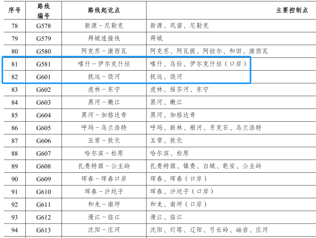
The 101 liaison lines added in the new version of the plan can be said to have changed the pattern of the national road number again. In the 2013 version of the plan, the number format of the liaison line is G5XX, with only 81, so the maximum number is G581.
2013 version of G581 (Figure: "2013 Edition Plan" ") ▼
The newly added 101 liaison lines in the new version of the plan did not make a smooth arrangement from the G582, and turned on the new G6XX sequence, from the G601 to G701.

G581 and G601
(Figure: "National Highway Network Plan") ▼
These 101 new contact lines can be divided into six categories:
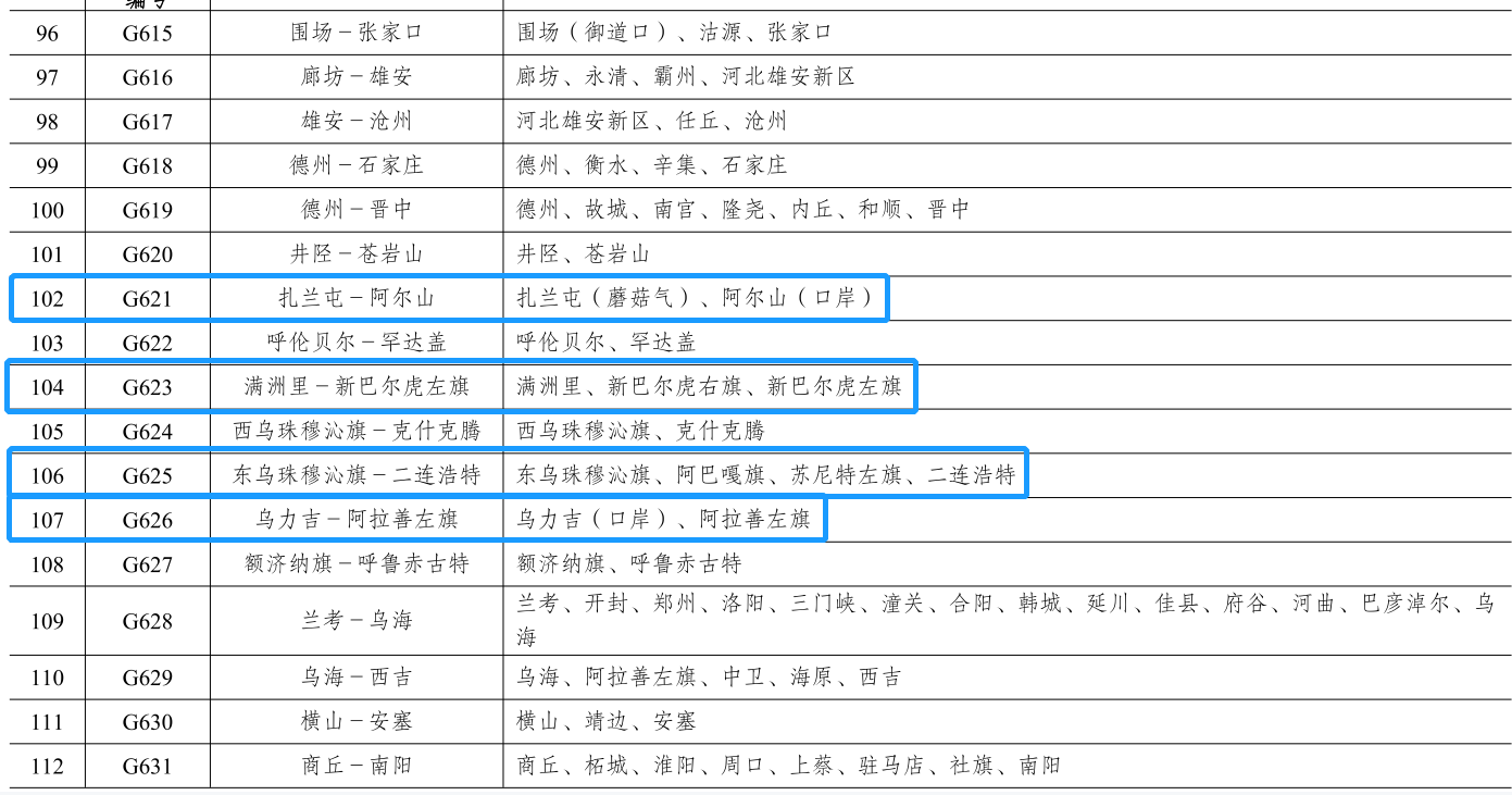
The first category is a variety of road network encryption functions, which is more common, including the frontier and the Mainland.
Border and Mainland encryption
(Figure: "National Highway Network Plan") ▼
The second category is the connection line to the intersection of the land border.

Linking to the port (Figure: "National Highway Network Plan") ▼
The third category is the connection line involving Xiong'an New District.
Involved in Xiong'an (Figure: "National Highway Network Plan") ▼
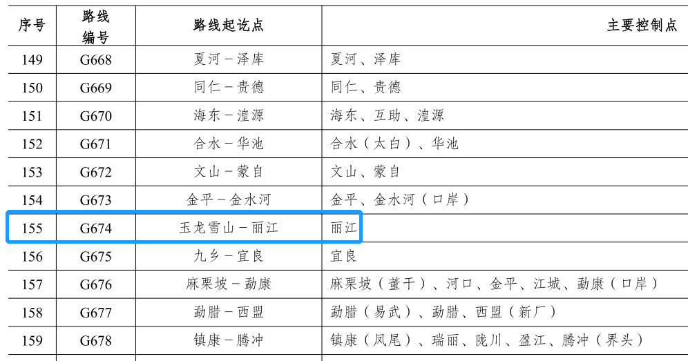
The fourth type is the connection line to important tourist attractions to the surrounding countries, such as the connection lines related to Cangyan Mountain, Pingtang, Yulong Snow Mountain, Kalajun, Tianshan Tianchi, Namiwu and other related liaison lines. Scenic "Dedicated Line" nature
(Figure: "National Highway Network Plan") ▼
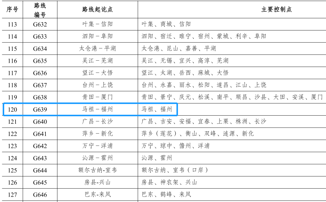
The fifth category is the connection line to the Taiwan Peng Jinma area.
From Fuzhou to Matsu (picture: "National Highway Network Plan") ▼
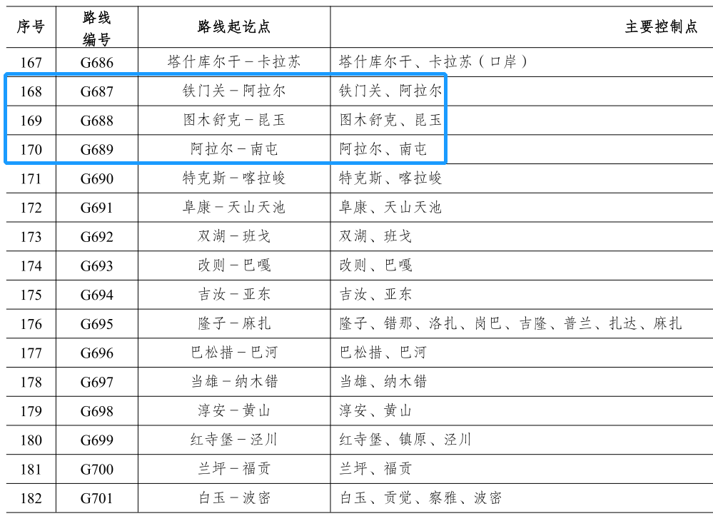
The sixth category is the Xinjiang Corps City Link.
Cross -Bingzuan City String up
The Tarim Basin will add another series
Crossing the desert highway through Taklama Gan
(Figure: "National Highway Network Plan") ▼
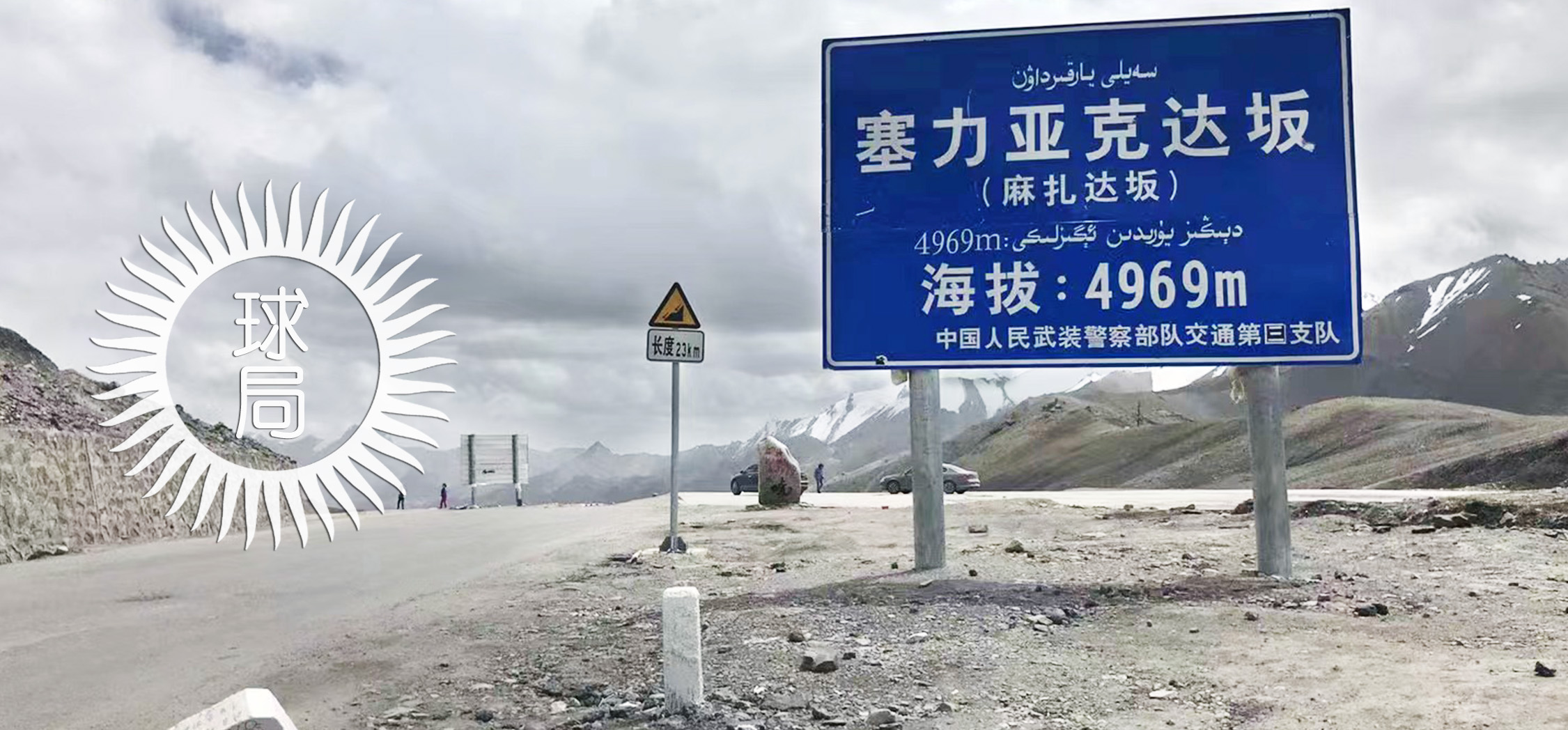
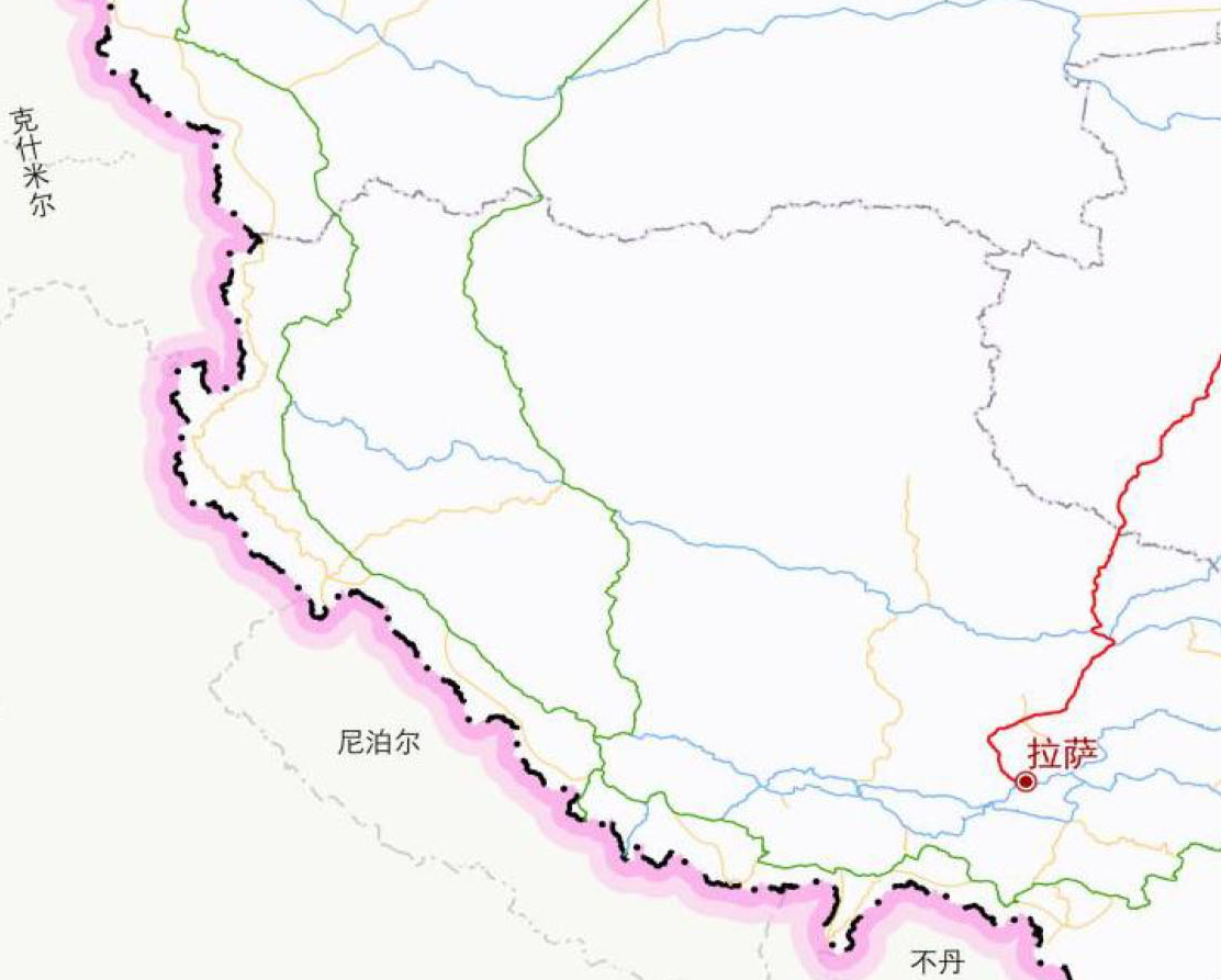
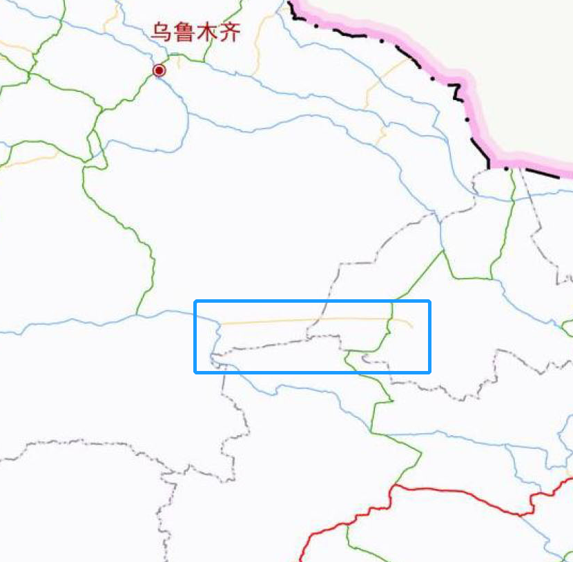
It is particularly noteworthy that in the line -up function of the road network in the frontier area, the New National Highway G695 (Longzi -Maza) will realize another new Tibetan highway, which is more than the existing G219 (old new Tibetan line) and the upcoming completion. The G216 (old new Tibetan east line) must be west, and it is close to the China -India border and the actual control line. It can be called the latest version of the New Tibetan western line.
The Maza here refers to the Maza Station (abandoned)
Because the Shengsheng Bridge is nearby, it can also be called "bridge"
(Left slip view more, picture: 杔)) ▼
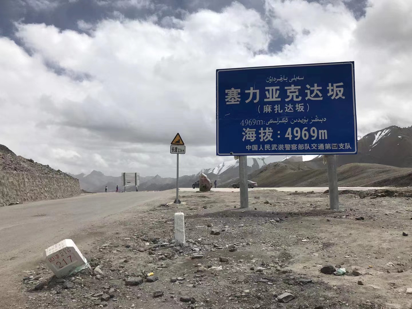
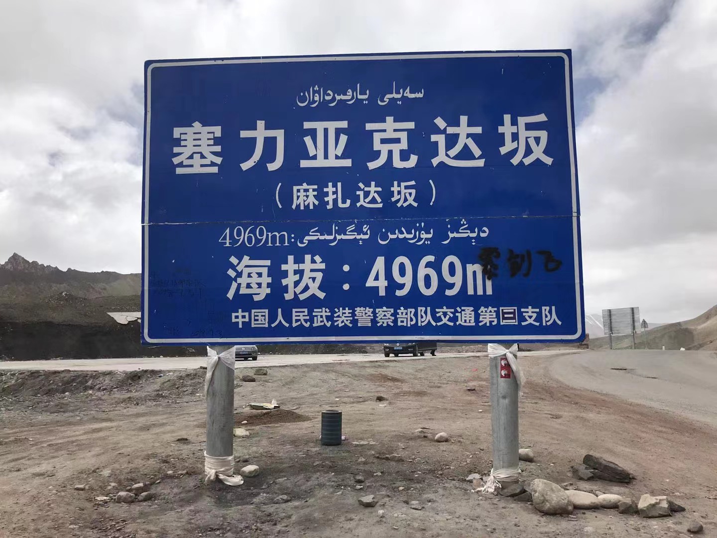
As for Mazada (Sekida/Seliakda)
It is located about 40 kilometers north of Maza

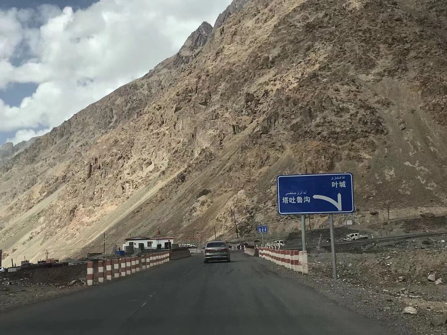
It's not the same position (view more in the left sliding, picture: 杔 杔) ▼
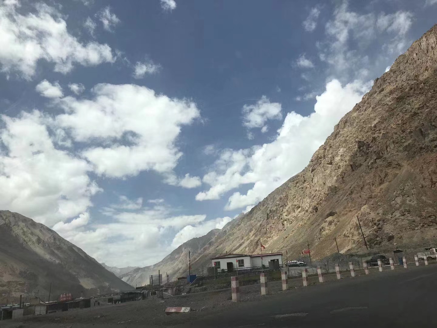
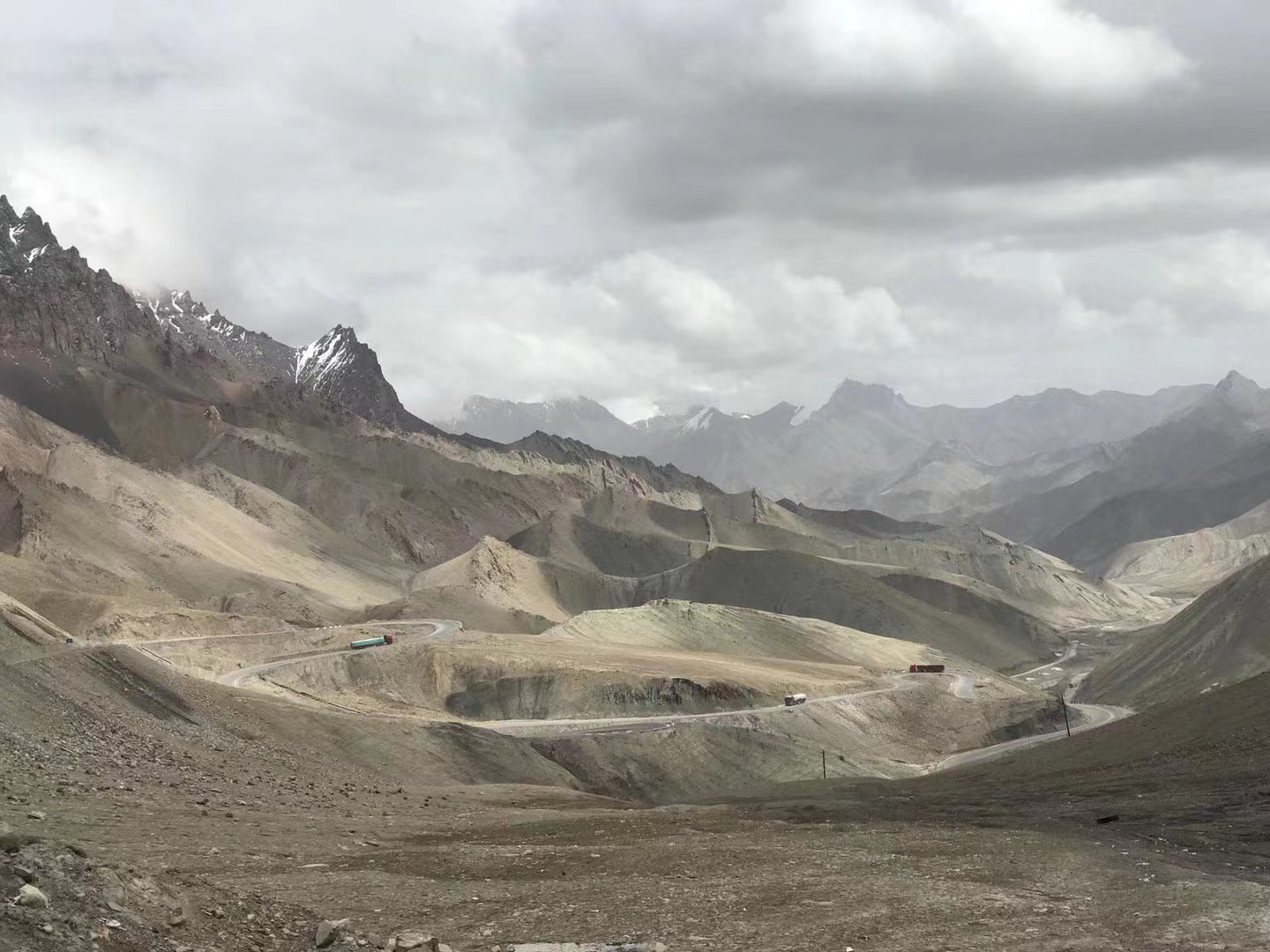
It will follow a series of well-known important points such as De Sandpin, the La Wan River Valley, the Hot Spring Daban, the Empty Kazanka, Ban Gongwa, the Barragas Dianjiao, Donglang, Jade Mai and other well-known important points. The bridge may also become part of the new national road.
Another new Tibetan line, the one in the west
(Figure: "National Highway Network Plan") ▼
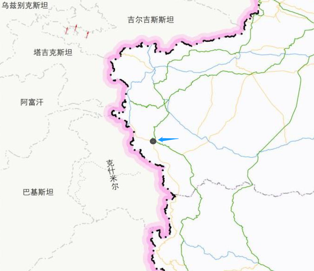
On the other hand, a number of new Tibetan highways cooperate with the New National Highway G684 (Maza -Red Qilafu), which will realize the vehicles from the direction of Tibet directly connected to the Hongqirafu Port, which is directly connected to the China -Pakistan Highway. City, Kashgar and other places.
The highlight of the 2013 version is Kangsova
The highlight of the 2022 version is Maza
(Figure: "National Highway Network Plan") ▼
And Maza will also become another hub of the high -altitude border area in the southwestern part of Xinjiang.
G219+G684+G695, Maza Hub

(Figure: "National Highway Network Plan") ▼
41 adjustment routes, a small part of the old rays, longitudinal lines, and horizontal lines, most of which are from the old contact line. The line adjustment method is basically or extended or shortened.
From the vertical line
(Figure: "National Highway Network Plan") ▼
Among them, the most noteworthy is the New National Highway G571. It is the Subei connection line in the 2013 version of the plan, and in the new version of the plan to Subei -Ruoqiang. ) (Bashlkan).
New G571 (Figure: "National Highway Network Plan") ▼
In a certain sense, the line will be "resurrected" by the old G313 National Highway, which has been abandoned, and returns to the national highway network system in and out of the Xinjiang channel.
A "resurrection" channel in and out of Xinjiang
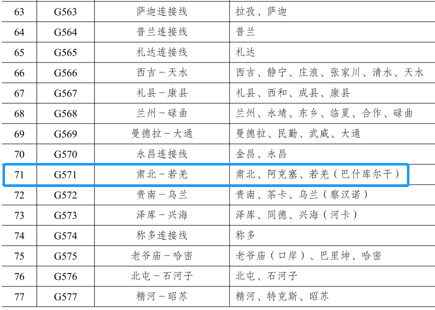
(Figure: "National Highway Network Plan") ▼
The old G313 National Highway (now part of the G571 National Highway), also known as the South Xinjiang Highway, is also the only national road in China that has been revoked. Another national road that has been revoked is the old G226 National Highway, and the entire line has been incorporated into the G227 National Highway. As for the old G228 National Highway (post -planning to the coast) and the old G99 national highway and other lines, the situation is more special.
La Fuquan is a must -have place for the old southern Xinjiang highway (picture:: 杔 杔) ▼
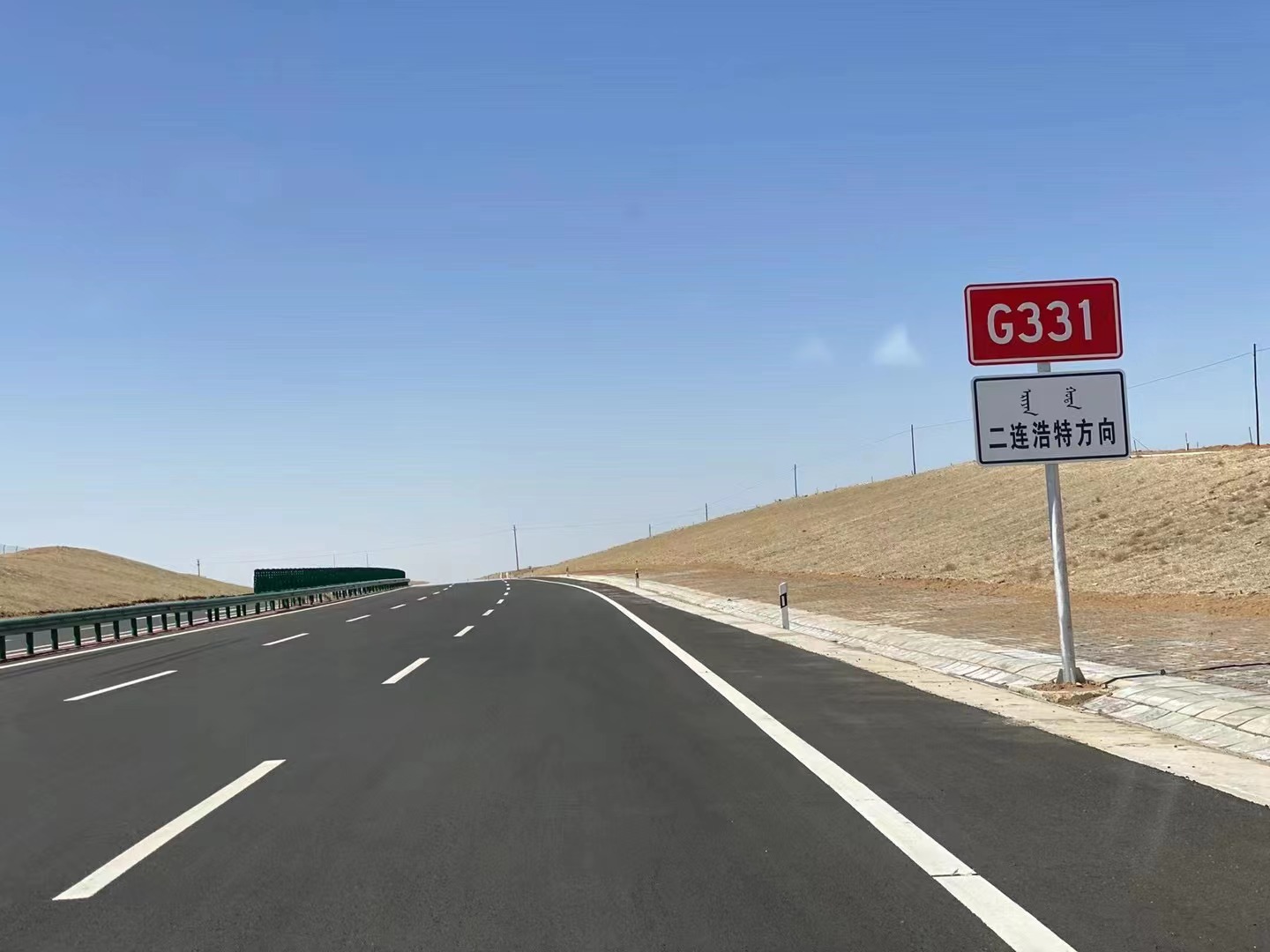
Of course, due to the nature of the long -view planning, some lines may not be able to start in recent years. It may be important to pay attention to projects that are still under construction in the 2013 version of the planning. During the "Fourteenth Five -Year Plan" period, the construction of ordinary national highway will be accelerated, prioritizing the G219 and G331 lines, and other border national roads, and basically eliminate ordinary national roads and other exterior sections.
Compared with the hot G219

G331 is also worthy of tourist attention (Figure: 杔 杔) ▼
*The content of this article is provided for the author, which does not represent the position of the Earth Investment Bureau
Cover: 封 杔 :
End
- END -
Heaven and earth, Qianqiu Family State- "Xiaolong Three Backs" academic seminar

On the afternoon of June 18th, Yang Rufeng's new book release and academic seminar...
Lile and Le Shandong | Liaocheng: Guanxian Qing "July 1" literary party and "Seven One" Engineering Literature and Art Report performances ended successfully!

In order to celebrate the 101st anniversary of the founding of the Communist Party...