Do you know these little -known secrets on the Chinese land?
Author:Institute of Geological Earth Time:2022.07.25


Do you know why the lake in the Tengger Desert Wulan Lake is so bright?
Do you know how the blue scales of Shangri -La Baishura are like the blue scales of Shenlong?
Do you know why the Millennium Ancient Salt Field in Lancang River Basin has brine can only have salt in Yanjing area in Tibet?
Do you know that the black Dudshan on the surface of the moon is actually Yadan landform?
Do you know that there are not only Gege dynasties in the Ali region, but also the Xiongxu capital in the legend of Tibet?
Do you really understand these beautiful scenery scattered on the Chinese land?
Tengger Desert Wulan Lake
——The bright red "Earth Heart" hidden in the depths of the desert
We found the "heart" of the earth in the desert. In the vast desert, a hot and hot red surrounded by the desert oasis will be found. The shape of the lake surface is like a beating heart and printed on the earth. The bright red lake flows on the surface for hundreds of years like blood. It is "the heart of the earth" -whalan Lake. "Ulan" means "red" in Mongolian. This mysterious red lake has a small area, and it is difficult to find it on the map, but it has been truly existed in this vast sandy sea for hundreds of years. Essence Stay away from the hustle and bustle, mysterious and spectacular.
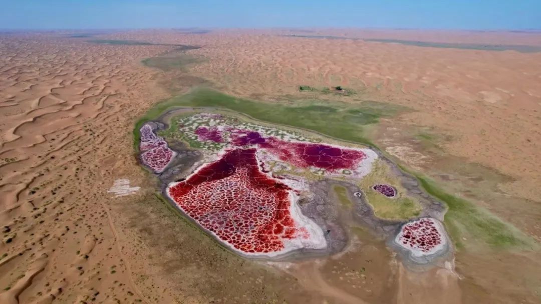
Figure 1
On our beautiful earth, the strange lakes are mostly salt lakes, and Lalan Lake is no exception. It is a veritable salt lake. Salt Lake is a kind of saltwater lake, and it is a lake with high salinity in the arid areas. At the same time, it is also the product of the development of the lake. It is rich in a variety of salt and is an important mineral resources. There are about 200 kinds of salt minerals deposited in salt lakes. Human beings have been able to extract resources from salt, alkali, graxitrier and other resources from salt lakes.
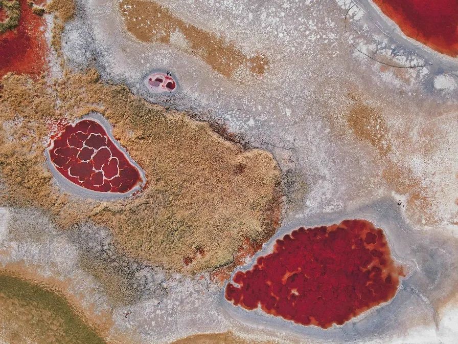
Figure 2 Wulan Lake
Entering the 21st century, with the development of technology, salt lake resources began to turn to diversified comprehensive development. Through science and technology integration, the development of deep processing of salt, extending the industrial chain, make full use of sodium sulfate, magnesium salt to develop high value -added products such as Yuanming powder, sulfide and laundry powder, and develop cosmetics and tourism industry with lake mud and brine. It also develops salt chemicals, produces pure alkali, metal sodium, develops salt lake agriculture, and develops drugs such as salt algae powder, β-carotene. With the rapid development of new energy vehicles and lithium batteries in recent years, lithium has received widespread attention, and power batteries or material projects have largely relying on highly scarce lithium ore resources. The competition of lithium resources is very fierce. Giant's soldiers must fight. In the type of lithium ore, the salt lake brine reserves are huge, and the hard rock type is second. The world has discovered and made lithium ore resources that have been made and preliminary estimated. Salt lake -type lithium resource reserves accounted for 78.3%of the world, and hard rock types accounted for 21.6%. It can be seen that salt lake brine can not only provide us with salt and other resources, but also rich minerals. In the process of comprehensive development of salt lake resources, how to comprehensively and efficiently extract high -value -added lithium products from the vast salt lake will become one of the new industries for future development.
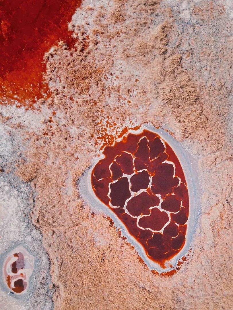
Figure 3 Wulan Lake
The wonderfulness of Wulan is because of water quality, the whole lake looks bright red under the sun. Coupled with the special texture of the lake, it looks like blood vessels. In the world, such bright red lakes are rare. The reason why the lake in Wulan Lake is so red, first of all, because the lake water contains microorganisms such as Du's salt algae and salted bacteria. These salt algae will release a bacteria carotene, and the higher the temperature, the more released. Du's salt algae is a microalgae that can live in high -salt seawater, and often becomes red in high -salt environments. The most prominent feature of Du's salt algae is that it contains a large amount of β -carotene, and its content is many times higher than the content of β -carotene in carrots and fruits. Under the sun, the lake will look particularly bright red. Secondly, the environment where Wulan Lake is located is less than the formation of salt lakes due to dry climate, which is also conducive to the formation of salt lakes. This also provides a living space for the reproduction of salt algae and microorganisms in the salt lake. A circle in the salt lake is like the white part of the blood vessel vessel, but it is actually saline -alkali ingredients, which makes Wulan Lake look more vibrant and lively. The low -lying and closed terrain is also conducive to the convergence of the surface and groundwater. Especially in the desert environment, it makes the lake water difficult to dry completely, which forms the Wulan Lake we see today.
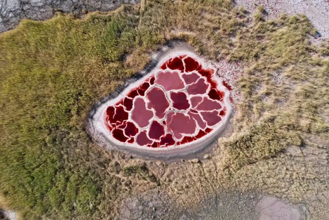
Figure 4
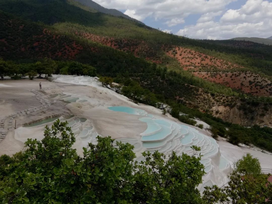
Shangri -La Baishura, Shangri -La, Yunnan
—— The "Earth Cake Skirt" prepared with clouds
Baishura is located at the foothills of Haba Snow Mountain, Baidi Village, Sanba Township, Sanba Township, Southeast of Shangri -La, 101 kilometers away from the county seat and 2380 meters above sea level. The reputation.
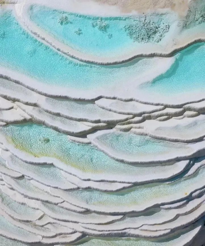
Figure 5
Bai Shuitai, layer of calcium, follow the trend, like a "earth cake skirt" prepared with clouds. Calcium Chinese is a calcium carbonate deposition formed by a large amount of CO2 when the geothermal water containing calcium bicarbonate is exposed. The premise of calcium deposition is the flowing water and the dissolved CO2 in the water. CO2 dissolved in water is usually derived from the atmosphere or the depth of the crust. Calcium Hua is also an important symbol in the fourth discipline. It records the geological structure and climate change information, and has the scientific value of rebuilding the ancient climate and the ancient environment. For example, the age of calcium Hua can represent the specific time of the fourth period of the ice and wet climate change. A large number of studies have shown that calcium deposition is related to climate change and geological structure.
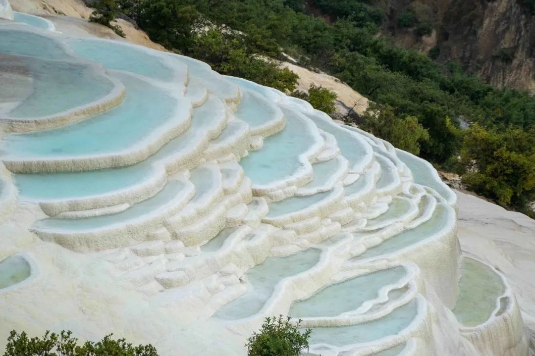
Figure 6 White Water Terrace
The white water platform is a natural wonders formed by the dissolving of calcium carbonate in the spring water. Snow water penetrates under the cracks and accepts carbon dioxide in the depths, and dissolves the surrounding carbonate rocks, forming spring water rich in calcium bicarbonate. The spring water continues to emerge from the surface. When the algae biological effects are used through the algae beach, calcium bicarbonate in spring water reacts quickly. Carbon dioxide evaporates with water, and calcium carbonate with white particles is deposited down to produce calcium carbonate deposition. The formation of calcium is also inseparable from the participation of creatures. HCO3-or CO2 in the water consumption of algae consuming water consumption in water, accelerating the deposition of CACO3, and the sedimentation of chemistry and biology to promote the formation of calcium. The color of the carbonate formed is mostly white and light yellow, and the structure is mostly porous sponge. Figure 7 Baishui Terrace (Wikipedia)
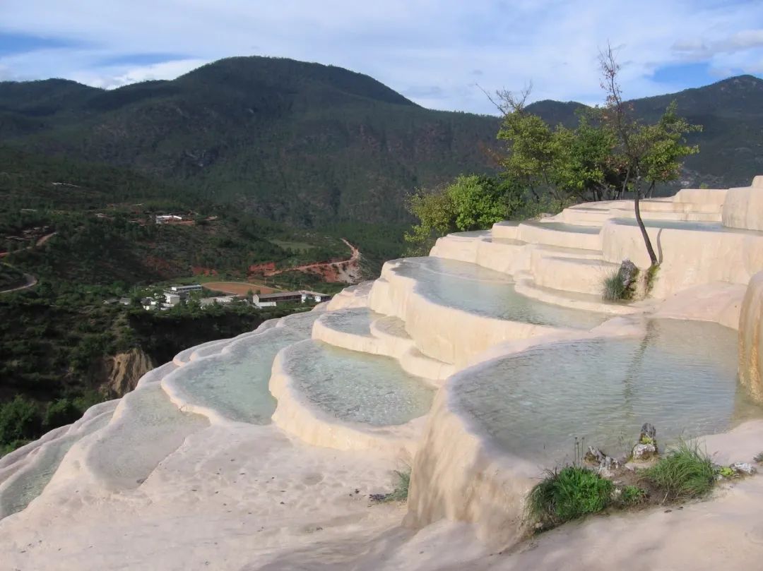
On the white water platform, cyanoscopy is an absolute advantage algae, especially in the calcium deposition. Through the biological deposition of cyanobacteria, CACO3 can directly deposit on the surface of the algae. The uneven and scattered ponds such as terraced fields are affected by minerals. The impact of the minerals of the pond shows a refreshing blue in the sun. The layers of mantles are like layers of terraces and are known as the Chinese version of "Turkish Castle Castle". There is also a beautiful legend here. In order to let the local Naxi people learn to jump terraced fields, cultivate cultivated land, and change such a "terraced field", it is also called "immortal fields" by later generations.
Figure 8 Baishui Terrace (Wikipedia)
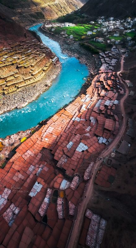
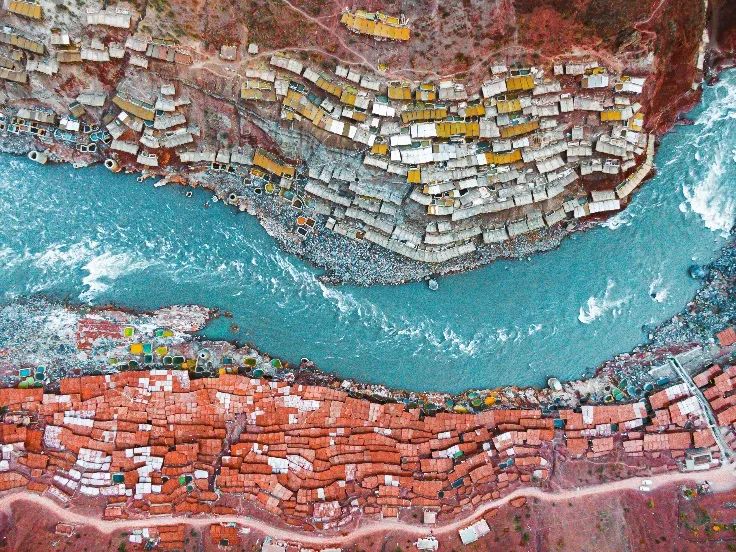
Millennium ancient salt field on the side of Lancang River
——The "Eye Shadow Plate" of the Earth
The ancient salt fields on the banks of the Lancang River in the Naxi National Township of Mangang County, Changdu City, Tibet Autonomous Region still retain the world's most primitive manual salt method. Yantian was built on both sides of the Lancang River. It was built from multiple wooden columns. The rack was paved with a water -transmitting soil into planes. Local residents pulled out brine from the salt brine well on the side of the Lancang River. The sun exposure and air -dried, crystallized into salt. Looking from a distance, Yantian was scattered. Guyan Tian's traditional hand -made salt has a history of more than 1,300 years, and has been included in the world's intangible cultural heritage list. This is not only the only artificial primitive salt exposure of the "tea horse ancient road", but also the unique place in the world Humanistic wonders. It can be described as Mang Kang's millennium ancient salt field, and the small grids of Founder have a unique landscape of artificial primitive salt.
Figure 9 Mangkang Yantian
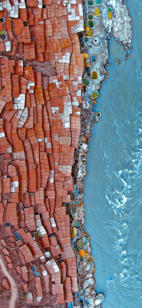
There are more than 3,200 salt fields on the upper layers of the beach and cliffs on both sides of the Lancang River, and the annual output of millions of salt is millions of pounds. On the salt field on the west bank of the Lancang River, due to the dark redness of the soil, it is famous for its soil. Yantian on the east bank is mainly produced with yellow and white salt, commonly known as snowflake salt, which is higher than red salt. Due to the differences in the conditions of geology and soil, different pink worlds have been formed.
Figure 10 Mangkang Yantian
In the Lancang River Basin, there is only salt brine in Yanjing area in Tibet. Local villagers said that this was turned into tears of the legendary "Dami" Snow Mountain goddess. After the study, it was found that this was due to the continuous rise of the Qinghai -Tibet Plateau, and the climate was getting more and more drought. The lakes on the plateau continued to evaporate. Salt shell. After geological transformation, the salt shell was buried deep underground. Later, the rock layer was broken, and the salt in the underground hot spring dissolved in the ground and flooded the ground, forming today's salt well.
Figure 11 Mangkang Yantian
Hei Duoyama in Qinghai
—— God looks like the moon surface of the moon
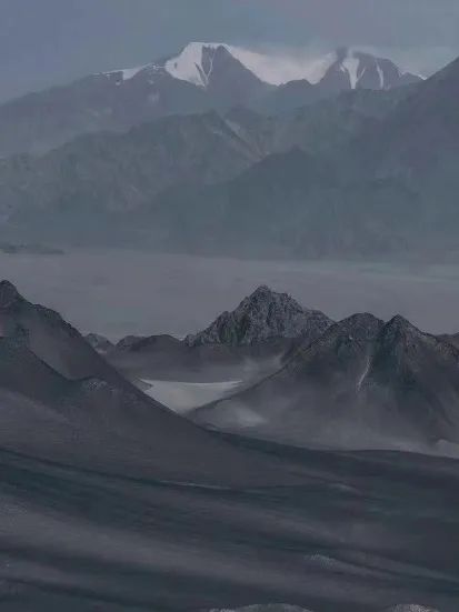
There is a "loneliness" place in Qinghai. The Haixi Mongolian Tibetan Tibetan State is a place surrounded by a uninhabited area. It is a unmanned area to the south of the unmanned area. It is a desert with an area of nearly 50,000 square kilometers. This small town is developed by petroleum and asbestos, and it is far from the surrounding cities.
Figure 12 Heidshan
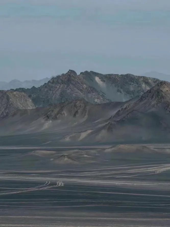
There is a place about 13 kilometers from Lenghu Town, Qianya City, with extreme desolation, lonely and mysterious. This place is the Black Du Mountain. Here is a gray -black mountain at a glance at a glance. Just like its name, the large and small mountain bags are covered by black, gray sand and gravel, and are known as "human moon". It has not yet been developed here, retaining its most primitive appearance, a mysterious pure land. There are no colorful and six -color color in Qinghai Salt Lake, no green mountains and green water from Sanjiang source, no color, no vegetation, no life, gray -black seems to be its main color. The original rough colors are retained here. Watching it is like the surface of the moon, and there are also many adventure enthusiasts to come here to explore the "moon". This is also a unique Yadan landform.
Figure 13 Hei Dushan
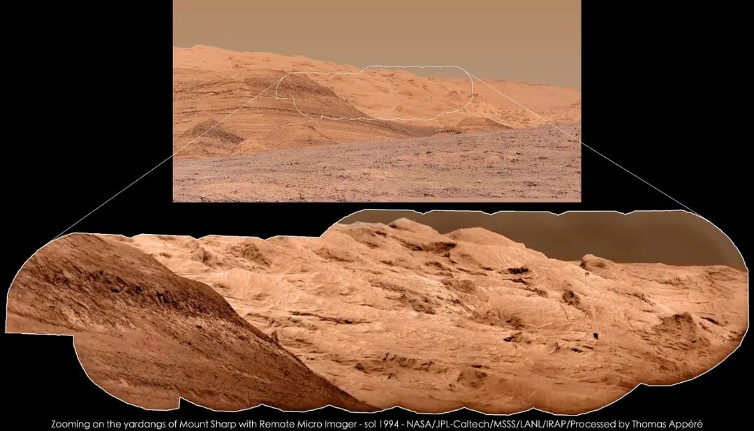
Yadan landform is a typical wind erosion landform. The narrow Yadan landform refers to the distribution of extreme arid areas and some arid areas. It is 65 million years away from the ancient and new discipline. On the sediment that formed rocks, formed by the effect of wind and floods, it has a considerable distribution range and developmental scale, which is based on streamlined and long -shaped wind erosion landforms. "Yadan" in Uyghur means "a hill with a steep wall". The word "Dan" comes from Uyghur transliteration. Yadan has no specific color, and its color depends on the color of the original sediment. Because the color of the original sediment in the Heidshan area is gray -black, and the long -term abrasion effect of the wind, the temperature difference between day and night and occasional heavy rain promotes weathering. Exactly the moon. Figure 14 Hei Dushan
Speaking of Yadan landform, it is not unique to the earth. At some places on Mars (the Megusha Slogita layer near Amazon and Equatorial), Yadan landforms are also very common. Is it surprising? In the history of Mars geological evolution, the wind plays an extremely important role, and is one of the important external stress depicting Mars surface shape. It is still active on the surface of Mars, shaping the dunes (sea), the wind into stripes, Yadan landforms, wind erosion, wind erosion Many landforms such as pit. In the process of erosion such as Yatan on Mars, fresh strata will be constantly eroded during the formation process. It is a natural window for studying the characteristics of the surface of Mars on the surface of Mars. It provides important samples for studying the history of Mars Winds and Sand Activity and understanding the evolution of climate. It is one of the hot spots in Mars scientific research in recent years.
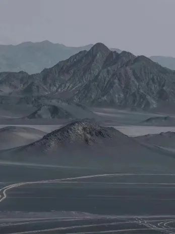
Figure 15 Curiosity Roaming Microcarmark Shardan Yatan Landfang-1994 Mars Day (Wikipedia)
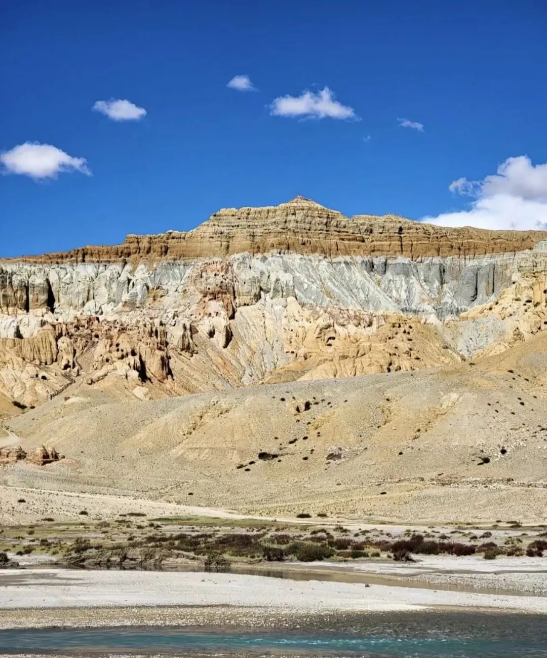
Ali "Silver City", Tibet
——The legend in Tibet
Perhaps 90%of travelers who come to Ali will set their vision to the disappeared civilization Guge dynasty. As everyone knows, there is a more legendary silver city near Gege. It is built on the terrain in Zada Tu Forest. It has a history of nearly 4,000 years and has bred the ancient religious Yongzhongzhon religion in Tibet. It is also Tibet. Legend has the capital of the ancient elephant kingdom.
Figure 16 Silver City
Khyung Lung DNGul Mkhar (KHYUNG LUNG DNGUL MKHAR), and is also used as Qionglong Silver City. The site of Kalong City, Gall Township, Gal County, Tibet is located at the top of the Karl East Mountains at 4,400 meters above sea level, covering an area of more than 100,000 square meters. Tibetan is "Qionglong Weica", and Qionglong Weica is "Dapeng Yincheng". The ancient elephant male civilization is the true root of the Tibetan civilization.
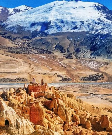
Figure 17 Silver City
Silver silver city was built in Zada Tulin. Earthlore landforms are a new type of flow erosion landform that people have only known in these years, and it is the art crystallization of soil and soil loss. The earth forest land appearance refers to the collective name of a series of landforms such as the semi-loose-semi-solid debris sediment in the semi-loose-semi-solid debris sediment through flowing and accumulating.
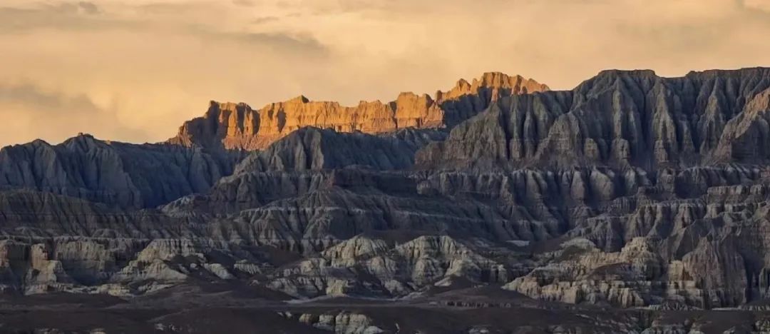
Figure 18 Zada Tulin
This type of accumulation is gentle, and under the erosion of the surface flowing water, it is cut into thousands of grooves. In some levels, due to the rich coordinates of iron, the hard -textured iron hat is formed after weathering, which protects the clay and gravel layer of the lower part, and the erosion of the rainwater weakens, thereby forming soil like pillars and columns. Lin, like the relics of the ancient castle, the image of anthropomorphic matters, is full of attitude and lifelike. This special geomorphic form of Turkey has actually reported and recorded in many countries around the world, such as the Bryce Canyon in the United States, Kappadoria in Turkey, Valle de Luna (Moon Valley) in Bolivia, and China Tibet Ariza Basin, Qinghai Longyangxia, Datong, Shanxi, Xichang, Sichuan, Tianshui, Gansu, and Yuanmou in Yunnan.
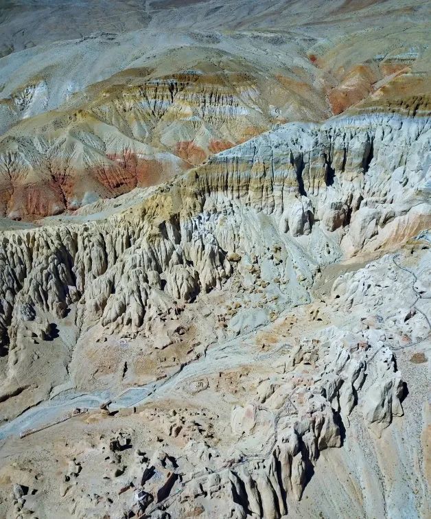
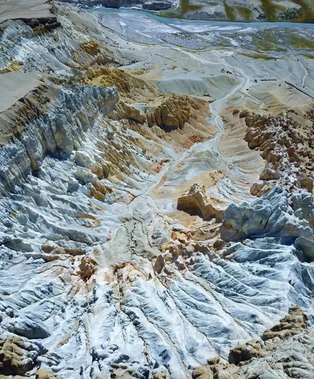
Figure 19
More than a million years ago, it was a large lake with more than 500 kilometers between Pulanda. It was the Himalayan mountain -building movement increased the lake basin and the water level decreased. The mountain rocks that exposed the water surface were carved out of this scene through wind and rain. And the mysterious Xiongxiong ancient country built by Yazda Tu Forest, maybe many people do not understand and even feel strange. The wind and sand on the ancient Silk Road crossed the thousands of years and sealed the historical dust before the 7th century AD. However, as the common foundation of Tibetan culture and Yunnan Naxi culture, the ancient elephant and civilization that combines the three major civilization essence of Central Plains, West Asia and South Asia, but still shines today. When it comes to the silver city, it is the most famous ancient elephant ink. It is the place where the three doors of the ancient elephant kingdom goes up and down. Over time, the erosion of the wind and rain, the silver city of the dome, could not see the shadow of the palace at all. Only large and small caves were left, which looked much older than the ancient kingdom.
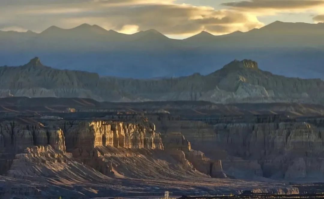
Figure 20 Silver City
main reference:
[1] Liu Benpei, Cai Yunlong. Introduction to Earth Science [M]. Higher Education Press, 2000.
[2] Niu Qinghe, Qu Jianjun, Li Xiaoge, Dong Guangrong, Zhang Kecun, Han Qingjie. Yadan Landform Research and Outlook [J]. Earth scientific progress, 2011,26 (05): 516-527.
[3] Li Ping. "Yadan Landform" and "Danxia Landform" identified [J]. China Place name, 2019 (11): 38.
[4] Song Jixiang, Lu Hongliang, Zhang Zhengwei, Liu Yeyi. Analysis of the Floating Results of the Floating Selection of the Albar East Site in Tibet [J]. Journal of Tibet University (Social Science Edition), 2019,34 (01). [5] Liu Yanjun. Fairy Huritors Baishui Terrace [J]. Geographical teaching, 2020 (21): 2. 2.
[6] Luo Penghui, Zhang Shitao, Tian Yimin, Lei Bin, Deng Qi. Tulin Land Printing Research [J]. Journal of the Earth, 2020,41 (04): 575-582.
[7] Yan Fei, Dong Faqin, Dai Qunwei, Zeng Jia, Cao Qin, Wang Yinjia, Dai Li, Yi Xiaoyi, Yang Gang. China Calcium Deposition and Climate Change Research [J]. , 40 (05): 1189-1197.
[8] Dong Faqin, Dai Qunwei, Zhao Yulian, Chen Mulan, Rao Hanyun, Lu Zhenzhen, Zong Meirong, Li Bowen, Emin CIFTCI, Mehmet Furkan SENER. Turkish cotton Castle and China Huanglong and Baishui Terrace Calcium Degeneration Research [J]. Chinese rocky, 2021,40 (06): 1069-1076.
[9] Wang Jiang, Xiao Long, Huang Jun, Zhao Jiannan. The research progress of Mars Yatan landform [J]. Geological Journal, 2021,95 (09): 2742-2754.
[10] Pan Tong, Li Shanping, Wang Tao, Han Guang, Jia Jian Group. Qinghai Lithium Mine Mining Features and Mining Potential [J]. Geological Journal, 2022,96 (05): 1827-1854.
The picture comes from the Internet.
Figure 1, 4 Source@r 图 Aries Building 1;
Figure 2, 3 Source@小 图 图 图 图 图 图: Liang Chen Meijing
Figure 5 Source@小 图 图 图 图 图 to travel;
Figure 6 Source@小 图 图 小 图;
Figure 9, 11 Source@小 图 Fier Fier's nomadic plan;
Figure 10 Source photographer Bao Calia;
Figure 12-14 Source@北 图 Northwest Travel Planning Little Madasi;
Figure 16 Source@小 图 图 SZ square gun;
Figure 17-20 Source@小 图 图 DRMAMBA,
Thank you very much for authorizing the use of licenses for using the above pictures.
Beautiful editor: Han Yatong
School pair: Zhou Xingxing Liu Qi County

- END -
Provincial government approves consent!
Guizhou Provincial People's Government approves consentSeven centralized styles in...
Beijing Radio and Television Bureau held the second quarter of the documentary push for excellent review meeting
Recently, the Beijing Radio and Television Bureau held the second issue to promote the high -quality development training of the documentary through the online+offline method and the second quarter