The new tropical low pressure has been generated, and the impact on Shenzhen is ...
Author:Olympic News Time:2022.08.08

According to the Guangdong Provincial Meteorological Bureau
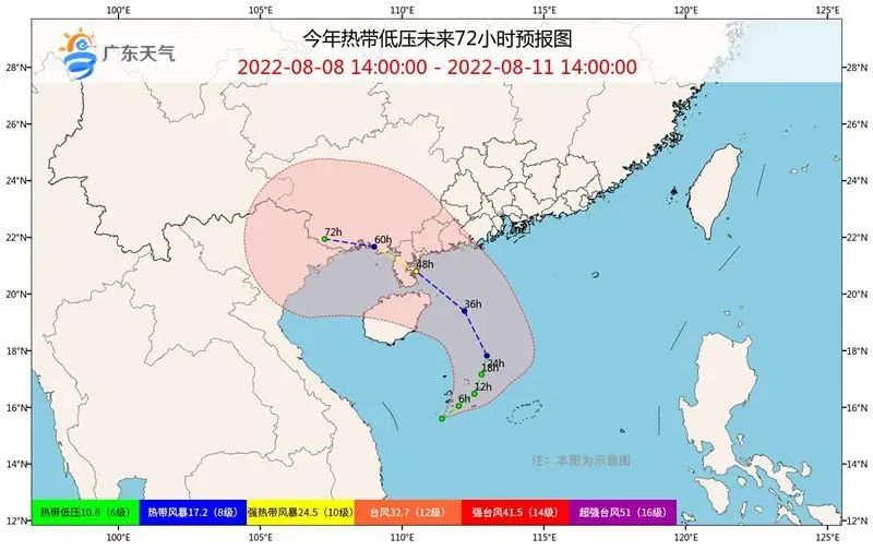
Tropical disturbance, which is located on the sea surface of the central part of the South China Sea
It has been strengthened to a tropical low pressure at 14:00 on the 8th
The center is located in the south of Zhanjiang City
About 630 kilometers on the sea
That is, 15.6 degrees north latitude, 111.4 degrees east longitude
The maximum wind level near the center 7 (16 meters/second)
It is expected that the tropical low pressure will move towards the northeast to the northwest at a speed of about 15 kilometers per hour. Level to 10) Login in the above coastal areas.
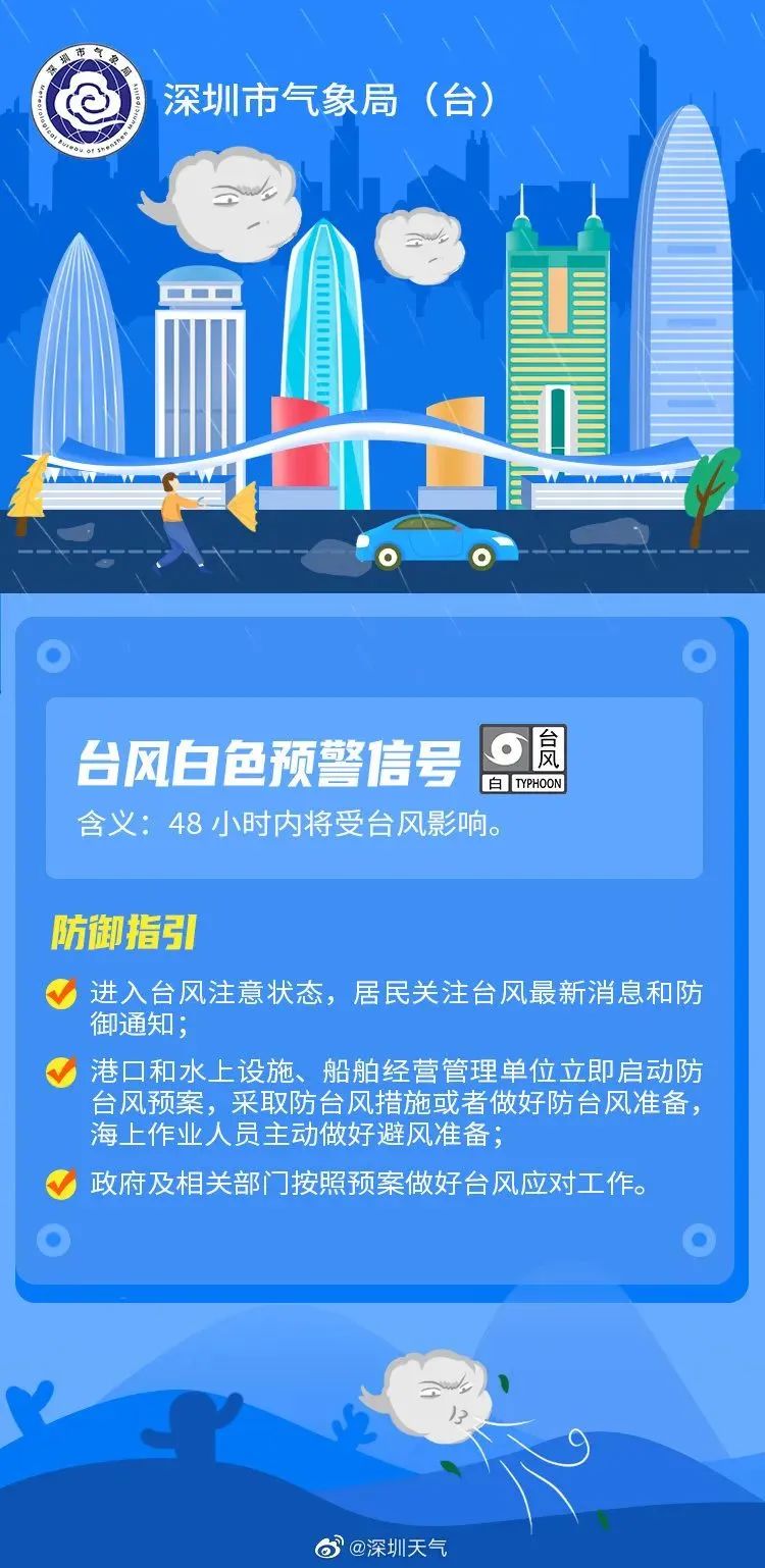
At present, the Typhoon White Early Warning signal in Shenzhen is also effective. According to the latest news of the Shenzhen Meteorological Bureau, under the shadow of the tropical low-pressure peripheral of the South China Sea, a new round of wind and rain will appear on 9-11 Shenzhen (including Shenshan) and accompanied by thunderstorms.
Let's take a look at the specific weather forecast
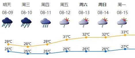
On the 9th, there were heavy rain to heavy rain; on the 10th, there were heavy rain to heavy rain; on the 11th, there were local heavy rainstorms; the largest gust of gusts 8-9 on the coast, highlands and sea areas on the 9-10th.
Cloudy on 12-15, there are intermittent showers or thunderstorms.
There are also the following risk prompts, please check
1. On the 9-11, the largest gust of gust of gust of the coast, highlands and sea areas, please pay attention to the placement of outdoor items, reduce coastal tourism and sea activities, and pay attention to safety at sea and high-altitude operations.
2. In the early stage of Shenzhen, the cumulative rainfall was large, the soil water content was high, and the risk of geological disasters was extremely high. Citizens were requested to stay away from dangerous areas such as slope, retaining wall, and old houses.
3. Frequent rainfall on 9-11, high risk of urban waterlogging and road accumulation of water. When rainy areas such as river channels, low-lying waterlogging areas and other dangerous areas, try to avoid indoor as much as possible to reduce unnecessary outdoor activities and homework, bypass them, bypass them, bypassing it. Pay attention to the safety of travel.
- END -
The first "zero -plan power outage" demonstration area of Fucheng was completed
In the citizen's impression, the power supply department often issues a power outage announcement, and plans to perform power outages or replacement of poles such as power outages or replacement of po...
Construction of the position of the platform and the municipal customs committee of the Old Cadre Bu
In order to further promote the construction of veteran cadre work and grass -roots party building, on June 1 and 2, the Municipal Party Committee Old Cadre Bureau, the Municipal Customs Working Comm