Typhoon "Mulan" is ready!
Author:Huizhou TV Station Time:2022.08.09
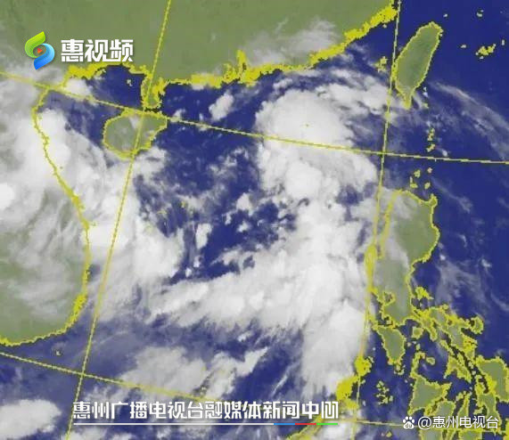
The tropical disturbance, which is located in the sea surface of the central part of the South China Sea, has been strengthened to a tropical low pressure at 14:00 on the 8th. The Huizhou Meteorological Observatory predicts that it will first move to the northwest at a speed of about 15 kilometers per hour.For "Mulan".It is understood that the tropical low voltage has the characteristics of a wide range of winds and high peripheral winds, tending to the coast of Hainan to western Guangdong.
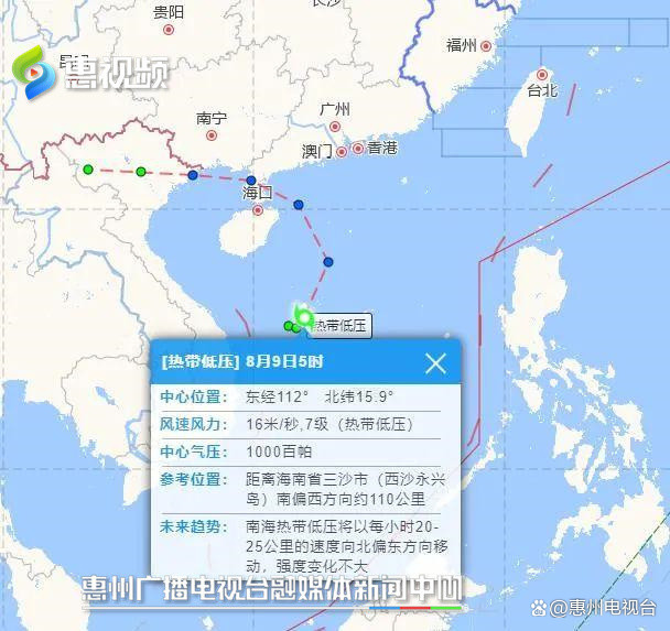
Huizhou Meteorological Observatory Weather Forecast: "At present, this typhoon is the strength of the tropical storm, the central wind is eight, and the wind speed is 13 meters per second. Affected by it, the city will have very obvious precipitation in the future."

Affected by it, from the 9th to 11th, Huizhou had a local heavy rain precipitation process.At present, the white warning of Typhoon of Daya Bay, Huiyang, and Huidong takes effect.
In view of the development trend of tropical low pressure, according to the "Huizhou City Flood Control, Drought Prevention and Wind -proof and Prevention Emergency Plan", the Huizhou Three Prevention Headquarters decided to launch a wind -resistant level IV emergency response at 24:00 on August 8.The 24 -hour joint -duty system is implemented during the windproof emergency response period to ensure the safety of the lives and property of the people.
- END -
Luchuan County Meteorological Bureau issued a lightning yellow warning signal [III level/heavier]
Luchuan County Meteorological Bureau issued a thunderbolt yellow warning signal at 2:45 on June 8, 2022: At present, the thunderstorm cloud group is gradually approaching the western part of Luchuan C
[Creating City in Action] Le'an Street: Creating Capital Action not only stops people from benefiting people's livelihood

In the past, some cars stopped at the fire channel. In case of an accident, we did...