Guilin: Without him, there would be no world world
Author:Institute of Geological Earth Time:2022.08.11


"
There are mountains in the cave, and there are holes in the mountains.
300 million years ago, there was still a sea of ocean.
The bones of various creatures in the ocean and other calcium -containing substances are slowly deposited together, forming a thousand -meter -thick limestone on the bottom of the sea. Thirty million years ago, due to the role of the crustal movement, the good show of marine changes was staged again.
The limestone surfaced to the sea and became a less hard land. Then the performance time of rain and snow and rivers, water flowing, dissolving, erosion, cutting, polishing ... eighteen martial arts were scratched on the "soft" land.
The limestone cannot resist, and the above part of the ground becomes a peak forest, peak, and lone peaks with many dreams and poetry.
"There are mountains in the cave, there are holes in the mountains", this is the Karst landform, also known as the rock -soluble landform.
"Karster" is a transliteration English place name. It originally refers to a limestone height in central Europe and the Mediterranean coast, which means that the rocks are exposed. European geologists first announced officially, so "karst" became synonymous with this rocky landform.
In fact, a Chinese did not use any instruments and depended on the volume of visual inspection, and comprehensively inspected the solvemental landform, which was more than 100 years earlier than the Europeans. He also recorded these important contents in his diary.
Let us shout his name loudly: Xu -Xia — Guest!
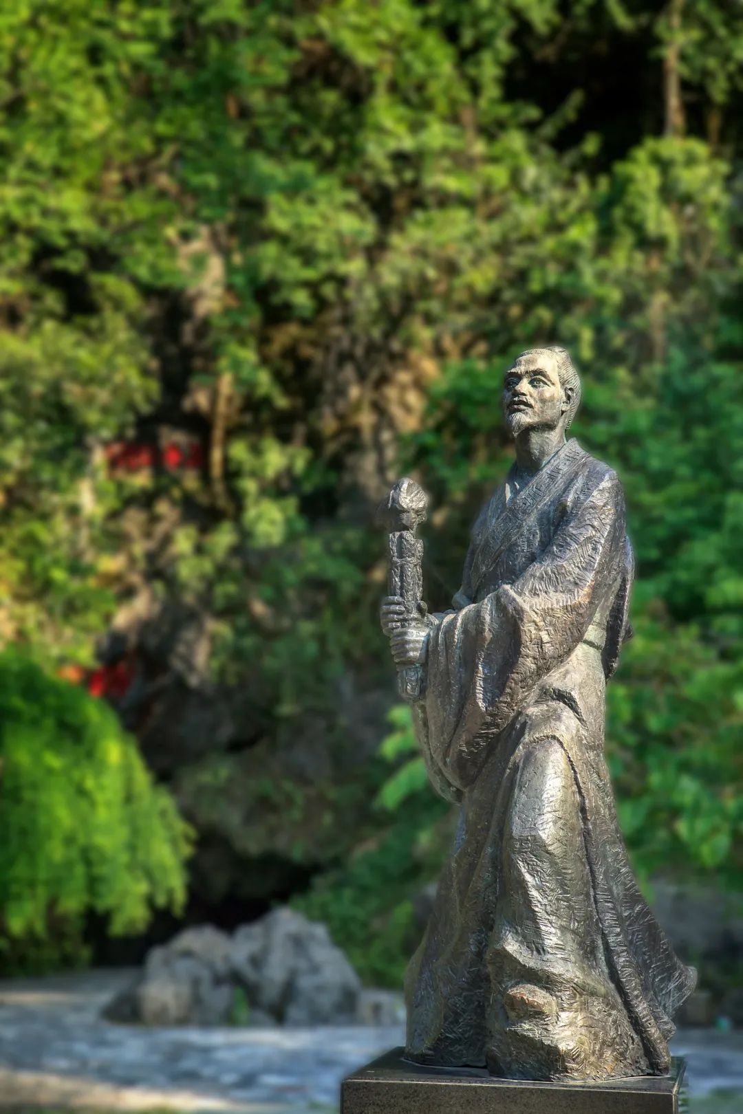
Yes, Xu Xiake can be said to be a great pioneer of rock -soluble landlord science.
If "Xu Xiake Travels" can be published earlier, then this kind of landform is likely to be named "Xu Xiake" or "Guilin".
Because the starting point of Xu Xiake's rock -soluble land -soluble land scientific research is Guilin -here has the world's unparalleled karst beauty.

Gui Lin in 50,000 words of travel notes
Xu Xiake "temporarily lived" in the landscape of Guilin, climbed more than 320 stone mountains, drilled into more than 60 caves, climbed rock 9 times, and wrote a very detailed travel notes with more than 50,000 words.
We know that in ancient times, due to the blockage of Nanling, people traveled and traveling in Lingnan and inland.
So the question is, how did Xu Xiake come to Guilin? He arrived in Xing'an County, Guilin from Lingqu, Hunan. It was the busiest period of Lingqu Water Transport in history. The most lively street in the county is the section of Lingqu through the city.
On both sides of the sinking foot, the goods are sold along the coast. You can buy it on the ship. The shopping experience is particularly good. However, on the day Xu Xiake came, I do n’t know why the street was a bit deserted. Only a few near Wanliqiao were doing business. Wanli Bridge is the oldest bridge on Lingqu. It was first built in the Tang Dynasty and was named after 10,000 miles (5,000 kilometers) from Changan.
From Wanliqiao, you can see the "steep door".
"Steep Gate" is a very creative design, which is a sluice unique to Lingqu that allows the ship to pass. The two sides of the strait are made into semi -circular shapes, stretched into the heart. When the boat passed, the steep rod was erected to block the water flow and raised the water level, and the boat could pass smoothly. Xu Xiake stood on the edge of Qu for a long time and observed how the fleet passed.
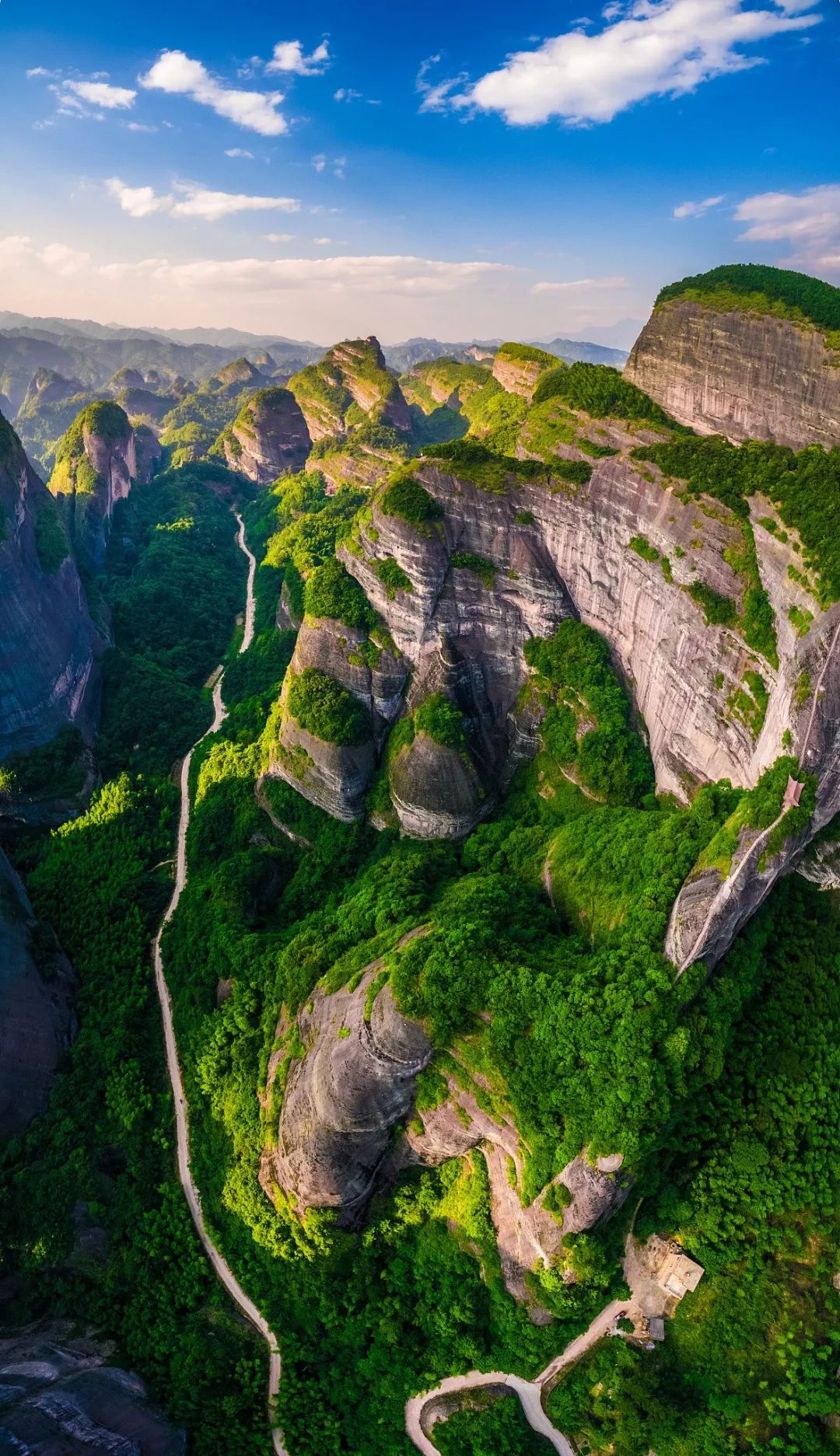
People often say that Chongqing is a mountain city, so is Guilin.

Walking on the street, you always meet a mountain. It's just that the mountain is really not much higher than a building. It is exquisite, as if it is a big bonsai in the city, and Qixing Mountain is one of them.
Qixing Mountain is composed of seven -seater at about 250 meters above sea level, and is named after the corresponding Beidou Seven Stars. Qixingyan is in the half -mountainside of Qixing Mountain. It is a cave of about 1000 meters long. The stone lacta, stalagmites, stone pillars, stone veils, and stone flowers in the cave are strange and strange.
It was originally an underground river. More than 1 million years ago, an earthquake changed its destiny, revealing the ground and becoming a cave.
Before Xu Xiake ordered the torch to explore the cave, Qixingyan was already a tourist destination, but no one knew how many holes had Qixingyan.
After Xu Xiake drilled back to the cave twice, he played the dust on his body and said that there were 15 caves in Qixingyan. The current scientific researchers use modern instruments to find it. They only found 15 holes in the founding.

Big city bonsai
Guilin's most famous "big bonsai" is Xiangbi Mountain, which is the symbol of the city emblem of Guilin City and the landscape of Guilin.
Xiangbi Mountain is located on the west bank of the Lijiang River in the center of Guilin. The rocks hang into the water like a giant elephant with nose extension.
This behemoth is 55 meters above the water surface, 108 meters long, and 100 meters wide. The rear body stands on the shore and the front body is overwhelming. It has been standing here for 360 million years.
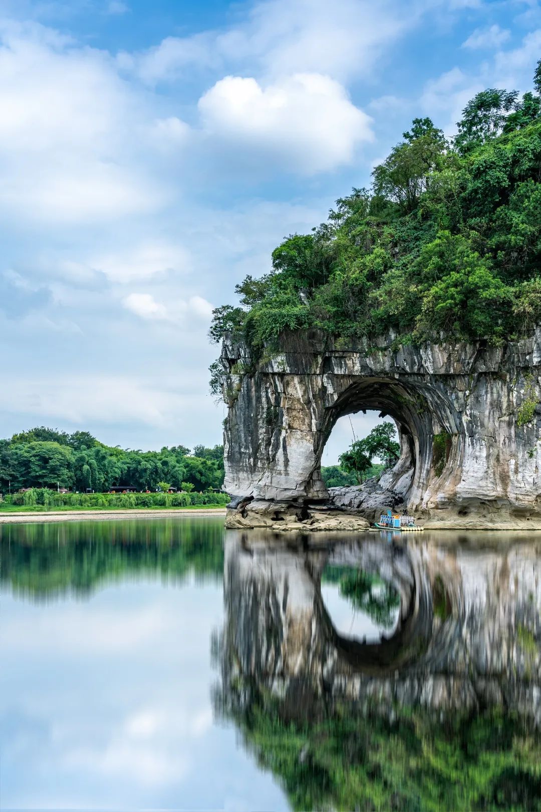
The elephant nose and oblique arches are all exquisite and lifelike. There is a circular cave between the elephant nose and the elephant legs. When the river rises, it is like a bright moon surface.
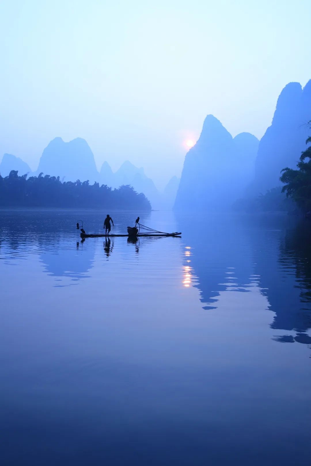
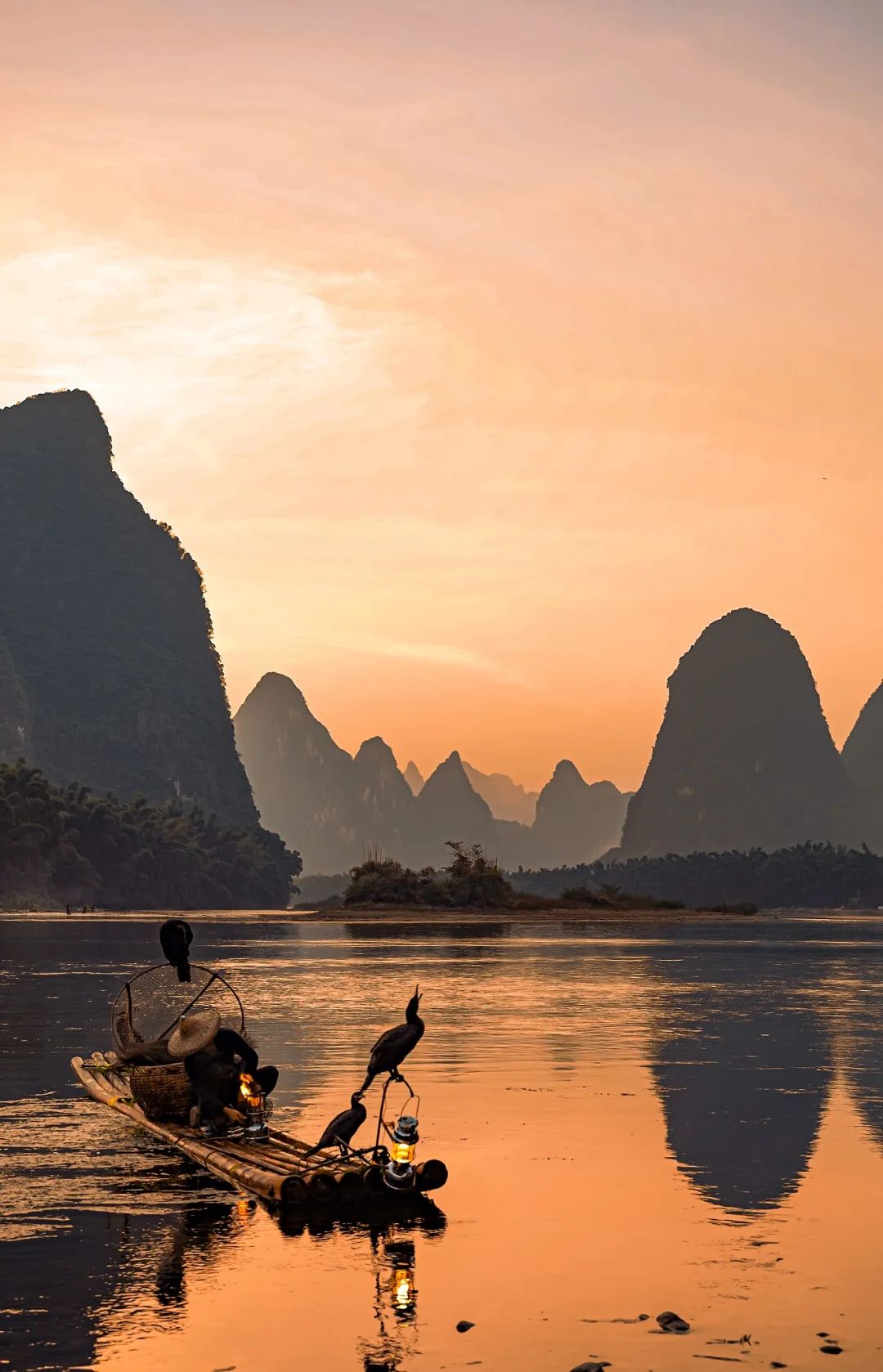
This hole is the water moon hole that Xu Xiake repeatedly mentioned in his diary. On the night of the full moon, a moon in the sky, a moon in the Lijiang River, and the moon cave is also a moon.
How did Shuiyue Cave appear?
It turned out that the water surface of the Lijiang River was wider than now, and the amount of water was larger than now. The entire Xiangbi Mountain is an island of Jiangxin. However, the crust rose, the Lijiang River narrowed, and the water moon cave emerged from the underwater, which changed from small to large, and gradually formed.
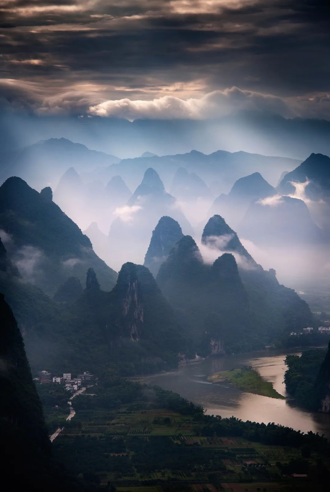
Xiangbi Mountain and Shuiyue Cave are masterpieces of rock -soluble landforms and Lijiang.
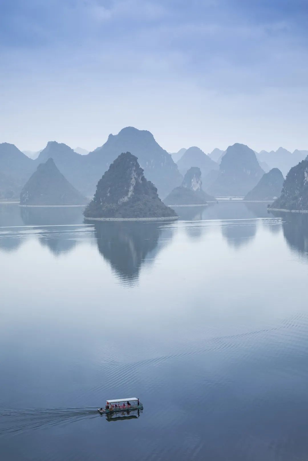
Such a masterpiece is just the prelude to the world of Guilin's landscapes. The real essence is on both sides of the Lijiang River. The Lijiang River belongs to the Pearl River Water Department, which originated from the highest peak of Nanling Matshan for 164 kilometers. The Lijiang River often refers to the river section of 83 kilometers from Guilin to Yangshuo. It is the most typical, richest, and most concentrated area of rock -soluble landforms. It is the peak of the real karst beauty. Between the tens of thousands of upright peak forests, Lijiang cuts a deep "V" -shaped canyon like a cake. The scenery on both sides of the strait is beautiful and extraordinary, like the state of immortality. In Xu Xiake's words, "the intention is not the intention", which means that the Lijiang River is too beautiful, and it is completely beyond imagination.

Like us, he also traveled to the Lijiang River by boat. He set off from Guilin at noon and was dark when he reached Yangshuo. However, Xu Xiake expressed regret. In his diary, he said that the Lijiang River flowed from Guilin to the south.
There are many Jiangzhou split in the river. There are no reefs and rapids, and the water flows slowly and stable. Although the waterway is curved, the boat should not have an accident at night. The moon rose too slowly. His boat touched the black navigation, but the moonlight stopped at the shore when the moonlight died.
We have also arrived, follow Xu Xiake to get off the boat. Have you fell in love with Guilin?
- END -
The "three batches" project in Lintong County adds a strong motivation for "Linke's Speed"
Yingxiang.com (Elephant Journalist Yang Zengqiang, correspondent Han Jingjiao Yonggang) The number of concentrated projects, large investment, and high quality, will further set off a new climax of t
Non -relics Dunhua 鲜 North Korean top water dance
The Korean Top Water Dance was included in the provincial intangible cultural heri...