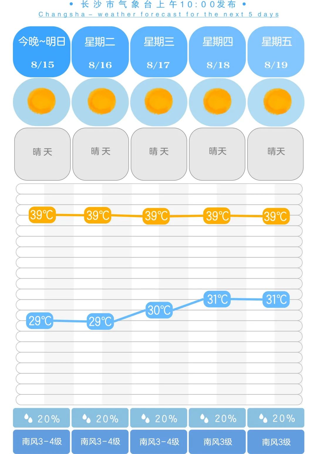
In the next week, Changsha will continue to be sunny and hot, high temperature weather!
Author:Changsha release Time:2022.08.14

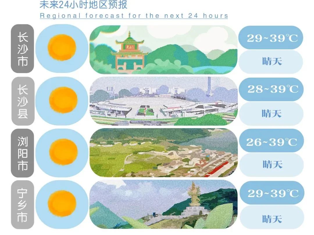
On the weekend, the hot and heat continued, and the Hunan Hydrological Water Resources Survey Center issued a drought blue warning on the 13th. The meteorological department is expected to be above 39 ° C in local area and prefecture in 12 cities and states on the 14th.
At present, we are in the middle stage of Sanfu Tian, which is the hottest time of the year, and this year's midfu can be regarded as "high -end version". It is a burst. Various historical records such as the maximum temperature, minimum temperature, 40 ° C+hot days, and continuous high temperature days in many places across the country have been broken or will be broken.

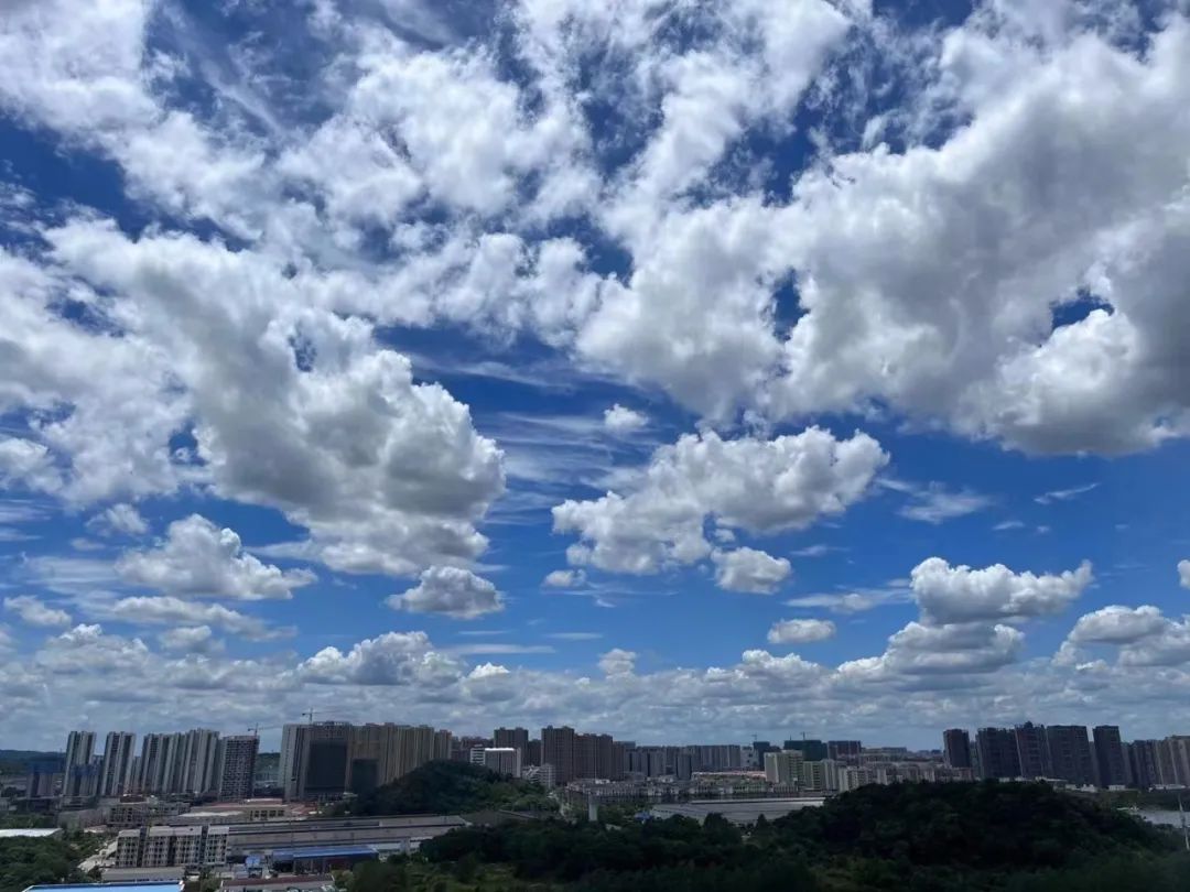
Changsha release photography group "Gu Shan Taiyun"/Photo
Why is it so hot this year? How long does it take to get hot? Can Changsha make artificial rainfall? Xiaobu interviewed meteorological departments around related topics.
How hot is this year?
Since July, Changsha's high temperature days have reached 34 days since July this year. In the middle and lower reaches of the Yangtze River in my country, there have been large -scale and strong high -temperature weather. The highest -level red warning was released for two consecutive days. "In the next two weeks, the high temperature weather in the south will continue. It is expected that the comprehensive intensity of high temperature weather this year may be the strongest since the complete record in 1961." Chen Lijuan, chief forecaster of the National Climate Center, introduced. The current high temperature process, since July 20th, the average high temperature impact range is 147,000 square kilometers, covering nearly 70%of Hunan Province, and the comprehensive intensity is "special".
The reporter learned from the Municipal Meteorological Observatory that since July, this round of high temperatures in Changsha has reached 34 days. Why is it so hot?
Chen Tao, chief forecast at the Central Meteorological Observatory of the deputy high -strength control field, said that the main cause of high temperature occurring is related to the abnormal conditions of the atmospheric circulation. "From the perspective of current monitoring, the Western Pacific subtly high -pressure range is large and strong. Under its control, the southern region of my country is under the control of the sinking air. Below, near the ground heating is strong, so a large -scale high temperature weather appears. "
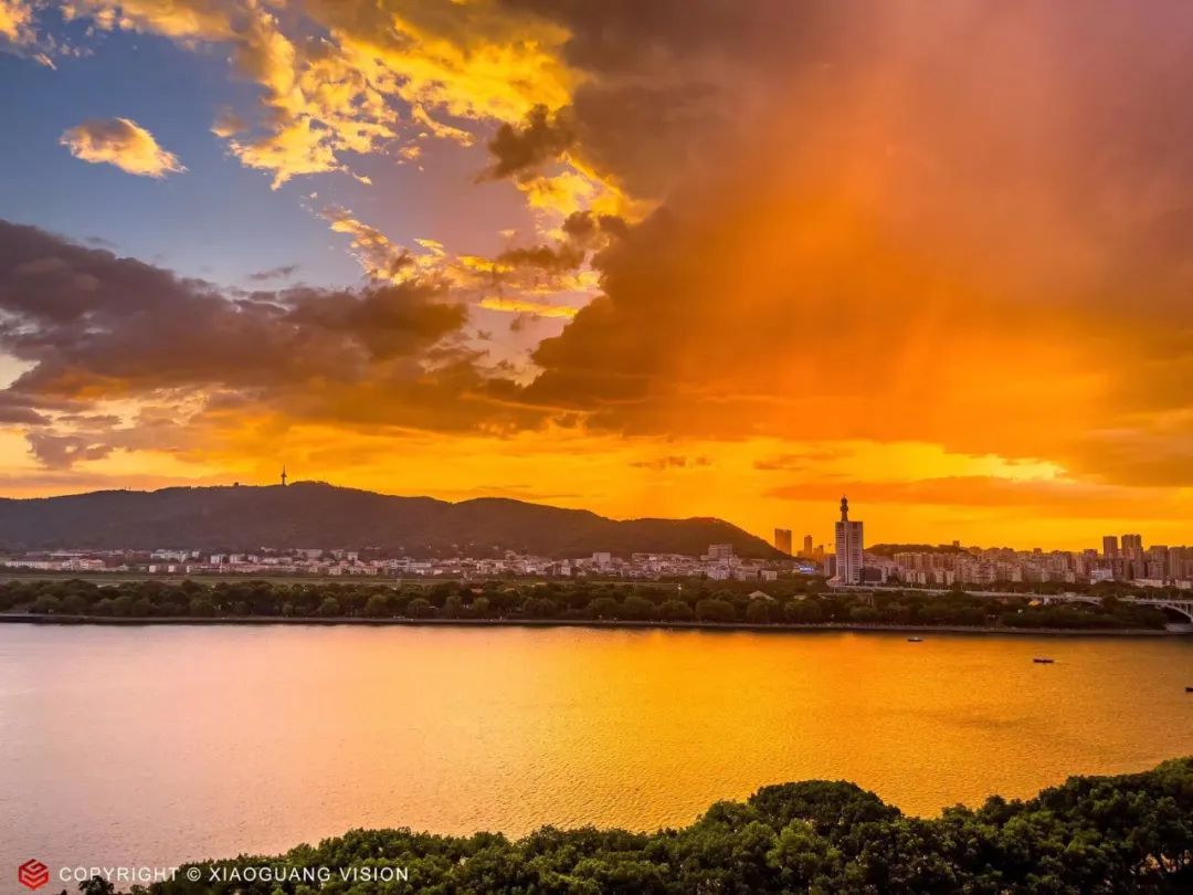
Changsha publishing photography group "Xiaoguang Vision"/Photo
Global warming is a large background of the frequent climate of high -temperature heat waves. The continuous abnormalities of the atmospheric circulation in the middle latitude caused frequent high -temperature heat waves in many places in the world. Zhou Bing, chief expert of the National Climate Center Climate Service, said that over the northern hemisphere, the Western Pacific subtropical high -pressure, Atlantic high -voltage belt and Iran's high pressure were enhanced, making the hot air on the ground unable to spread, and then there was a continuous high temperature incident. Climate events still affect the atmospheric circulation and promote the continuous enhancement of subtropical high pressure. Xie Yijun, chief expert of the Provincial Climate Center, said that with the warming of global warming, the Western Pacific subtropical high pressure shows a significant area of area expansion and strong strength. Strong, the more difficult it is to shake its status. "The subtropical high pressure is like a giant pot lid to cover the hot air in the heat wave area, and at the same time prevent the cold air from entering, through the comprehensive effect of radiation temperature increase, making the high temperature more and more intense. When can it increase rainfall? There is no condition in the next week, and it has been prepared for the continuous impact of high temperature heat waves, and the rainwater is scarce. The city's meteorological department predicts that the precipitation in Changsha is less than 40 % to 50 % in mid -to -late August. From ° C to 3 ° C, the drought will be further developed, and the drought in September will intensify. Why does the drought increasing, why not increase the rainfall? The reporter learned that the Hunan Meteorological Department is currently organizing the production of artificial rainfall and grounding artificial rainfall on the ground in the province. Operations. Artificial rainfall operating aircraft has arrived in Changsha on August 10.
"Artificial rainfall is not artificial rain, and the suitable weather conditions need to be successful." Huang Yuting, deputy director of the service center of the Municipal Meteorological Bureau, said that when the clouds are thick, the clouds in the clouds are in the middle of the cloud, and the rising airflow can only be launched through the rocket. Bouncing or aircraft sowing to send catalysts such as silver iodide into the cloud, thereby increasing the rainfall efficiency of clouds. "From the current point of view, there will be no good weather conditions in the next week." However, the technical staff of the Municipal Meteorological Early Warning Center has debugged the artificial rain increase operation equipment such as rocket launchers and pays attention to the weather dynamics at any time. The conditions will immediately grab the sky, urging the clouds.

Source 丨 Changsha Publish Comprehensive
Material 丨 Changsha Meteorological, Star Online, Changsha Evening News
Picture 丨 Changsha publishing photography group "Gu Shan Taiyun" and "Xiaoguang Vision"
Edit 丨 Chen Meng school against 丨 Wen Chunyan
Review 丨 Du Jin
- END -
87 -year -old Brazil's most richest widow died: the two husbands died 4 times to get married, and the jewelry collection was amazing

Fan said: jewelry ladiesRecently, Brazilian lady Lily Safra died at the age of 87 ...
Enping Public Security cracks down on crimes and does not feel soft, and rescue the enthusiasm of the masses!

Enping Police News