Typhoon "saddling" path to the south of the road has a great impact on the wind and rain of the sea surface of Gui South and Beibu Gulf
Author:CCTV News Client Time:2022.08.24
It is learned from the Guangxi Meteorological Observatory that it is expected that the typhoon "saddle" (strong tropical storm) will land on the western coast of western Guangdong during the day on the 25th, and then continue westward. From the afternoon of the 25th to the evening of the evening, it will enter Gui South with a strong tropical or tropical storm. Affected by it, from the 25th to 26th, most of Gui Nan had heavy rains, heavy rainstorms to the heavy rain, and there were 6-8 gusts of gusts 9 to 10 in the coastal and parts of the coastal areas. ~ level 9, gusts 10 ~ 11. The "saddle" path is adjusted south, which has a great impact on the wind and rain of the south of Gui South and Beibu Gulf, and it is necessary to further strengthen the defense.
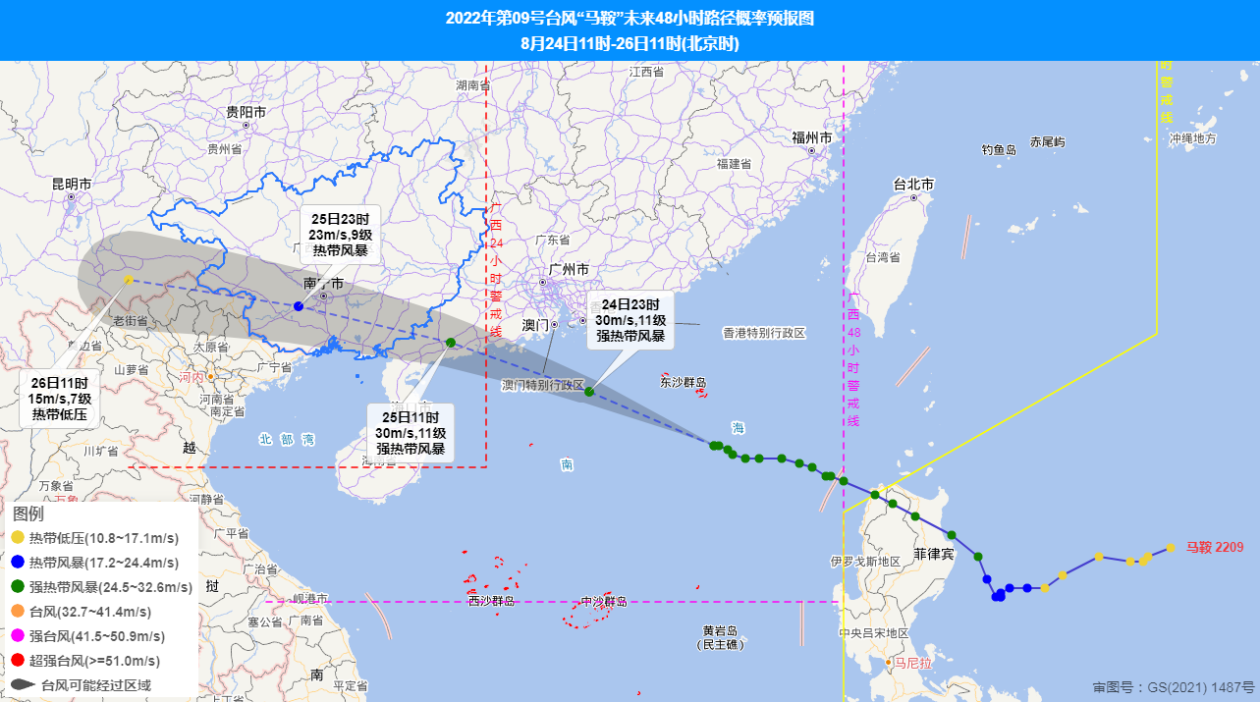
Typhoon No. 9 this year's "saddle" (strong tropical storm) center is located on the sea about 590 kilometers south of Guangdong (19.5 degrees north and 117.1 degrees east) at 11:00 today (24th). There are 11 levels (30 meters/s).
It is expected that the "saddle" will move north to north at a speed of 25 to 30 kilometers per hour, and the intensity will also be enhanced. From the morning of the 25th to the afternoon of Zhuhai, Guangdong to Zhanjiang, it will continue to the west. Tropical storms or tropical storms moved into Guangxi, and the intensity gradually weakened.
Affected by the "saddle" of typhoons, there will be obvious wind and rainy weather on the sea surface of Gui South and Beibu Gulf from 25-26. The cumulative process of the rainfall is more than 100 to 200 mm in the south of Gui South, with a local area of more than 250 mm, 20-80 mm in other parts of Guangxi, and 70-90 mm in the smallest hour. There are 6 to 8 gusts of gusts 9 to 10 gusts in Guinan and parts of the coastal areas, and levels 4 to 6 gusts 7 in other regions. There are rotating winds from the surface of Beibu Gulf of 7-9 gusts of 10 to 11.
Beibu Gulf Sea: Tonight, there will be shower or thunderstorms, and the southwind is 4 to 5; tomorrow to 26th daytime, heavy rain, rotation wind 7 to 9, gusts 10-11 levels; , Cloudy with showers or thunderstorms, southwind 4-5.
The typhoon "saddle" path is adjusted south and accelerated. The structure is densely structured and the extensive wind range has a great impact on the wind and rain on the sea surface of Gui South and Beibu Gulf. It is recommended that all localities and relevant departments further strengthen typhoon defense work to prevent secondary disasters such as rainfall, windy weather, and its possible urban and rural floods, floods, and landslides.
The Guangxi Meteorological Bureau upgraded to the yellow warning of the typhoon on August 24 and promoted to a major meteorological disaster (typhoon) level III emergency response. The meteorological department in the region will continue to closely monitor the dynamics of the desk and follow up to do a good job of monitoring and early warning forecasting services.
(Deng Junyang, the reporter of the head station)
- END -
[Satisfied Hekou in Action] Guo Island Town: "Light" to the masses' happy life to solve community governance problems
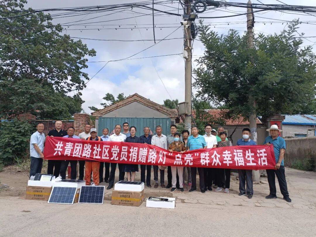
The level of community governance is directly related to the personal happiness of...
News story | The procuratorial power behind the love relay of 8 years

□ Li Zhifang Yan Zhao Zhang Xin/Wen TuOne morning in June 2022, Nanjing Universit...