Every line is all rivers and mountains!New version of standard map release
Author:China Youth Network Time:2022.08.29

Today (August 29)
2022 Publicity Publicity Day Publicity Day
And national territory conscious publicity activity week
The home event is held in Beijing
The theme of this year's activity week is
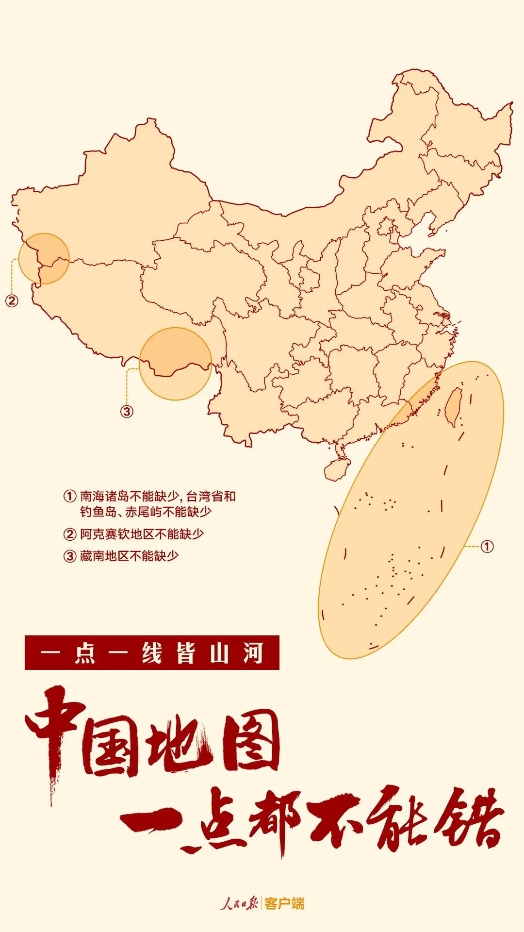
"Nothing can be used to use the map at all"
646 were released at the event site
2022 Edition Standard Maps and Reference Maps
How to identify the question map? Watch the video
How to view the standard map?
Users can pass through the official website of the Ministry of Natural Resources
And the national geographical information public service platform "Sky Map"
Standard map service system
Free browsing, download standard map
(For details, click to read the original text)
What is the national territory?
The national territory is a country
Exercise sovereignty and jurisdiction
It is a symbol of national sovereign and territorial integrity
The map is the most important manifestation of the national territory
Reflect the scope of the country's sovereignty
Has serious politics
Strict science and strict statutory nature
Behind the "Map" is not just a map problem
Demonstration of important islands, wrong painting border lines and other behaviors
Seriously damage national sovereignty, security and development interests
Every point, every line in the national territory
All areas that are not tolerated
The motherland can not be lost in one inch!
Map of China cannot be wrong at all!
- END -
The amount involved in the case was more than 700,000 yuan.

On July 7, the Public Security Bureau of Xiangtan County successfully cracked the ...
The Urban Management Bureau of Hentang District strengthens municipal maintenance and helps the creation of civilization
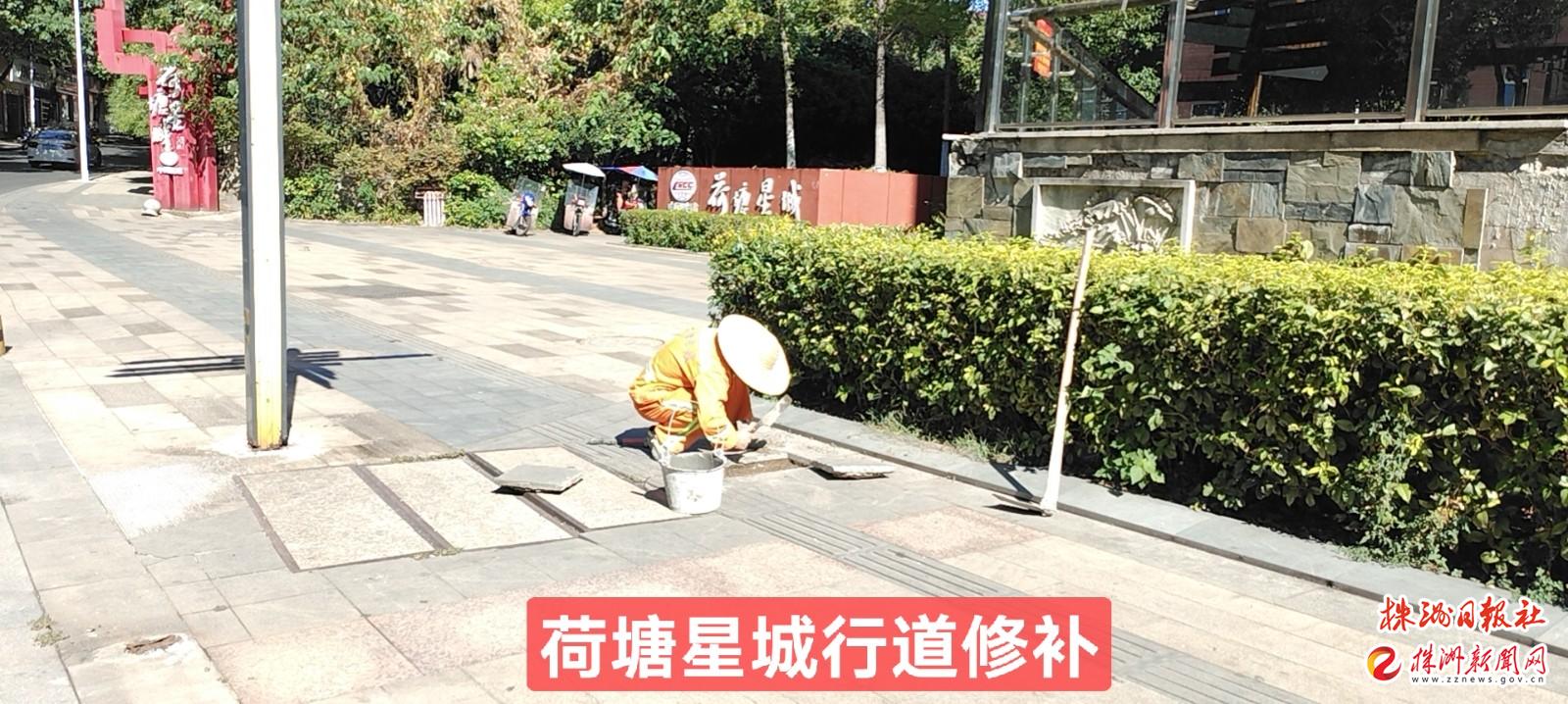
Zhuzhou News Network, August 16th (Correspondent Wang Xifang) Recently, the Munici...