7 satellites in the "Fengyun family" are running on track, what are you "busy"?
Author:Guangming Daily Time:2022.07.11
"The main data products of Fengyun No. 3 E -Star and Fengyun No. 4 B -star two Fengyun Meteorological 'New Stars' will be opened and shared to global users." Recently, at the 75th session of the World Meteorological Organization (WMO) Executive Council, Zhuang Guotai, Secretary of the Party Group and Director of the China Meteorological Administration.
Can these two satellites be able to serve the world?
According to reports, Fengyun No. 3 E Star is the world's first civilian morning dusk rail business satellite, filling the gap in the global numerical weather forecast model in the morning and dusk; Star, with the resolution regional imaging ability of 250 meters in a minute. These two satellites and ground application systems were transferred to business trial operation in June this year.
These are just the two latest members of the "Fengyun Family". Until now, my country has successfully launched 19 Fengyun Meteorological Satellites, of which 7 are running on orbit. As a keen space outpost, what are they "busy" in the vast galaxy?
People "Cold and Warm Star": Overlooking the change of Fengyun
These days, heavy rain and high temperature "sing the protagonist". According to the forecast of the Central Meteorological Observatory, from July 11th to 13th, a new rain belt is about to span the east to west, affecting the east of the northwest of my country to the central and southern parts of North China. Facing the complicated weather situation, the forecasters have the bottom: the wind and cloud meteorological satellite monitor the changes in Fengyun, provides timely and rich observation data, and the airflow moves at a glance.
Ren Suling, the chief service of the National Satellite Meteorological Center, said that 10 years ago, Fengyun Meteorological Satellite was generated for a cloud map every half an hour or even an hour with a space resolution of several kilometers. Up to 1 minute and 250 meters.
Not long ago, Jiangnan and South China suffered heavy rainfall. In the vast space at the same time, 7 windy and cloud -weather satellites are paid close to the changes. Every 5 minutes generate a cloud map of China and the surrounding areas, and a designated area cloud map is generated every 1 minute.
Whether it is the accuracy of 90%of the rainstorm warning, or a 40 -minute strong convection weather warning time, or the first time to achieve the forecast of the global typhoon ... my country's meteorological forecasting level is inseparable from the development of observation technology.
"my country's typhoon forecast has made great progress, and Fengyun Meteorological Satellite has made a good contribution." Xu Yinglong, chief forecasman of the Typhoon and Marine Meteorological Forecast Center of the Central Meteorological Observatory, introduced that in 2021, the fast imaging instrument of Fengyun 4 in the rail test stage, The typhoon "Fireworks" was conducted for 1 minute and high -frequency observation. The combination of still meteorological satellites and polar rail meteorological satellites has provided important support for the influence of the influence of typhoon wind and rain in real time. On July 2 this year, the typhoon "Siaba" landed in Guangdong, and there were extreme rainfall in South China. The Foshan Meteorological Observatory released a tornado alarm one hour in advance to win the time for the local defense disaster and the evacuation of the personnel.
Satellite monitoring data can not only accurately reflect the changes in the weather system, but also integrate the numerical forecast mode through data assimilation technology to further improve the accuracy of forecasting.
It is worth mentioning that for the first time in China, my country has achieved the prediction business of the observation business of the Star No. 4 A -Star Atmospheric Vertical Detector of Fengyun No. 4 in the world for the first time in the world. In 2018, the target observation and assimilation of typhoons such as "Maria" performed well. The numerical forecast and Fengyun No. 4 satellite detector "Tiandi Interaction" has carried out target observation and assimilation of the target of forecast demand.
The results show that high time and high spectrometer resolution data significantly improved the model of the typhoon path and the high -pressure strength and location of the subtropical high -pressure. The former chief scientist of the European Meteorological Satellite Development Organization Johannes Schmetz commented: "This is a milestone of the earth's static track detection and assimilation application." From 2018 to 2021, the Chinese Meteorological Administration's scientific research team carried out 9 target observation and assimilation, typhoon 24 hours and 48 The hourly path forecast increases an average of 10%.
Food "Guardian Star": "Wisdom Eye" knows the sky
As the saying goes, "watching the sky eat", meteorological conditions have an important impact on agricultural production, and satellites are a pair of "wisdom eyes" to capture meteorological conditions and agricultural production.
This year's summer harvest is a tough battle. In 2021, the northern part of my country has experienced rare autumn floods. In many places, the winter wheat was postponed and the erotic deviations.
"In order to win this summer grain defense war, the meteorological department has strengthened the linkage with the agricultural and rural departments and the provinces of grain and provinces in terms of satellite remote sensing, establishes a linkage mechanism for the monitoring of the agricultural meteorological remote sensing monitoring of the two -level agricultural meteorological meteorology of the country, and uses the multi -source satellite remote sensing data to comprehensively judge the growth of winter wheat growth. In the case, the analysis report of the impact of crop growth and meteorological conditions was provided to relevant departments in time, and it provided strong technical support for relevant departments to carry out the work of winter wheat spring tube. "Wu Menxin, a senior engineer of the National Meteorological Center, said that wheat harvest has now been harvested by wheat harvest Nearly ending, the harvest is good, and the agricultural meteorological remote sensing service has been well received by all parties.
From "watching the sky to eat" to "knowing the sky", the satellite remote sensing has made agricultural production unknown to known, and will be passive into initiative.
"The essence of agricultural meteorological remote sensing work is qualitative or quantitatively evaluating the impact of the past and future meteorological conditions on crop growth. Quickly and accurately grasp the space distribution of crop planting, which can improve the time and space matching accuracy of crop planting distribution and meteorological factor distribution. The accuracy of the accuracy of agricultural meteorological disaster monitoring and early warning and crop output meteorological forecast is of great significance. "Zhang Mingwei, associate researcher of the National Satellite Meteorological Center, introduced that in May of this year, the China Meteorological Administration" National-Provincial-City/County "integrated large crops distributed remote sensing monitoring The system is initially completed, and high -spatial resolution winter wheat distributed remote sensing products are first applied to the China Meteorological Administration's summer harvest food production meteorological forecast and agricultural meteorological disaster monitoring and early warning business, adding "weapons" to ensure the harvest of food. In order to realize the "rice bowl mainly contains Chinese food", it is also necessary to strengthen the monitoring and management of major food crops in my country.
In recent years, the Chinese Meteorological Administration, the Chinese Academy of Sciences, and the Ministry of Agriculture and Rural Affairs have used Fengyun Meteorological Satellite Data as the data source to carry out the monitoring of meteorological disasters at home and abroad and the monitoring and output estimation of major grain crops such as wheat, corn, rice, and soybeans It provides an important and reliable reference for scientific decision -making.
"Agricultural meteorological disasters have a great impact on my country's grain production, and the effects of drought are the most." In the view of Mao Kebiao, a researcher at the Chinese Academy of Agricultural Sciences, the surface temperature and soil moisture are important parameters in drought monitoring. , But the site is relatively sparse, the space is not enough, and the manual method is time -consuming and laborious.
It is understood that with the development of meteorological satellites, the number of bands and radiation resolution is continuously optimized, and its infrared remote sensing data can be reversed on the surface temperature. The microwave bright temperature data can be reversed to the soil moisture, giving meteorological disasters monitoring, crop growth monitoring, yield, production, and yield. Estimated to provide strong support.
Remote sensing quantitative countermeasures and farmland environmental parameters, based on the data of the windy meteorological satellite data, provides the key parameters of crop growth models, data assimilation systems, and crop estimation of crop growth, and provides valuable value for field agricultural management. refer to.
With the trial operation of Fengyun No. 3 E Star, Fengyun No. 4 B and its ground application system business, the development of agricultural satellite remote sensing business will be more likely in the future.
Ecological "Monitoring Star": Empowering Beautiful China
"Satellite monitoring images show that there are cyanobacteria water in the western coast of Taihu and Huxin District." Recently, a meteorological satellite monitoring report was sent to the Office of the China Meteorological Administration and the Jiangsu Meteorological Bureau, Ecological Environment Department, Water Resources Department and other relevant departments. Subsequently, a department -linked and territorial collaborative cyanobacteria prevention and control operation quickly launched, realizing early discovery, early intervention, and early disposal of cyanobacteria water.
This is due to the strong ground monitoring capabilities of Fengyun Meteorological Satellites. Among them, the static meteorological satellite can provide monitoring of 5 minutes once every 5 minutes in China and the surrounding areas, and can generate a cloud map once in 1 minute in the designated area. Can provide 6 high -resolution surveillance 6 times a day. According to reports, using the advantages of multi -star networking and collaborative observations, Fengyun Meteorological Satellite can also realize dynamic monitoring and evaluation of global and key regional ecological environmental conditions, high time resolution and high space resolution, and help the decision -making department respond faster.
Lake Chakhan Lake, located at the junction of Shangdu County, Shangdu County, Wulanchabu, Inner Mongolia and Kangbao County, Zhangjiakou City, Hebei Province. It is the largest inland saltwater lake in North China. In the past, the ecology was severely damaged due to lack of systematic protection.
In 2020, the special collaboration mechanism for the protection and restoration of the special collaboration mechanism of Chakhaner Wetland in Inner Mongolia and Hebei was established. Two years later, what is the progress of the restoration of the ecosystem of Cha Khan Er?
"Compared with the same period of last year, the vegetation index of Chakhan Laer area increased by 8.5%in April, and the water body area increased by 0.2 square kilometers." This clear special special report is based on the data of Fengyun No. 3 meteorological satellite. It has provided an important basis for evaluating the ecological environment governance of Chakhanl.
Through a variety of methods such as satellite broadcasting, Internet and remote sensing application systems, today, Fengyun Meteorological Satellite Data and products have been widely used in ecological monitoring.
The National Satellite Meteorological Center has also established long -sequence satellite remote sensing data sets such as vegetation, surface temperature, water body, cyanosal, sand, and snow since 2000. More than 10 technical guidance, including sand, dust, snow, and fire. Complete the development of satellite remote sensing applications (Smart) 2.0 and 3.0 version, use in the national meteorological department, and promote it to multiple countries.
In June this year, Fengyun No. 3 E Star, Fengyun No. 4 B Star and its ground application system were transferred to business trial operation. Han Xiuzhen, the chief service expert of the China Meteorological Administration and the National Satellite Meteorological Center, the senior engineer of the State Satellite Meteorological Center, introduced that the resolution spectrum imaginger in the micro -light type of Fengyun 3 E star has the ability to monitor the light information in the morning and dusk. Dynamic monitoring of urban lighting images. As the double -star shining space, its ecological monitoring capabilities have been further enhanced.
At present, my country has provided wind -cloud satellite data and products for 124 countries and regions, including the monitoring and evaluation of ecological environment and natural disasters. 30 countries have registered as an international user of emergency guarantee mechanisms. They have opened green service channels for 42 countries. More than 1,200 students from more than 100 countries have received special training in Fengyun Satellite Application. Our "Ecological Friends Circle" is increasingly expanding.
- END -
Deepen the cooperation of political schools Sichuan Zigong Da'an and Xihua University signed an intellectual property strategic cooperation agreement
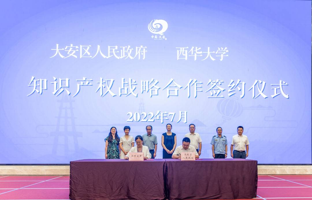
Li Juncong Cover Journalist Liu Ke ShengOn July 9th, the signing ceremony of the s...
Western Union Langalian Autonomous County Meteorological Orange Early Warning of the Great Mist [Cla
According to the latest meteorological data analysis, the West League County Meteorological Observatory was lifted at 11:40 on June 10, 2022 to release the heavy fog orange warning signal released at