National Marine Environment Forecast Center-Hohai University convens a period of staged results exchange meeting for science and education integration and co-construction platform
Author:National Ocean Forecasting Tai Time:2022.07.14
In order to further implement the National Marine Environment Forecast Center-Hohai University's science and education integration related work, and promote the joint construction of a marine environment forecasting business platform, on July 12, 2022, a "three-dimensional temperature salt field reconstruction of satellite remote sensing data based on satellite remote sensing data was held on July 12, 2022. And the "task cooperation and exchange summary meeting. Relevant leaders and comrades of the Business Science and Technology Division of the Forecast Center, the deep -sea department, the Wenyan streaming room, and the team members of Song Xiangzhou and Professor Wang Xidong of the Hohai University Ocean Academy attended the meeting.

The two parties have carried out in -depth cooperation on the construction of my country's marine environmental forecasting business platform and achieved staged results. He Zikang, a doctoral student at the 2020 doctoral student of the Ocean Academy, reported on the "Based on Satellite Data Reversing Marine Three -dimensional Win -salt Field". Introduce the basic overview of the satellite data back to the marine three -dimensional temperature salt field system. Zhang Yu, a deputy researcher of the "Mazu" model of the forecast center, introduced the independent marine circulation model from the principles and use of "Mazu", high -performance parallel computing and mid -scale phenomenon diagnosis analysis. The meeting interacted with a number of cooperation issues and business cooperation, and put forward the ideas and expectations of high -quality development for the next step. In the future, the two parties will focus on their advantages, exert their own characteristics, strengthen talent training, promote complete autonomy Construction of marine environment forecasting platform.

The marine environment forecast in the next two days
Expected tomorrow,
There are light waves from 0.8 to 1.5 meters in the Bohai and Yellow Sea;
The waters near the East China Sea, the Diaoyu Islands, the Taiwan Strait, and the Bus Strait are 1.3 to 2.3 meters of Zhonglang District;
There are 1.5 to 2.8 meters of the middle waves to Dalang District in the east side of Taiwan;
There are light waves from 0.8 to 1.3 meters in Beibuwan;
There are 1 to 1.6 meters of light waves in the north and central parts of the South China Sea;
There are 1.3 to 2.3 meters of Zhonglang District in the south of the South China Sea.
Expected the day after tomorrow,
There is no big wave area in my country.
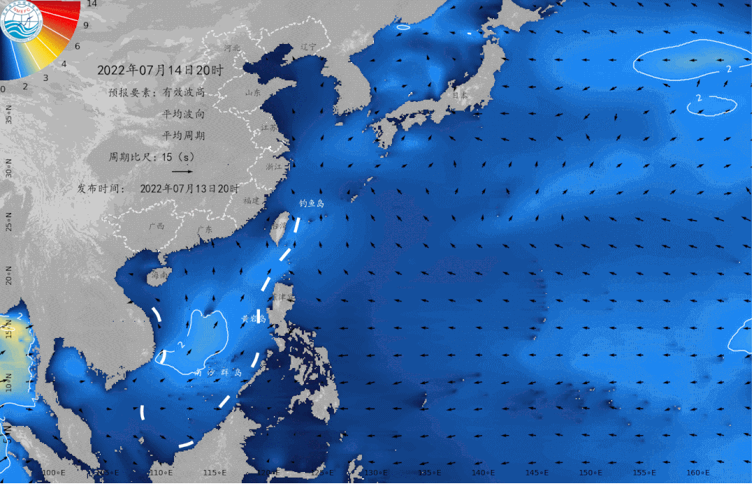
July 14th to 18th northwest Pacific wave numerical forecasting map
Beautiful island waters sea conditions
Expected tomorrow,
There is a 2.2 -meter -long wave near the sea area near the Diaoyu Islands, which is not suitable for traveling by boat;
There are 1.8 meters of Zhonglang near Yongshu Reef, Dongji Island, Dachen Island, Dongtou Island, Nanji Island, Pingtan Island, Dongshan Island, South Australian Island, Yongxing Island, and Huangyan Island are 1.4 ~ 1.6 The middle waves of rice, these islands are more suitable for traveling by boat;
The waters near the other beautiful islands in my country are light waves, with good sea conditions, and they are very suitable for traveling and island.
Beautiful island refers to the following 35 islands:
Juehua Island, Changshan Islands, Bodhi Island, Long Island, Liu Gong Island, Lingshan Island, Qinshan Island, Lianjima, Chongming Island, Shengsi Islands, Sushan Island, Dongji Island, Putuo Mountain, Dachen Island, Yuhuan Island, Dongdong Tou Island, Nanji Island, Laoshan Island, Sandu Island, Pingtan Island, Meizhou Island, Dongshan Island, Diaoyu Island, South Australia Islands, Wanshan Islands, Sichuan Shan Islands, Hailing Island, South Island, Dong Island, Dong Island, Dong Island, Dong Island, Dong Island, Dong Island, Dong Island, Dong Island, Dong Island, Dong Island, Dong Island, Dong Island, Dong Island, Dong Island, Dong Island, Dong Island, Dong Island, Dong Island, Dong Island, Dong Island, Dong Island, Dong Island, Dong Island, Dong Island, Dong Island, Dong Island, Dong Island, Dong Island, Dong Island, Dong Island, Dong Island, Dong Island, Dong Island, Dong Island, Dong Island, Dong Island, Dong Island, Dong Island, Dong Island, Dong Island, Dong Island, Dong Island, Dong Island, Dong Island, Dong Island, Dong Island, Dong Island, Dong Island, Dong Island, East Island, East Island, East Island, Dong Island Dazhou Island, Boundary Island, Wuzhizhou Island, Yongxing Island, Huangyan Island, Yongshu Reef.
More coastal tourism forecasts are all in China's marine forecast
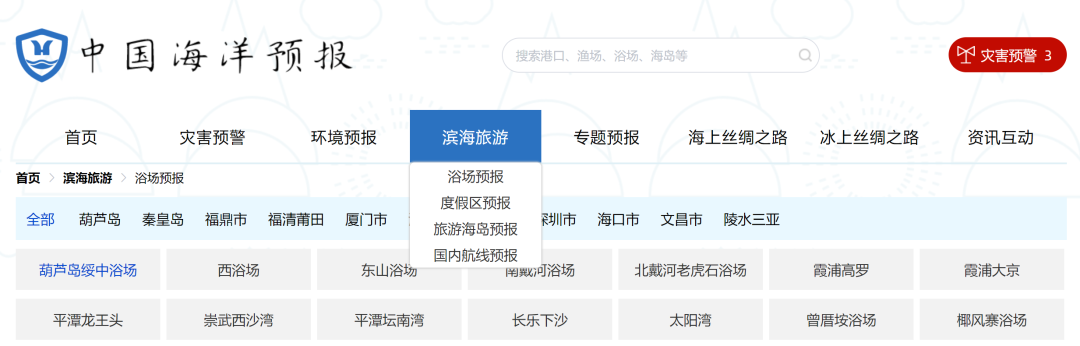
PC can log in to China Ocean Forecast Network http://www.oceanguide.org.cn/indexhome
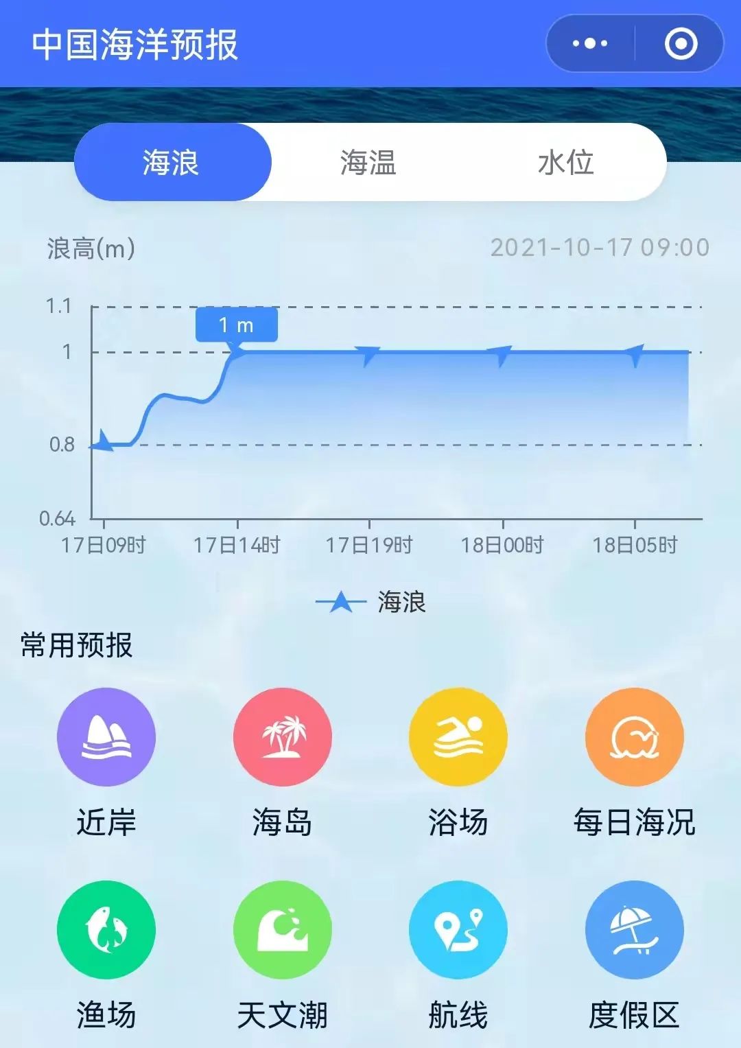
The mobile terminal can use China Ocean Forecast WeChat Mini Program
Click the picture below
Enter "China Ocean Forecast" WeChat Mini Program

Long press the picture below to identify the QR code
- END -
Epidemic prevention and control boat songs 丨 "Cross -provincial United" establish a border joint defense joint control mechanism
The town of Zhouqu Boyu is located in the upper reaches of the Baishui River. It i...
up to date!People in Wuhan

Notice of the municipal people's government on the appointment and removal of Li C...