The first plateau meteorological observation test of high -altitude large drones in my country was successful
Author:Cover news Time:2022.09.19
Cover news reporter Zou Ajiang Picture is provided by China Aviation Industry Group
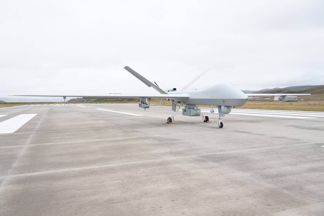
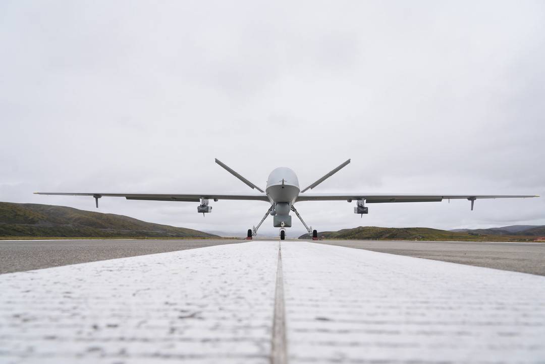
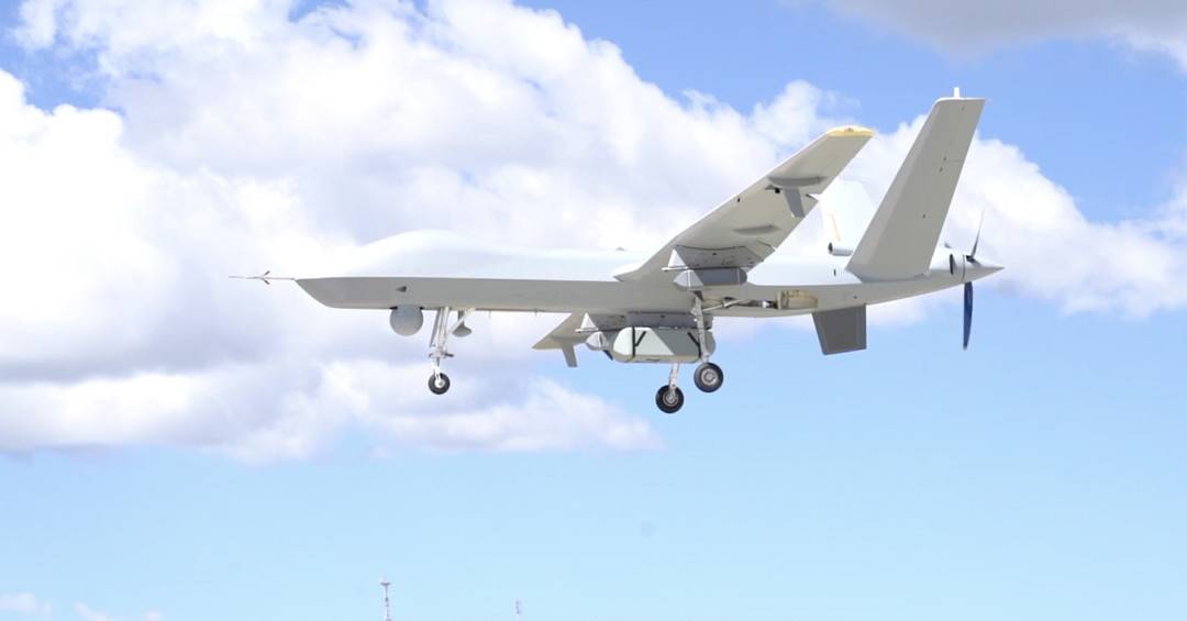
On September 19, the cover reporter learned from China Aviation Industry Group that on September 17, a large-scale drone "Pterosaur" -2 self-developed high-altogenic detection of high-altitude weather detection from the aviation industry was empty From the beginning, the Anima Qing Snow Mountain in the Sanjiangyuan area of "China Water Tower" successfully voted for 12 aircraft in the 7500 -meter high altitude, together with the comprehensive line instrument of the airborne synthetic aperture and the atmospheric microwave comprehensive profile. "Scan" vertical and lower surface.
It is understood that with the real -time transmission of observation data such as cloud system distribution, water vapor structure, wind farm and under -padding conditions in a group of Sanjiangyuan areas, the first -time operation of the high -altitude large -scale drone plateau meteorological observation test was successful. It provides key scientific data for scientific grasping the evolution of weather and climate systems such as high -voltage pressure, southern branch grooves, plateau vorteys such as the southern branch, and plateau vortex, and the influence of low latitude marine water vapor entering the channel of my country. The first line of defense of disaster reduction is of great significance.
Xu Xiangde, an academician of the Chinese Academy of Engineering and chief test consultant, said that the Qinghai -Tibet Plateau has a great impact on my country's, East Asia, and even global climate change, but the area is difficult to build stations, atmospheric vertical structures, and lack of observation information.
With the advantages of high -altitude large -scale drones, obtaining fixed -point and larger vertical observation materials, especially at the atmospheric vertical detection and water circulation three -dimensional structure and water supplies of Sanjiangyuan area and the "hometown of glaciers" wavemi and water supply. Knowing that it will become an important basis for the decision -making of the Qinghai -Tibet Plateau water resources and ecological security in the context of climate change.
The terrain of the southwest region is complicated and diverse, and has been regarded as a "ceiling" that has always been regarded as the difficulty of weather forecasting. This test is an important result of a large -scale unmanned aircraft meteorological observation project ("Haiyan Plan"), which helps to obtain comprehensive detection data of meteorological multi -dimensional, multi -dimensional, and high -resolution of Meteorological areas in Sanjiangyuan area. The meteorological department will fully apply the ecological data of the atmospheric vertical profile and the lower pads obtained this time, and promote the analysis of the influence of water-water resources in the "Asian Water Tower" and the influence of water resources in the later period. ability.
Since the launch of the "Haiyan Plan" of the China Meteorological Administration, it has achieved three -dimensional detection of cloud systems around the typhoon and promoted the establishment of drone marine detection mechanisms.

This year, the Meteorological Exploration Center of the China Meteorological Administration selected the "Pterosaur" -2 large-scale drone independently developed by the aviation industry, and 16 units including the aviation industry jointly conducted a Southwest Observation Test. The Sichuan Provincial Meteorological Bureau strengthened the coordination and weather forecast of the Sichuan Provincial Meteorological Bureau.
Li Liangxu, chief of the experimental chief and director of the Meteorological Exploration Center of the China Meteorological Administration, said that after the success of Shoufei, it will also focus on the water vapor channel, glacier distribution and glacier area water supply to carry out multiple aircraft detection in Sanjiangyuan area. The construction of the main body of the air -based observation system, explore the establishment of a national mobile observation business, and provide richer data for the ecological protection of the Qinghai -Tibet Plateau and the scientific response to climate change.

It is reported that the pterosaur drone that performs this trial task has high reliability and excellent complex environmental adaptability. It can not only conduct meteorological detection, but also be applied to various scenarios such as artificially affect weather operations, emergency communication, and disaster survey.

In the future, the aviation industry will accelerate the construction of pterosaur drone air -based meteorological detection platforms and contribute to my country's meteorological cause, emergency disaster relief and national economic construction.
- END -
Come to the Chinese Academy of Sciences to study!"Scientific Public Class" (Season 2) is here!
Recently under the offensive of high temperatureXiaobian just wants to air -condit...
Plants in China Space Station
Ask the growth and development of rice under the condition of the micro -gravity i...