congratulate!The first plateau meteorological observation test of high -altitude large drones in my country was successful!
Author:China Meteorological Administr Time:2022.09.17

On the morning of September 17th, in the Sichuan -Tibetan Qiang Autonomous Prefecture, Sichuan Province on the southeast edge of the "Range Royal Ridge", a large -scale drone from high -altogenic weather detection developed by my country started from Hongyuan Airport and at the "China Water Pagoda" The Anima Qing Snow Mountain in Sanjiangyuan area was successfully voted for 12 aircraft in the 7500 meters high altitude. Together with the comprehensive lines of the airborne synthetic aperture, the atmospheric microwave comprehensive profile, "scan" the vertical and lower pads of the Qinghai -Tibet Plateau!
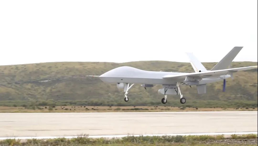
The picture shows drones take off
With observation data such as cloud system distribution, water vapor structure, wind farm and under -padding conditions in a group of Sanjiangyuan areas, the real time returns to the ground command system in real time. my country's high -altitude large -scale drone plateau meteorological observation test is successful in the first flight. my country's high -voltage pressure, southern branch slot, plateau vortex and other weather and climate systems have evolved, and low -weft marine water vapor enters the influence of my country's channels. The Dao defense line is of great significance.
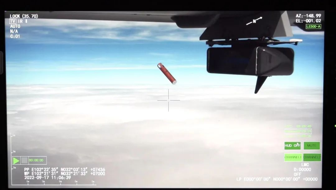
The picture shows the drone successfully voted for the empty device
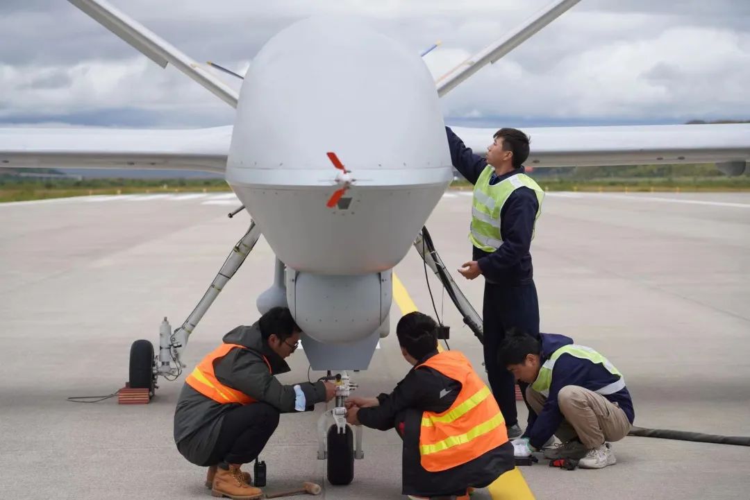
The picture shows the staff confirming the state before taking off
Xu Xiangde, an academician of the Chinese Academy of Engineering and chief test consultant, said that the Qinghai -Tibet Plateau has a great impact on my country's, East Asia, and even global climate change, but the area is difficult to build stations, atmospheric vertical structures, and lack of observation information. With the advantages of high -altitude large -scale drones, obtaining fixed -point and larger vertical observation materials, especially at the atmospheric vertical detection and water circulation three -dimensional structure and water supplies of Sanjiangyuan area and the "hometown of glaciers" wavemi and water supply. Knowing that it will become an important basis for the decision -making of the Qinghai -Tibet Plateau water resources and ecological security in the context of climate change.

The picture shows the staff of the Meteorological Exploration Center of the China Meteorological Administration analyzed the flight operation route at the test site

The picture shows the on -site consultation for this experiment
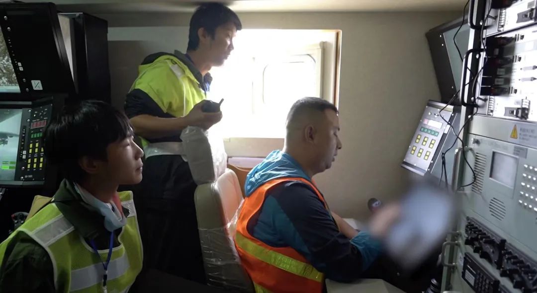
The terrain of the southwest region is complicated and diverse, and has been regarded as a "ceiling" that has always been regarded as the difficulty of weather forecasting. This test is an important result of a large -scale unmanned aircraft meteorological observation project ("Haiyan Plan"), which helps to obtain comprehensive detection data of meteorological multi -dimensional, multi -dimensional, and high -resolution of Meteorological areas in Sanjiangyuan area. The meteorological department will fully apply the ecological data of the atmospheric vertical profile and the lower pads obtained this time, and promote the analysis of the influence of water-water resources in the "Asian Water Tower" and the influence of water resources in the later period. ability. The picture shows the staff in the command cabin operation
The picture shows the weather analysis of the staff before taking off

Since the launch of the "Haiyan Plan" of the China Meteorological Administration, it has achieved three -dimensional detection of cloud systems around the typhoon and promoted the establishment of drone marine detection mechanisms. This year, the Meteorological Exploration Center of the my country Meteorological Administration selected a large-scale UAV-2 UAV independently developed by China, and 16 units including China Aviation Industry Group Co., Ltd. jointly conducted Southwest Observation Tests. The Sichuan Provincial Meteorological Bureau strengthened the coordination and weather forecast of the Sichuan Provincial Meteorological Bureau.
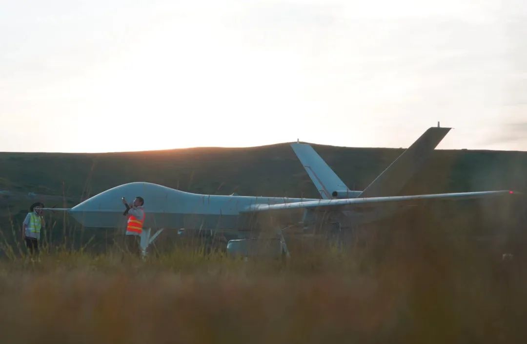
The picture shows the staff being checked before the drone takes off
Li Liangxu, chief of the experimental chief and director of the Meteorological Exploration Center of the China Meteorological Administration, said that after the success of Shoufei, it will also focus on the water vapor channel, glacier distribution and glacier area water supply to carry out multiple aircraft detection in Sanjiangyuan area. The construction of the main body of the air -based observation system, explore the establishment of a national mobile observation business, and provide richer data for the ecological protection of the Qinghai -Tibet Plateau and the scientific response to climate change.
Produced by China Meteorological Administration Xuanke Center (China Meteorological News Agency)
Author: China Meteorological Daily All -Media reporter Wang Liang Jian Jufang
Picture source: China Meteorological Bureau Meteorological Exploration Center
Edit: Yang Aoqing Liberal Arts King Suqin
Review: Duan Haoshu

- END -
The 25th anniversary of the Chinese People's Liberation Army entered the 25th anniversary of Hong Kong 丨 The blue dream of Suqian Ship

The blue dream of Suqian Ship——China People's Liberation Army stationed in the 2...
Bayi National Defense Education 丨 Continuing the red mental blood of the resident national defense education resources

In order to further improve the targetedness, effectiveness and appeal of the poli...