my country's high -altitude large drone plateau meteorological observation test is successful!
Author:Sichuan Observation Time:2022.09.17
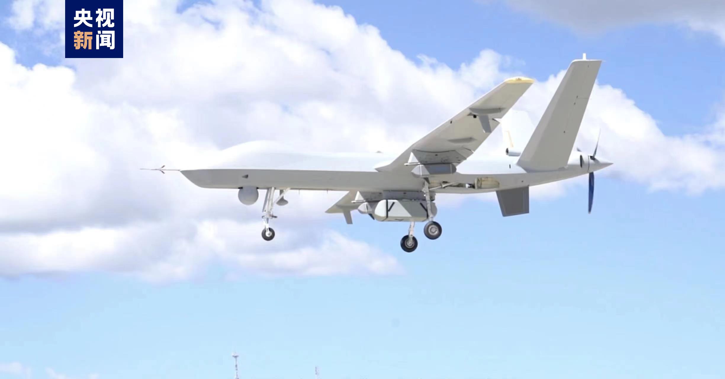
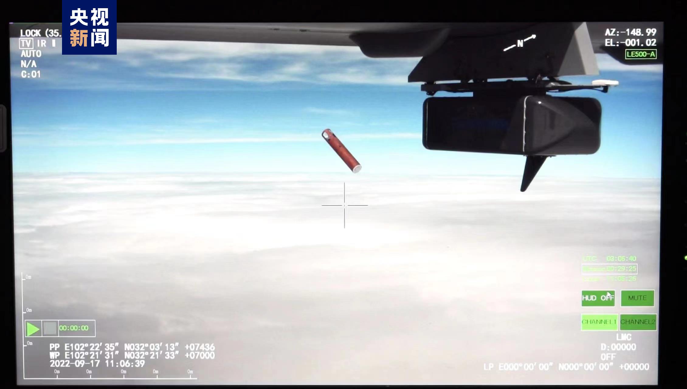
Today (17th), at the Aba Tibetan Qiang Autonomous Prefecture on the southeast edge of the Qinghai -Tibet Plateau, a large -scale drone from the high -altitude weather detection independently developed by my country starts from Hongyuan Airport in the "China Water Tower" Sanjiangyuan area Anima Qing Snow Mountain was successfully voted for 12 aircraft at a height of 7,500 meters, together with the airborne synthetic aperture radar and atmospheric microwave comprehensive profile instrument to achieve "scanning" on the atmospheric and lower pads of the Qinghai -Tibet Plateau.
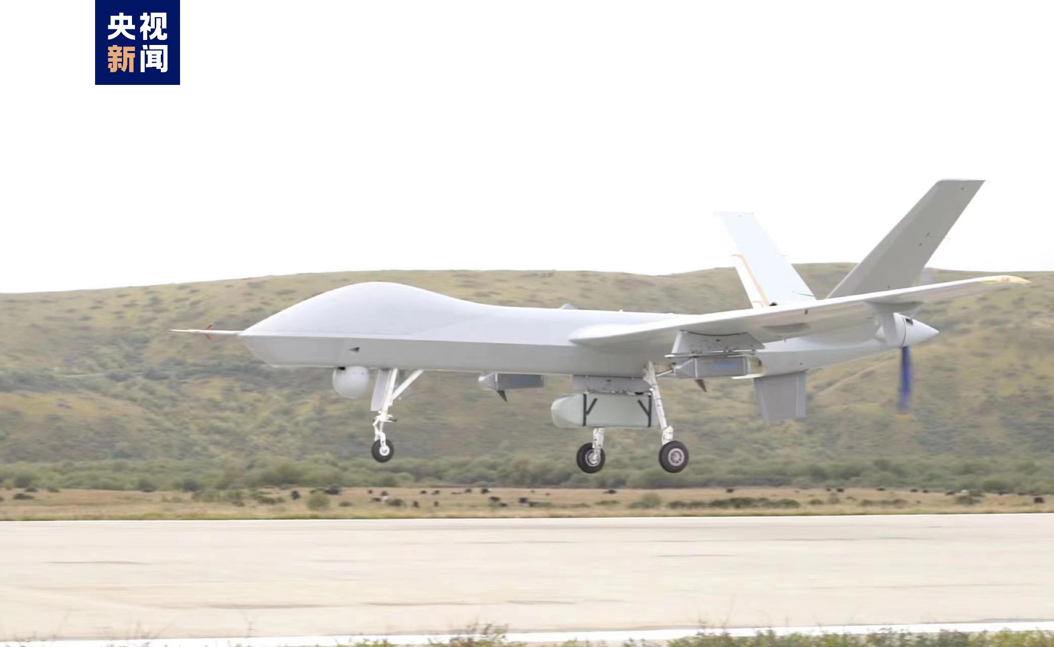
With observation data such as cloud system distribution, water vapor structure, wind farm and under -padding conditions in a group of Sanjiangyuan areas, the real time returns to the ground command system in real time. my country's high -altitude large -scale drone plateau meteorological observation test is successful in the first flight. my country's high -voltage pressure, southern branch slot, plateau vortex and other weather and climate systems have evolved, and low -weft marine water vapor enters the influence of my country's channels. The Dao defense line is of great significance.
Xu Xiangde, an academician of the Chinese Academy of Engineering and chief test consultant, said that the Qinghai -Tibet Plateau has a great impact on my country's, East Asia, and even global climate change, but the area is difficult to build stations, atmospheric vertical structures, and lack of observation information. With the advantages of high -altitude large -scale drones, we can obtain fixed -point and larger vertical observation data. In particular, the new cognition of atmospheric vertical detection and water circulation of water in Sanjiangyuan and "Glacier Hometown" Bodi will become an important basis for the decision -making of the Qinghai -Tibet Plateau water resources and ecological security decision -making in the context of climate change.
This test is an important result of a large -scale unmanned aircraft meteorological observation project ("Haiyan Plan"). Since the launch of the "Haiyan Plan" of the China Meteorological Administration, it has achieved three -dimensional detection of cloud systems around the typhoon and promoted the establishment of drone marine detection mechanisms. This year, the Meteorological Exploration Center of the my country Meteorological Administration selected a large-scale UAV-2 UAV independently developed by China, and 16 units including China Aviation Industry Group Co., Ltd. jointly conducted Southwest Observation Tests. After the successful first flight, the meteorological department will also focus on the water vapor channel, glacier distribution and glacier area water supply to carry out multi -aircraft detection to promote the construction of a vacuum observation system with high -performance large drones as the main body. Observation business provides richer data for the ecological protection of the Qinghai -Tibet Plateau, scientific response to climate change.
- END -
Military and civilian fish and water family!The Hongyun Xinti Community of Jixianli Street held the theme activity of celebrating the "August 1st"

to warmly celebrateThe 95th anniversary of the founding of the Chinese People's...
quick!quick!quick!Female soldiers are signing online for less than 2 days
In the second half of 2022Female soldiers apply for registrationCountdownThe regis...