Aerospace Science and Technology Exploring System help "scan" the atmosphere of Qinghai -Tibet Plateau
Author:Guangming Daily client Time:2022.09.20
Recently, the first plateau meteorological observation test of high -altitude large drones in my country has achieved a complete success. The airborne underwriting underwriting of the 23 Aerospace Meteorological Company of China Aerospace Science and Technology Institute is brought into the designated height of the target airspace. In the "China Water Tower" Sanjiangyuan area, Anima Qing Snow Mountain was a 7500 -meter high altitude, and successfully cast 12 down -type air -to -air device. Together with other airborne loads, it "scanned" the atmospheric and lower pads of the Qinghai -Tibet Plateau.
A group of observation data such as cloud system distribution, water vapor structure, wind farm and under -padding conditions in the Sanjiangyuan area are returned to the ground command system in real time. my country's high -altitude large drone plateau meteorological observation test was successful.
It is understood that this is a successful successive succession system under the airborne and exploring system under the "Haiyan Plan" in 2020. In many years of R & D, the airborne investment -type empty system has gradually formed a series of products, which are tested and used on a variety of drone platforms, and have good generality. This product can play an active role in many industries and fields such as meteorological emergency, disaster monitoring, ecological monitoring, and artificially impact weather.
The Qinghai -Tibet Plateau has a great impact on my country's, East Asia, and even global climate change, but the area is difficult to build stations, the vertical structure and the observation information of the under -pads. Advantages, through the airborne and exploration system, can not only complete the mobility and refined detection of vertical atmosphere of the target area, and make the business -based detection of related areas possible.
The vertical atmospheric detection data obtained by the lower investment and exploration system can not only provide valuable data such as the three -dimensional structure and water supply such as Po Mi and other atmospheric vertical detection and water replenishment of atmospheric vertical detection and water supply. The research results will also become an important basis for the decision -making of the Qinghai -Tibet Plateau water resources and ecological security in the context of climate change.
After the successful first flight, the meteorological department will also focus on the water vapor channel, glacier distribution, and glacier area water supply in Sanjiangyuan area, carry out multiple aircraft detection, and promote the construction of the air -based observation system with high -performance large drones as the main body. The Qinghai -Tibet Plateau ecological protection and scientific response to climate change provides richer data. (Guangming Daily All -Media Reporter Zhan Yuan Correspondent Yang Chuan)
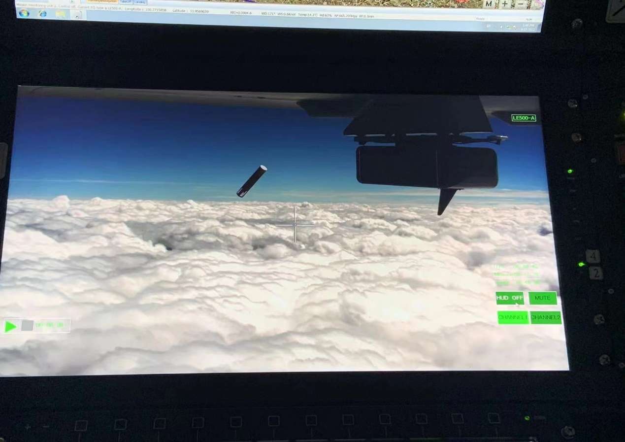
In the figure, the cylindrical body is the exploration instrument of the lower investment.
- END -
Russian Defense Minister: The Russian army consciously slows down the offensive speed and is intended to minimize civilian casualties

According to the Russian satellite news agency reported on the 24th, the Russian D...
Cyber Security Propaganda Week | Build a "defense line" on the Internet and keep the "bottom line" of the network

Author | Zeng Qingfeng, Yin Huan, Feng BolunWith the rapid development of the Inte...