Typhoon "Xuan Lannuo" will affect the east of East my country in the eastern waters of China to be vigilant
Author:National Ocean Forecasting Tai Time:2022.08.31
Typhoon Xuan Lannuo (strong tropical storm level) this year was generated on the 28th on the Pacific Ocean on the 28th. Affects the waters of the eastern part of my country.Affected by it, it is expected that Zhejiang, Fujian, Shanghai, and Jiangsu's near -shore waves can reach 5 meters. It is expected that the process of this process has a longer influence and a wide range of influence. The highest warning level of the wave alert is orange.
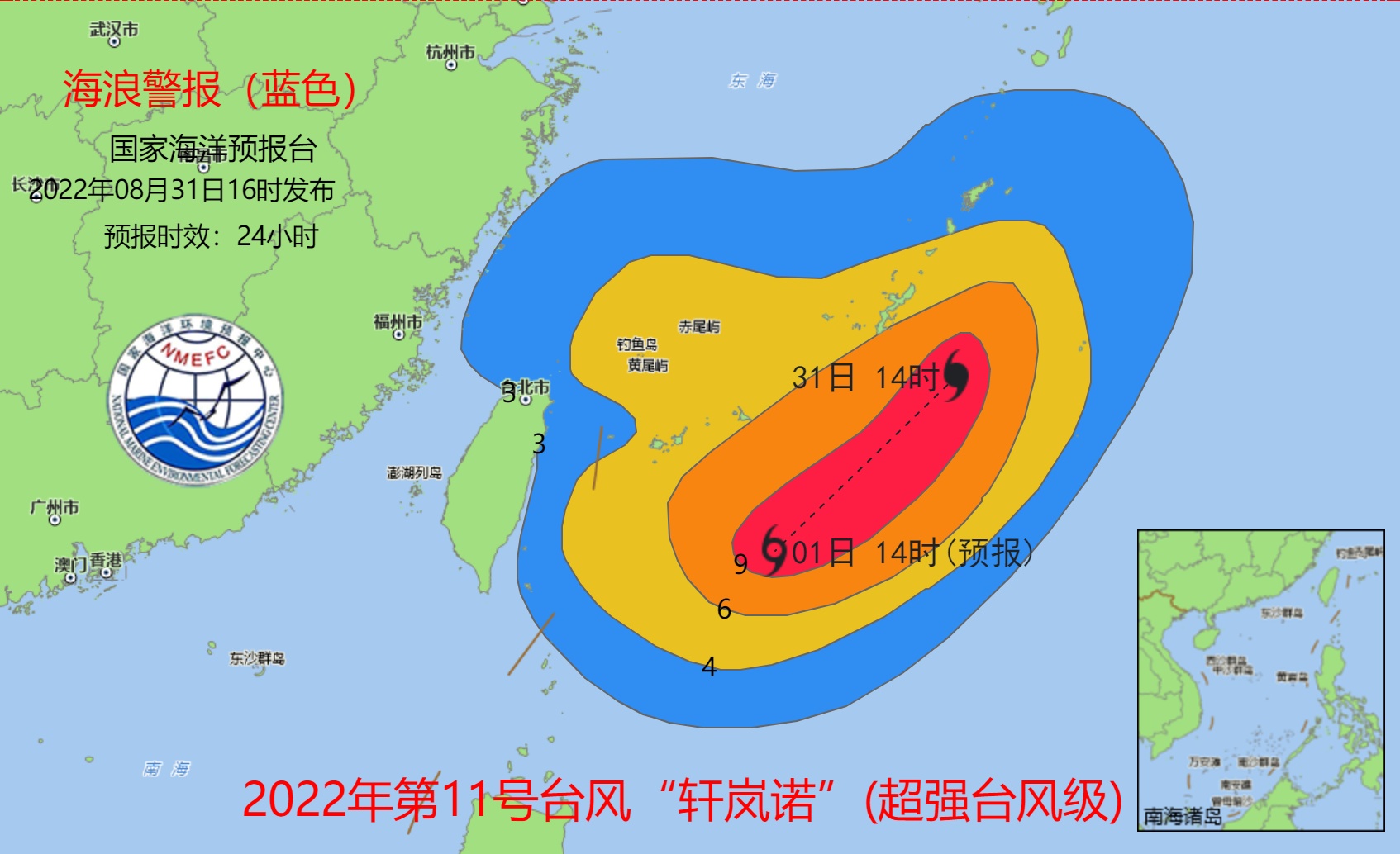
In this regard, the National Oceanic Forecasting Power issued a wave of blue alerts at 16 pm this afternoon: Affected by Typhoon Xuan Lannuo (Super Typhoon Grade) No. 11 this year, it is expected to be on the night of August 31 to September 1st.The southern part of the East China Sea and the east of Taiwan will appear 3 to 5 meters to the huge wave district; 2 to 3 meters from the near -shore waters in Zhejiang and northern Fujian will appear to the large waves from 2 to 3 meters.Near -shore sea wave early warning level is blue.Please pay attention to safety in the above -mentioned sea areas, and relevant units of the coastal coastal to take anti -wave avoidance measures in advance.
- END -
"520" and "1314" during love, can I ask for it?

When you are in loveCome on the mouth of the earthy loveAfter breaking upNo one lo...
There are thunderstorms or hail!Henan starts major meteorological disasters level IV emergency response

The monitoring of the Provincial Meteorological Observatory shows that on June 22,...