The super typhoon "Xuan Lannuo" continues to approach my country's East China Sea!Zhoushan Maritime Starting Grade IV DIA emergency response!
Author:Putuo Rong Media Center Time:2022.09.04
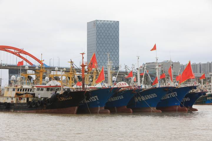
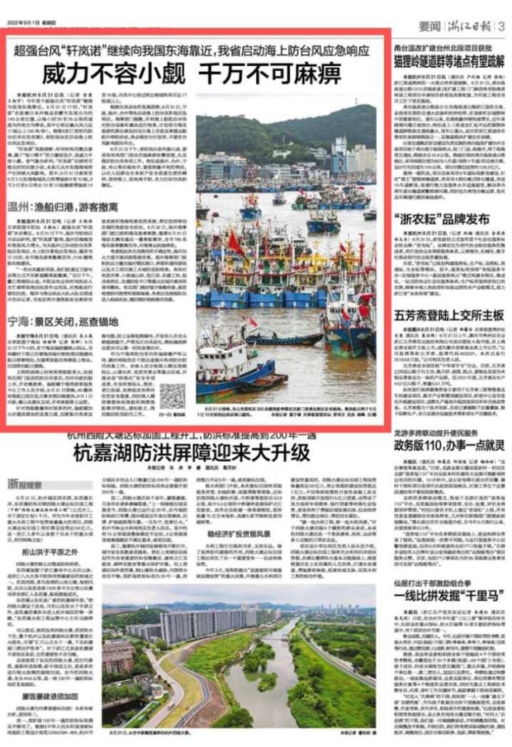
In accordance with the "Drinking Drought Control and Drought Prevention and Taiwan Emergency Plan", Zhoushan City Defense Index launched an emergency response to Taiwan ’s Taiwan anti -aircraft emergency response at 17:00 on August 31. On the evening of the 31st, more than 300 fishing vessels in Putuo District, Zhoushan City stopped at Shenjiamen Fishing Port and nearby safe anchors to avoid the typhoon "Xuanlan Nuo". The remaining ships will reach the corresponding port before 10 am on September 1 to avoid wind.

Shenjiamen Fishing Port
Shenjiamen Fishing Port
The super typhoon "Xuan Lannuo" is here! Today, it has begun to affect the eastern waters of my country.
It comes from the Central Meteorological Observatory website
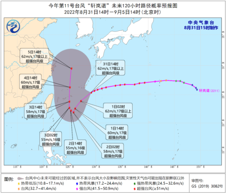
The Typhoon Alert of the Fisheries Meteorological Observatory of Zhoushan City: Typhoon Xuanlan Nuo (Super Typhoon Level), No. 11 this year, is 850 kilometers southeast of Zhoushan today, which is 25.4 degrees north latitude, 129.1 degrees east longitude, and central air pressure is 915 hundred Papa , The maximum wind of the center is above 17 or more, moving towards the southwest with about 25 kilometers, and the intensity is maintained.
Affected by it, it is expected that there will be 10 gusts in the Fujian fishing ground today. Tomorrow will start at the east of Fujian, Fujian, fishing mountains, and Wentai fishing grounds tomorrow morning. There are level 10 gusts in the north and 11 gusts at the Fujian Fishing Field. On the 3-5, Lu Si and Dasha fishing ground wind have strengthened to level 12, and other fishing ground winds have been strengthened to level 14. At level 16, please pay special attention.
Due to the influence of Typhoon "Xuan Lannuo", some flights of Zhoushan will be suspended!
Zhu Jiajian Xizheng Passenger Station
Dear passengers: Due to the influence of typhoons, the ship needs to enter the Hong Kong to avoid the wind. From September 1st, all ship class will be suspended. The specific flight information will be notified according to the weather forecast of the day.
Zhangzhou Passenger Terminal
Dear passengers: Due to the influence of typhoons, the Zhu Jiajian Baisha will be suspended on September 1, and when will it be notified separately.
New Town Night Plump
Dear passengers: Due to the influence of typhoons, the Night Tour of Lingcheng Bay Bay will be suspended from the evening of August 31.
Dongji Company
Connecting Dongji Company notified that on September 1st and 2nd, Dongji and Laoshan were suspended. Only the 0810 East Polar flight on September 1 was retained as the government and residents to enter the island to resist Taiwan. Empero tickets in the window.
【Previous news】
According to the Central Meteorological Observatory, at 8 am this morning, the center of the super typhoon "Xuan Lannuo" is located on the northwest Pacific Ocean, which is about 265 kilometers east of Naha, Okinawa Prefecture, Japan. /Second), the lowest air pressure in the center is 915 Baipa.
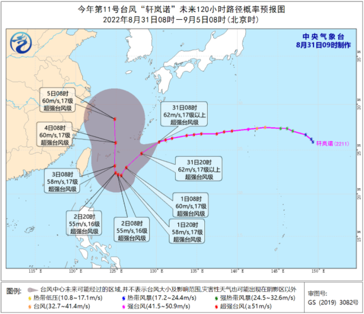
The picture comes from the Central Meteorological Observatory
It is expected that "Xuan Lannuo" will move west to southwest to the southwest at a speed of about 30 kilometers per hour. From September 1st to 2nd, it will stagnate or rotate at the east of the Ryukyu Islands and move to the north to west. , September 3rd moved to the sea on the southeast of the East China Sea on September 3. Affected by the influence of the weak and cold air south and the peripheral circulation of "Xuanlan Nuo", the wind in the East my country Sea in the East China Sea in the early morning of September 1 will gradually increase to level 6-8, and the gusts will be 9-10.
Meteorological experts remind that the typhoon "Xuan Lannuo" will affect my country's East China Sea. Pay attention to the adverse impact of sea winds on the sea of fishing boats and pay attention to safety.
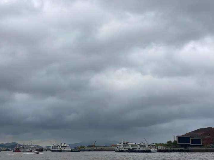
On the morning of August 31, affected by the peripheral of the super typhoon "Xuan Lannuo", the sky of the Zhoushan Sea was gloomy and the clouds were dense.
Yesterday afternoon, the cold air in the north arrived, bringing storms. Today, Zhejiang Province once from north to south, compared with obvious rain and thunderstorms, and today the rain belt is more concentrated in the central Zhejiang region.
Affected by rainfall and cold air, high temperatures in the province today will be "died and drums", and the temperature drops significantly. Except for temperature, Taiwan, and Li today, the highest temperature in other regions will fall below 30 ° C.
According to the forecast of Zhoushan Meteorological Observatory, the city is cloudy to cloudy today, and sometimes there are showers. It is cloudy to overcast tomorrow, and it will sometimes show a shower from yin tomorrow at night. There was a shower of the day after tomorrow. The city's highest temperature today is 29 degrees, the highest temperature tomorrow is 30 degrees, and the lowest temperature tomorrow and the day after tomorrow will be 24 degrees.
From September 1st, the province's high temperature weather has been completely alleviated. It is not only difficult to find high temperatures at 35 ° C in our province, but the temperature has basically remained under 30 ° C.
(Part of the content comes from the Central Meteorological Observatory website, Zhejiang WeChat WeChat account, etc.)
- END -
Oregon Track and Field World Championships: McPlain's fourth time in 13 months refresh the world record

[Global Times Comprehensive Report] Breaking the world record is not the norm of t...
Several killers hidden in the "wild tour"!

Reporter Kang ShaPictures Sichuan Provincial Emergency Management Department