Today, there will be wind and rain in the long time of the day of the day.
Author:Global Times Time:2022.09.05
In the past day, Typhoon "Xuan Lannuo" gradually approached the coast of the eastern part of my country. At 5 am this morning, the center was about 245 kilometers east of the Zhujiajian Island in Zhejiang Province. The cloud system on the west side has been swept to Zhejiang, Shanghai and other places. Affected by it, heavy rain or heavy rain appeared in northeast Zhejiang, eastern Shanghai, southeast Jiangsu, and northern Taiwan Island. Taipei, Shaoxing, Ningbo, and Jinhua in Taipei, Taiwan, Zhejiang, Ningbo, and Jinhua; Grade 6-8 gusts appeared in Shanghai, central southern Jiangsu, and Taiwan Islands, and 9-11 areas of the eastern part of Zhejiang and eastern Taiwan Island.
This morning, "Xuan Lannuo" moved to move north to move north, and the intensity maintained a super typhoon level (level 16, 55 meters/second). It is expected that the intensity of "Xuan Lannuo" will gradually weaken in the future, and move to the northeast today today. On the morning of the 6th to the morning of the South Korea, it will move quickly to the northeast of Japan and gradually become a green cyclone.
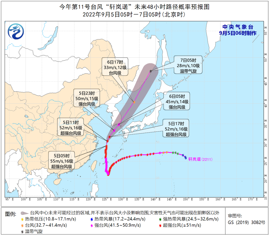
Affected by it, there will be wind and rain in the Yangtze River Delta region during the day. Among them, there will be heavy rain in northeast Zhejiang, Shanghai, southeast of Jiangsu, and other places. , Changjiangkou District, Hangzhou Bay, Taiwan Island Coast, Northeast Zhejiang, Shanghai, eastern Jiangsu and the coast will have 6-9 garage, and the gusts are 10-11. Among them, most of the East China Sea, the southern Yellow Sea, Hangzhou Bay, and northeast Zhejiang The coastal wind is 10 to 12, and the gusts are 11-13. Central Meteorological Observatory continued to issue typhoon yellow warnings this morning
Essence
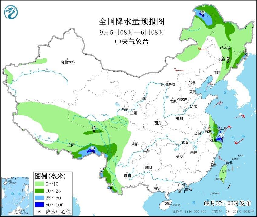
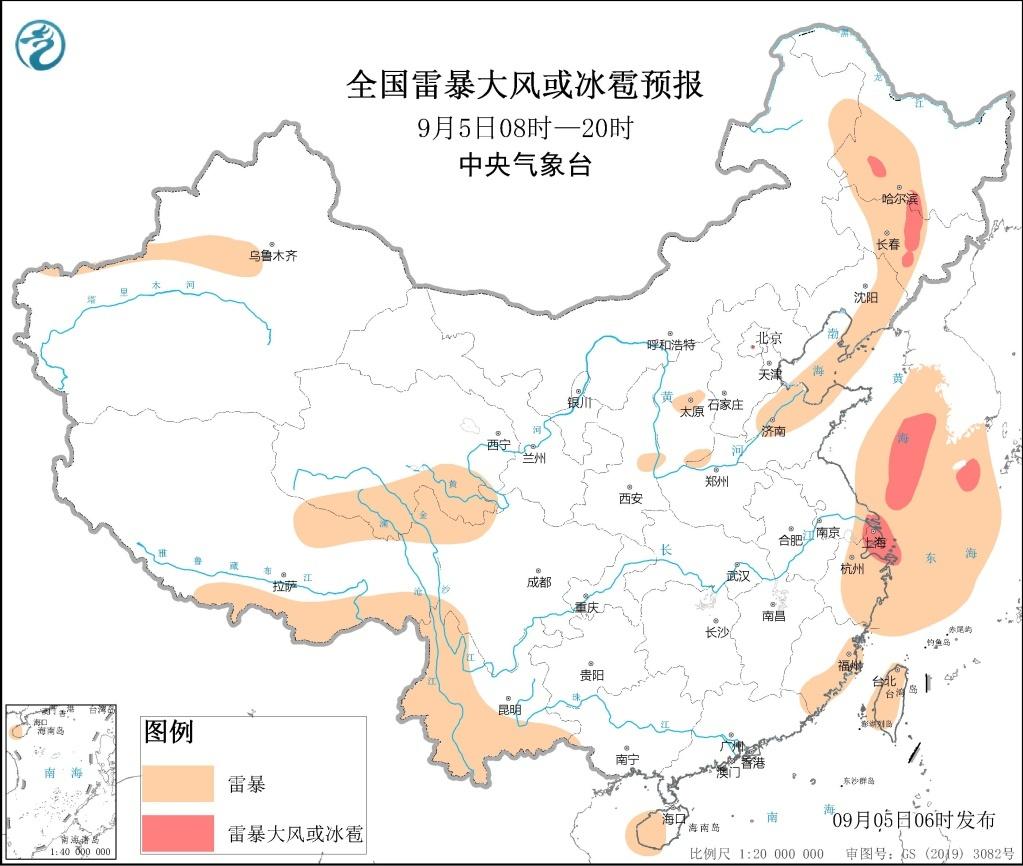
As the typhoon turns to the northeast, the precipitation in East China has weakened. It is expected that from the night of the 5th to the 6th, the "Xuan Lannuo" in the north will affect the Northeast region with the cold vortex of the Northeast. There will be middle to heavy rain in eastern Jilin and eastern Heilongjiang. In addition, due to the cold vortex, during the day on the 5th, there were convective weather in the central part of the Northeast region. Land in south of Heilongjiang and central Jilin need to be alert to thunderstorms or hail.
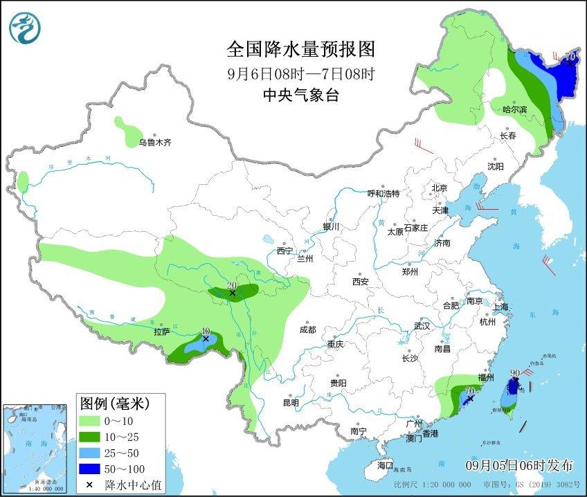
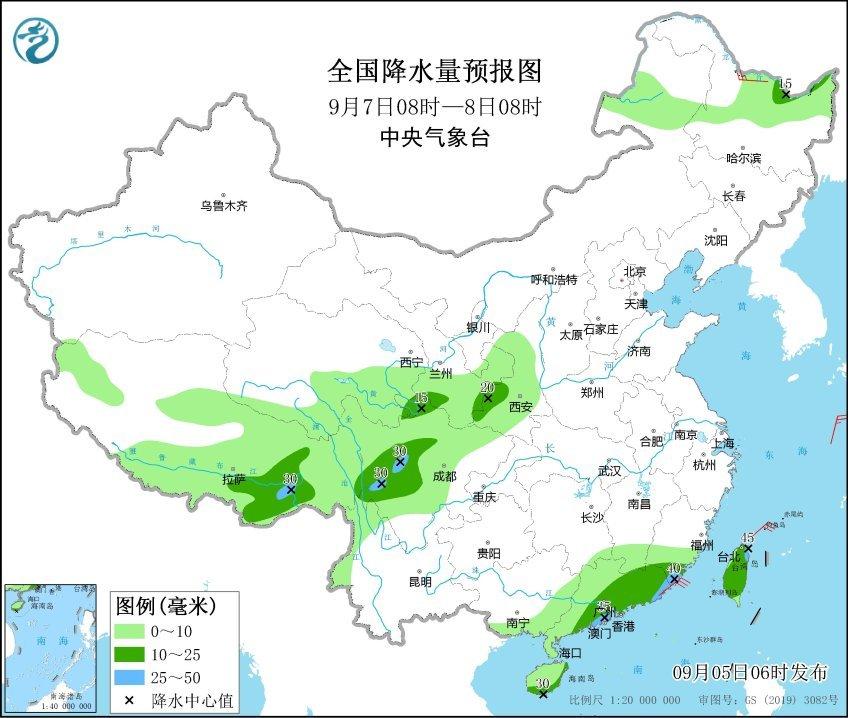
Looking at the southwest region, due to the eastward shift of the short -wave slot of the plateau, the rain and water will be abundant in the next week. It is expected that this two days (5th to 6th), Tibet, southern Qinghai, western Sichuan, western Yunnan and other places will be small to middle rain. Among them, there are rain sandwiches in northern Tibet and southern Qinghai. There are heavy or heavy rain in western and southern Yunnan. From the 7th to 9th, there will be small rain and heavy rain in the central and eastern parts of Tibet, southern Qinghai, east, Sichuan, Yunnan, and South China.
Meteorological experts remind that recently, due to the influence of Typhoon "Xuan Lannuo", heavy rainfall in Ningbo, Shaoxing and other places in Zhejiang, and high risk of geological disasters in the local area; Pay attention to prevention, stop outdoor hazards such as large -scale rally indoor and outdoor rally and high altitude, and stay away from billboards and temporary buildings.
Source: Central Meteorological Observatory
- END -
Innovative methods and methods to improve the effective effectiveness of Qinhuangdao Municipal People's Congress system to strongly promote the orderly development of five linkage supervision work
On June 15, the reporter learned from the Standing Committee of the Municipal People's Congress that in accordance with the five linkage supervision work of the provincial people's congress system, th...
Tears in the audience!This is the model

On June 28, 2022, the Propaganda Department of the Party Committee of the Autonomo...