Sichuan Luding 6.8 earthquake: Double -tailed scorpion drone urgently aid
Author:Colorful Guizhou.com Time:2022.09.05

Double -tailed scorpion drone airlines. Tengshun science and innovation map
China News Service, Chengdu, September 5th (Reporter Liu Zhongjun) Reporter learned from Sichuan Tengshun Kepochi Co., Ltd. on the 5th that the company's double -tailed scorpion drone urgently assisted Luding to earthquake relief.

The corner of the Luding Zone after the aerial earthquake. Tengshun science and innovation map
At 12:52 on September 5th, a magnitude 6.8 earthquake occurred in Luding County, Ganzi Prefecture, Sichuan Province. The depth of the earthquake was 16 kilometers. The earthquake caused part of the communication in Luding County and Ya'an City in Luding County, Ganzi Prefecture to damage.

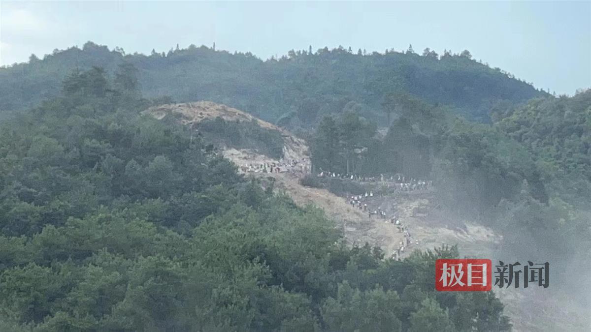
Mountains damaged in aerial earthquakes. Tengshun science and innovation map
After the earthquake, the Sichuan Provincial Communications Administration and the Emergency Management Department immediately launched the secondary response of emergency communication guarantee, and emergency scheduling the Tengshield Science and Technology Double -Tail Scorpion drone flew to the affected area to help earthquake relief.

Mountains and roads damaged in the earthquake area. Tengshun science and innovation map
It is understood that after receiving the rescue mission, Tengshun Science and Technology quickly completed the deployment and flight preparation of the drone task, and the airspace coordination was completed urgently with the support of the relevant departments of the aviation management department. At 17 o'clock, the Teng Shield Double -Tail Scorpion drone hanging the photoelectric reconnaissance pod and the air base station equipment took off from Zigong Fengming Airport. After 1 hour and 40 minutes, the drone flew over the earthquake area, launched a wide area inspection of the disaster situation and implemented public communication coverage tasks. The rescue disaster relief command and mobile phone communication of the affected people resumed.

Mountains damaged in the earthquake. Tengshun science and innovation map
The drone aircraft showed that the earthquake caused the mountains and the road damage was severely buried. At present, on -site earthquake rescue work is ongoing.
In February 2022, Sichuan launched the "Large High -Altitude Network Emergency Communication UAV Platform" project. In July, at Ganzi Kangding Airport for the first time in the complex natural environment and real emergency conditions such as "high altitude" area and "signal -free" area, such as "high altitude" areas, "no signal" areas, etc. , Complete the "actual combat" test of emergency communication on the entire network to complete the drone. After the earthquake, the Sichuan Provincial Communications Administration launched an emergency plan for the first time. Emergency communication guarantee services are provided in the disaster area.

The double -tailed scorpion drone took off and assisted the earthquake relief in Luding County, Ganzi Prefecture. Tengshun science and innovation map
It is reported that the double -tailed scorpion drone will assist in the earthquake relief work of Luding County, Ganzi Prefecture, which further enriches large drones to participate in emergency rescue, emergency communication application scenarios and use connotation. The emergency communication system is of great significance and demonstration effect. (Finish)
- END -
Southwest University teachers and students in the Northwest University of Beibei Mountain Fire in Chongqing: Foreign teachers assembled oil saws, teachers participated in the fire extinguishing fire
Jimu Journalist Liu YiOn August 21, a sudden fire in the streets of Beiwaima Stree...
Sichuan launched the "Sanxingdui -Sands" theme travel route

On July 27th, the 2022 Beautiful China · Hearts promotion activity hosted by the ...