After the Luding 6.8 earthquake, what did the Earthquake Bureau do?
Author:Sichuan Earthquake Administrat Time:2022.09.08
A magnitude 6.8 earthquake attacked Sichuan Luding, and the rescue work is still continuing. In the overwhelming fragmented information, we sort out the work done by the seismic system after the earthquake.
Earthquake warning
Tell you how long the earthquake horizontal waves have arrived
In recent years, whenever there is a large earthquake in China, the information of the earthquake warning will always have a wave of screens. Everyone exposed the warning notice they received, for a few seconds, as long as tens of seconds, full of technology.
This is due to the China Earthquake Early Warning Network.
China Earthquake Early Warning Network produced early warning information 6.2 seconds after the magnitude 6.8 earthquake, and released channels such as the early warning terminal, mobile APP, village and village emergency broadcast, and third -party platforms. Major projects, other industries, and earthquake -proof disaster reduction management departments issued early warning information in advance. Among them, the Kangding Earthquake early warning information was available for 9 seconds, the amount of earthquake early warning information of Ya'an City was 21 seconds, and the number of earthquake early warning information in Chengdu was 56 seconds. Essence
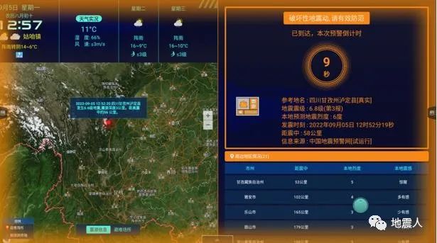
Early warning terminal receiving and response interface (Kangding)

Early warning terminal receiving and response interface (Ya'an)
Residents and students who received the earthquake early warning information took the corresponding risk aversion measures to evacuate in a timely manner, and relying on the national earthquake intensity reporting and the construction of early warning projects, the China Earthquake Early Warning Network once again played a positive disaster reduction role in this earthquake. Good social benefits.
Earthquake intensity speed report
Tell you the possible destruction of the earthquake area
After the earthquake, in the "Sichuan Luding 6.8 Earthquake Earthquake Position Location Map" published by the Sichuan Earthquake Administration, it marked the possible destruction of the area near the earthquake -the rapid report of the earthquake.
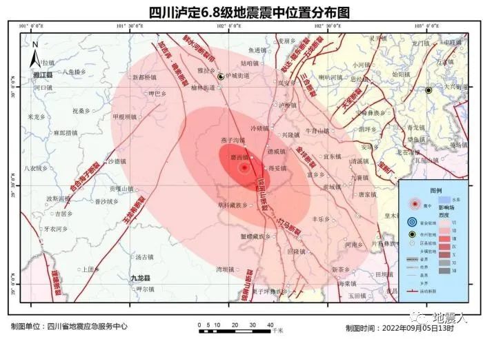
Several concentric circles of different colors around the earthquake represent the degree of damage caused by the earthquake (earthquake intensity) caused by the earthquake. The earthquake intensity value produced within a few minutes after the earthquake comes from the earthquake intensity report. After the earthquake, the data of hundreds or even thousands of monitoring sites were collected, and the intensity speed report was automatically generated by analysis. Compared with the conventional earthquake intensity inspection, the significance of the intensity speed report is more about fast assessment of disaster situations and reference for rescue work.
Earthquake report
Tell you the accurate location, size and depth of the earthquake
We are accustomed to the seismic information pushed by social platforms, first of all, a "automatic measurement result", and then a "formal measurement result", which is a product produced by the seismic quick report.

The result of the automatic measurement is the real -time monitoring data of the computer's automatic processing of the earthquake network, achieving fast seismic positioning and seismic determination, and the speed is very fast. However, fast and quasi are often not available. Seismic parameters are determined by a relatively complex scientific computing process. The fastest speed is required to give the three elements of the earthquake, which is inevitable that there is a deviation with the automatic measurement results of the computer system. The 24 -hour -duty earthquake measurement personnel will perform artificial calibration of the results of the seismic speed report in a timely manner, exclude the interference factors, and provide accurate and reliable "formal measurement results".

Earthquake monitoring tracking
Follow the earthquake closely without letting go of the slightest movement of the earthquake
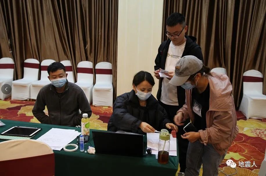
After the earthquake, the Earthquake Administration must immediately organize the earthquake to discuss, put forward the trend judgment opinions, and at the same time, the personnel will be sent to implement the earthquake tracking monitoring, and the earthquake -site mobile observation platform network will be set up. Improve the precision accuracy of the on -site aftershocks, and more accurately obtain data changes such as GNSS, geomagnetic, gravity, etc., and provide richer information for the earthquake area and surrounding earthquake situation. The work team in the front cooperated with the rear command and did not let go of the earthquake.
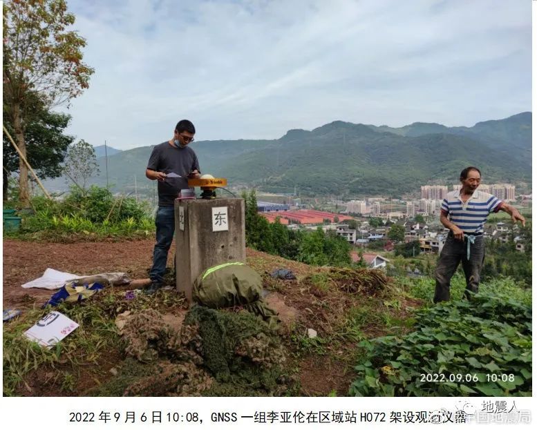


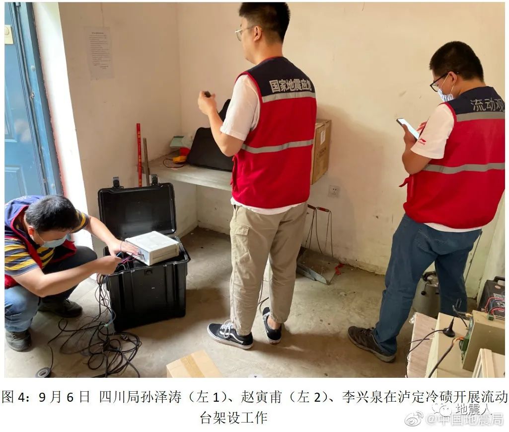


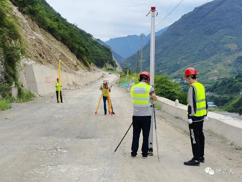
The on -site work team of the Sichuan Bureau conducts a level observation
Earthquake survey, drawing intensity diagram
Find out what the damage to the earthquake is like
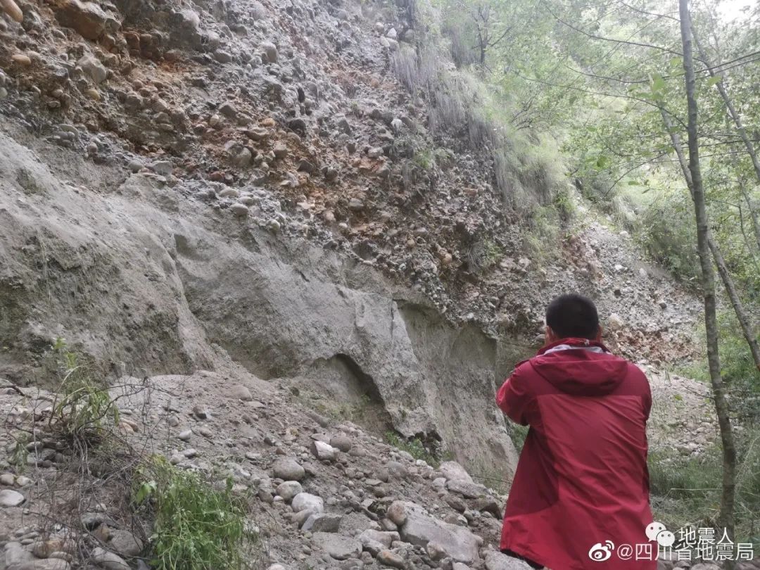
The intensity speed report mentioned earlier is a possible earthquake intensity based on earthquake waves and experience formulas. What exactly does the earthquake disaster area be destroyed, the degree of damage of the house, whether there are secondary disasters, how the destruction of the lifeline project, is it affected by the industrial and mining enterprises ... Earthquake intensity maps provide a scientific basis for the resettlement and reconstruction of the people in the disaster area.
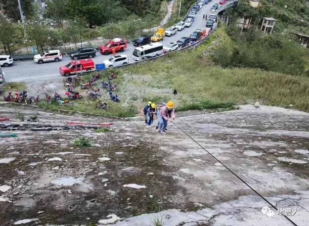
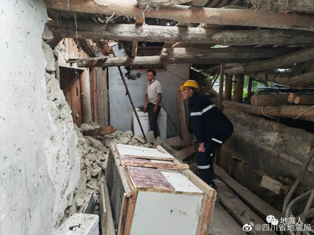
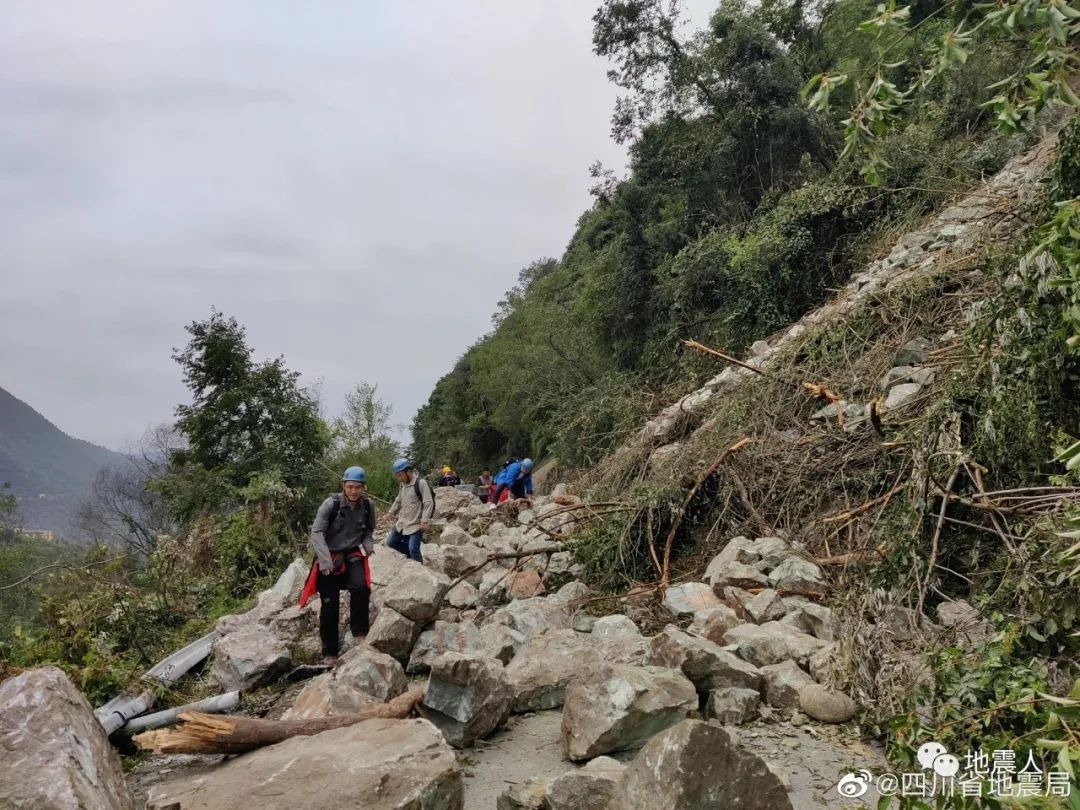


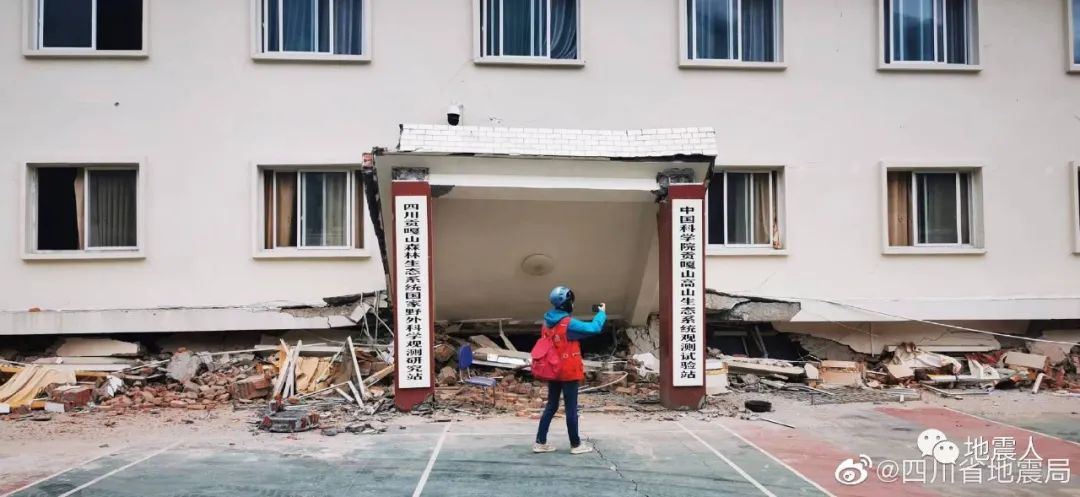
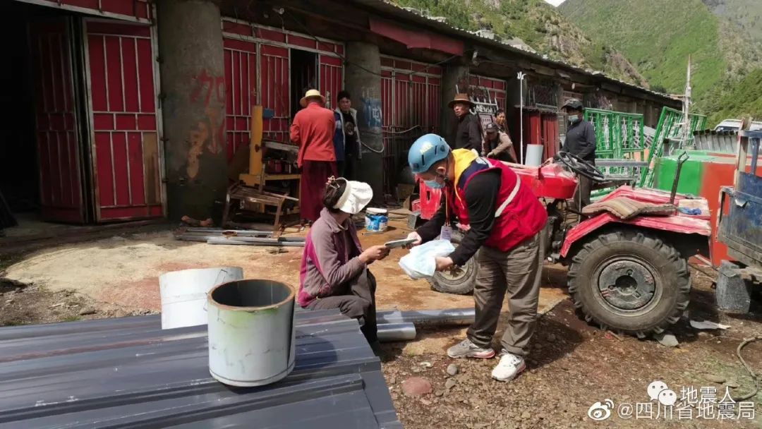
On -site work team conducted a survey of earthquake damage
The Sichuan Earthquake Administration sent a total of 19 disaster investigation teams and 1 personnel casualties investigation team, and a total of more than 160 staff members of the drone disaster survey team conducted a disaster investigation. When conducting a intensity survey in the earthquake area, the road was collapsed from time to time, and the motor vehicles could not pass. The investigation team members were in danger. Wearing a helmet, carrying the material bag, carrying the equipment and equipment required for the survey, and going forward to the investigation point. They risked the danger that the damaged buildings could collapse at any time, collected first -hand disaster information, and practiced the responsibility of the earthquake with practical actions.
Preliminary Draft Draft
Earthquake science
Every time the occurrence of a natural earthquake is an opportunity to deepen the earthquake research at one time
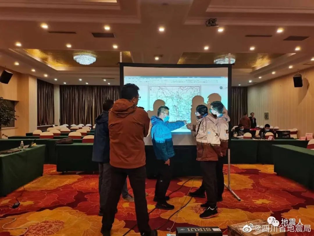
After the earthquake, the China Earthquake Administration launched the 6.8 magnitude earthquake scientific research work in Luding County, Ganzi, Sichuan to strengthen the scientific and technological support for the post -earthquake trend research, intensity assessment, and post -disaster recovery reconstruction.
This scientific examination adopts the combination of indoor and scene to carry out the "anatomy" research from the entire process from the seismic structure, the environmental environment, the earthquake breeding process, and the disaster mechanism. Essence Emphasize the combination of the system inside and outside the system, and invite well -known experts such as Peking University, China University of Science and Technology, Tianjin University, China University of Geology (Wuhan), Guangdong University of Technology, and Chinese University Essence

On September 6, the China Earthquake Administration issued the Sichuan Luding 6.8 magnitude earthquake scientific research plan, set up the earthquake scientific examination headquarters, and held a seismic scientific investigation work in Beijing in accordance with the earthquake scientific research plan. The ministry has formed a scientific research team consisting of multi -disciplinary experts inside and outside units inside and outside the seismic system. At present, the first team members who conducted earthquake structure exploration and earthquake surveys have arrived in Sichuan.
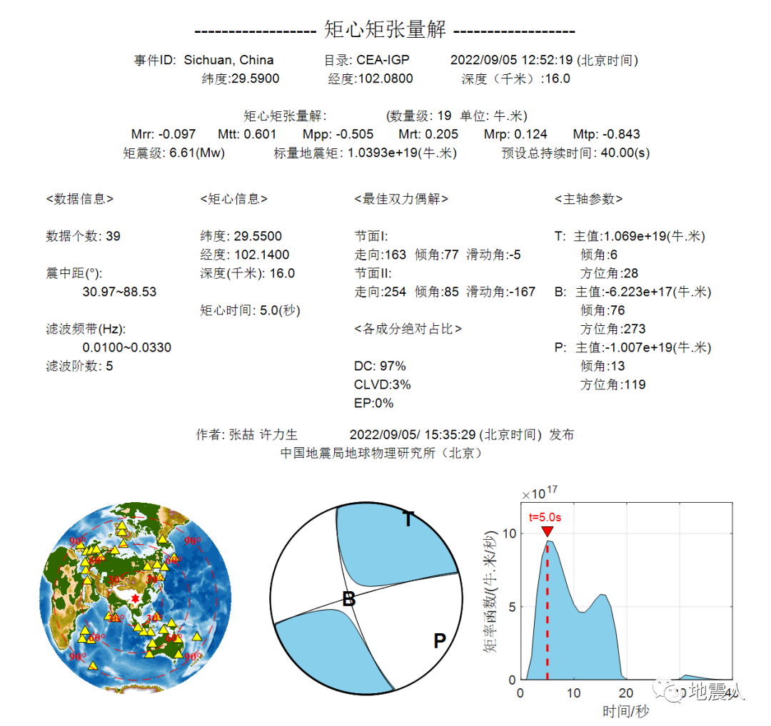
The China Institute of Earth Physics of the China Earthquake Administration has obtained the discovery of the earthquake source characteristics of this earthquake through research through the discrimination of torque, the background of the earthquake rupture process, and the positioning of the resurrection of the earthquake.
Earthquakes, publicity science popularization, communication security, logistics support ...
After the earthquake, there are many more and many of the earthquake systems.
Carry out earthquake analysis and discuss, and study the development trend of earthquakes,
Propaganda popular science solution to doubt and confusion, maintain social stability,
Communication guarantee, stand up to the bridge linked in front,
Logistics support allowed the team members to work with peace of mind, without any worries
... ...

Earthquake emergency response work involves all aspects. In the dangerous earthquake zone, behind the distant large, countless seismic people are still busy.

source:
China Earthquake Administration's official website, Weibo
Sichuan Earthquake Administration's official website, Weibo
Official Weibo of China Earthquake Network Center@中国 中国 中国 网
China Earthquake Administration First Monitoring Center official website
The public account of the Yunnan Earthquake Administration "What is the earthquake bureau done? (3) -Earthquake Rescue "
Public account of the Institute of Earth Physics, China Earthquake Administration, "September 5, 2022, Sichuan Ganzi Prefecture Luding 6.8 Earthquake Source Features"
Source: Earthquakeman
- END -
"Scenery is good" -Exical implementation of helping enterprises' rescue policies to h
Where you look at, pure and flawless. Through the grassland, snow mountain, experience the rain and snow, finally reaches the Nami Wrong Lake at 5,600 meters of altitude. Liu Fang, Hunan girl who wo
Qinghai Gate: "Golden Flower Sea" is "Golden Flower Sea"

24-hour hot pictureMeng Fandong: The quality of preservation must be one tendonHo...