Yang Yong, a geological scholar and chairman of the Hengduan Mountain Research Association, interpreted the rainfall. What invisible hidden dangers need to be alert to the Luding earthquake?
Author:Daily Economic News Time:2022.09.09
On the fourth day after the "9.5" Luding 6.8 earthquake, all the force was still seizing the possibility of any rescue after seizing the "Gold 72 Hour".
According to CCTV News, as of 12:00 on September 9, the Sichuan Luding 6.8 earthquake has killed 88 people, and the earthquake also caused 30 people to lose contact and more than 400 people injured.
The rescue did not stop, and the threat of the secondary disaster after the earthquake became increasingly emerged.
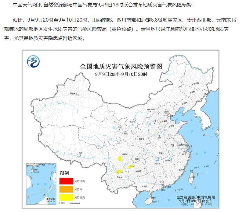
China Weather Network reminds that it is expected that from 20:00 on September 9th to 20:00 on September 10th, the weather disaster risk of geological disasters in the local area of Luding 6.8 earthquake -stricken areas is relatively high. From the night of September 7th, the Luding Zhen District was launched, and some areas were accompanied by lightning up.
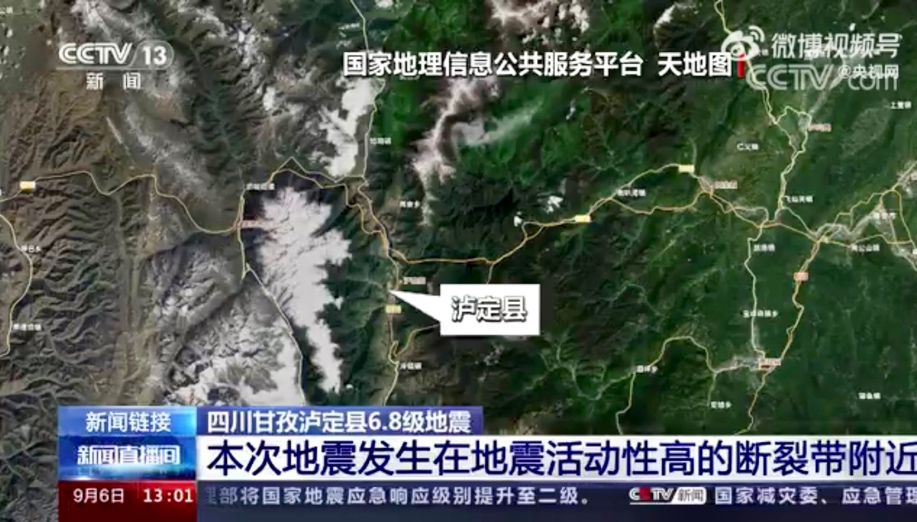
Photo source: CCTV Video September 6 Screenshot
In the context of such weather, what kind of hidden risk should we be alert? "Daily Economic News" reporter interviewed Yang Yong, the chairman of the Hengguanshan Research Association. "Because the geological conditions after the earthquake are already fragile, and the impact of rainfall the rainfall may lead to landslides, mudslides, etc., local need to beware of secondary disasters." Yang Yong reminded.
"This earthquake is under Gongga Mountain, and the historical earthquake is rich."
The Luding earthquake, the sense of earthquakes in Sichuan is obvious. Even if it is not around the earthquake, it can be obvious that this is not a small earthquake.
"Indeed, a magnitude 6.8 earthquake is a destructive strong earthquake, which is very close to the large earthquake (magnitude 7), and the duration of this earthquake is longer. Said by reporter.
According to the popular science articles from the Institute of Geology of the Chinese Academy of Geological Sciences, the magnitude of the earthquake level is 1.0, and the energy difference is about 30 times; the difference between 2.0 per difference and the energy difference is about 900 times. "For example, the energy released by a magnitude 6 earthquake is equivalent to the energy that the United States throws in Hiroshima in Japan. A magnitude 7 earthquake is equivalent to 30 magnitude 6 earthquakes."
Earthquakes of the same size are not necessarily the same; the same earthquake is different in different places. In order to measure the destruction of the earthquake, scientists "produced" another "ruler" one -to -one earthquake intensity. my country divides the intensity into 12 degrees, the intensity of 9 ~ 10 degrees collapse, and the ground destruction is severe.
According to the Sichuan Earthquake Administration on September 5, according to the rapid evaluation of the Sichuan Luding 6.8 earthquake disaster, the highest intensity of the earthquake reached 9 degrees.
This time, it was just a microcosm of the Sichuan earthquake.
According to the China Earthquake Network Data, in August this year, 6 earthquakes occurred in Sichuan, with intensity earthquakes between 3 and 4. In the past five years, there have been 549 earthquakes in Sichuan, including 464 times or above, 394 times from 3.0 to 4.0, 61 times to level 4.0 to 5.0, and 20 times above 5.0. The largest earthquake is the earthquake. This time is also the largest earthquake after a magnitude 7.0 earthquake on Jiuzhaigou on August 8, 2017.
"From the perspective of the terrain, Luding is located on the edge of the east of the Qinghai -Tibet Plateau. The southern end of the fresh water river is a tall mountain canyon. The terrain is steep and the geology is fragile. This episode is just under Gongga Mountain. Very rich. "Yang Yong said that Kangding in Ganzi Prefecture, Sichuan had a major earthquake in the late Ming Dynasty, and a magnitude 7.5 earthquake in 1955.
Yang Yong also introduced that related studies showed that after the 2008 Wenchuan 8.0 earthquake and the 2013 Lushan 7.0 earthquake, the stress near the Xianshui River broke nearly increased significantly. It was extremely active around 2014 and frequent small and medium earthquakes. The fracture belt is increased from north to south to south to south, and it has the possibility of inducing large earthquakes, which is equivalent to activating this part of the area.
The earthquake will occur once the crust section is squeezed over the rock formation. Therefore, compared with other places, the possibility of a big earthquake on the area on the geological fracture zone is greater. The three main breakders distributed in Sichuan Province are Longmen Mountain Fracture Belt, Form River Fracture Belt, and the Anning River -the Muhe River Fracture Belt.

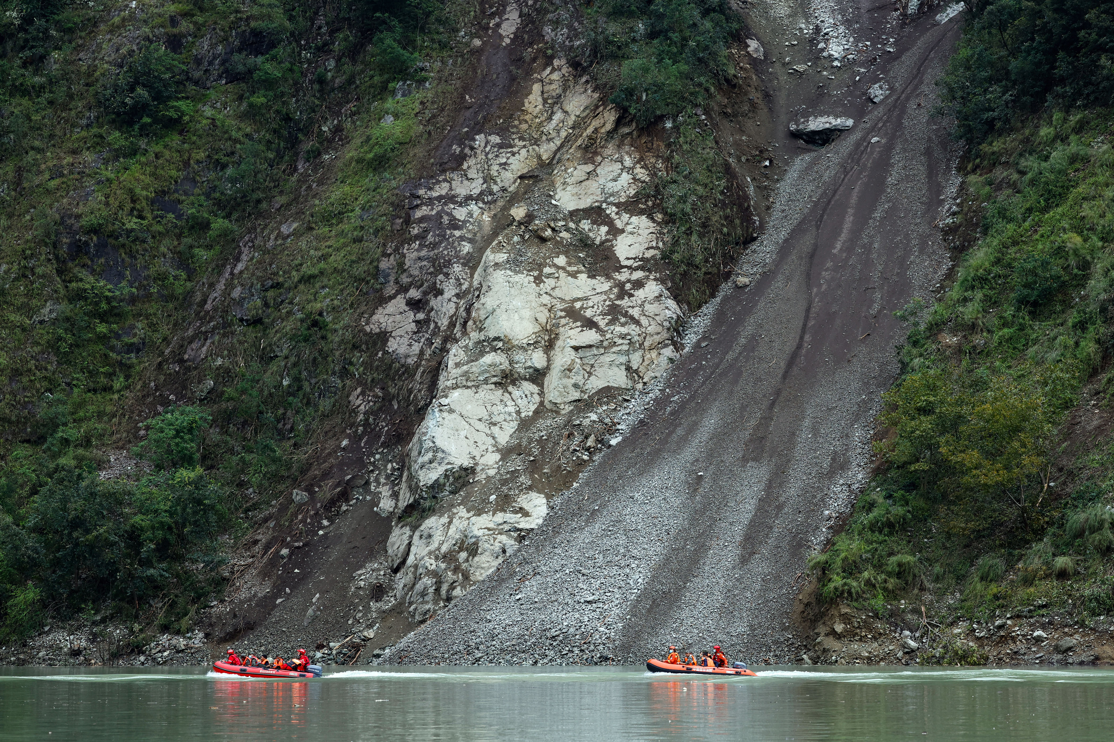
On September 5th, more than a thousand troops rescued forces urgently assisted in the Sichuan Luding earthquake -stricken area. Source: Xinhua News Agency issued
Hydropower stations and transmission networks need to prevent secondary disasters
The high valley of the Dadu River has passed through urban and rural areas. The water resources around Luding County are rich in water and resources. Hydropower stations composed of dams, reservoirs, and factories are densely distributed. If the earthquake causes dams to damage the dam -lake, the consequences are unimaginable.
Yang Yong introduced that the dam and the epicenter were closer to the Dagang Mountain Reservoir below the mouth of the Dadu River, as well as the above Luding Reservoir. In the tributary of the Dadu River, there are many small and medium -sized stalls in the Tianwan River, Lengzhu Guangou, and Gasgou. The territory of Caofei Township, Shi Mian County.
The Sichuan Hydropower Station, which has just experienced the worst drought in the past ten years, has become the focus of people's concern due to earthquakes.
According to the media reports on September 5, the Sichuan Provincial Department of Water Resources Department preliminary statistics, 4 large reservoirs and hydropower stations, 1 medium -sized reservoir, 176 small reservoir hydropower stations, and 39 dikes within 50 kilometers near the epicenter. No report on the disaster situation of water conservancy disasters has not been received yet.
"At present, there are not many information, but based on the general common sense, the main factory and dams of the hydropower station are okay." Yang Yong believes that after the "May 12 Wenchuan earthquake", the state has made many adjustments to the earthquake zone. Especially for the southwestern region where the earthquake occurs, the requirements of the earthquake resistance have been improved. In addition, Sichuan is in high temperature and drought in the summer of this year, and there are fewer water. These reservoirs are in a low water level. Therefore, the threat of the reservoir is not much. What is to prevent now is to enter autumn in September and October. After long drought, there will be a strong rainfall and precipitation process. The earthquake shocked the surface, forming dangerous rocks and materials, and may form secondary disasters such as landslides and mudslides.
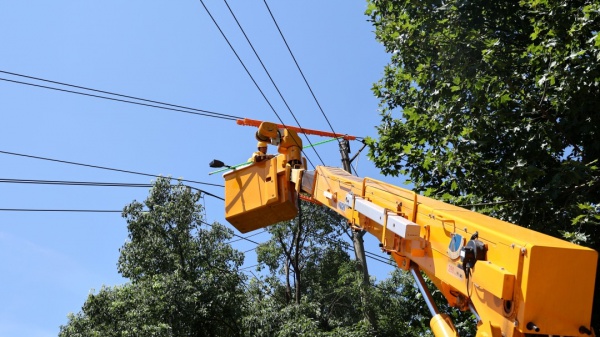
In addition, in Yang Yong's view, there is still a grid system to pay attention to. The transmission network is also a very important part of the power station. If there is a problem with the power grid, it will also affect the normal operation of the power grid.
"The transmission grid extends along the canyon. From the situation of the downfall of the online helicopter, some high -voltage transmission wire towers are on the landslide, which is already crooked. Yang Yong said, "The inspection and maintenance of the transmission grid has a disaster plan, but the workload in this area will be relatively large now.
On September 6, rescuers entered the picture of Wandong Village, Luding County.
The "incubation period" of geological dangerous rocks has been in the Wenchuan earthquake formed for several years.
After the earthquake, the mountain of the right bank of the East Village of Wan Village, Luding County collapsed, and blocked the deeds to form a dammed lake.
According to interface news reports, after the earthquake, Liu Jun, a group of villagers Liu Jun, a group of villagers in Wandong Village, Luding County, quickly discovered that the Wandong River at the door of the house suddenly "no water". The villagers judged according to the common sense that the upstream collapse should be collapsed upstream. The soil stones blocked the river and formed a dammed lake.
The lakes formed by the landslides caused by the earthquake to block the river are dammed lakes. Under the washing and erosion of rainwater, once the lake was blocked, the lake water overflowed and poured down to form mountain floods.
"It is also located in the Fresh Water River Fracture Belt, which occurred in the 7.75 (speculated) Kangding Earthquake in 1786 to cause large -scale mountains to collapse and block the Dadu River. At that time, there was no communication and no rescue system. After the collapse, Hongfeng's head rushed across Chongqing, and even reached Yichang, Hubei. History records, people on the Yangtze River rolled over the boat. "Yang Yong described.
"Of course, there will be no history in history." Yang Yong said, "The destruction of the dammed lake is mainly based on its water storage capacity and the duration of the flood peak. Nowadays, you can intervene through human intervention, such as excavating flood ditch on the dammed body, so that it can be flooded in advance. In addition, according to the volume and hazard of the dammed lake, the reservoir library to accept the flood peak in a timely manner. "
On the evening of September 6, the Sichuan Provincial Department of Water Conservancy issued an announcement that according to remote sensing analysis, the above -mentioned Wan Donghe dammed lake is about 4 kilometers from the intersection of the Dadu River. big.
Picture source: China Weather Network Screenshot
There is also a thing that worried Yang Yong is the geological dangerous rock and harsh geological environment hidden in the gorge forest after the earthquake. "The Dadu River Valley dry tributary canyon is steep and deep, and the forest vegetation is dense. Although there is no collapse in some places, the cracks of the mountains produced by the earthquake may form a dangerous rock area. It may be a major hidden danger in the future. Formation of slippery disaster. "
Therefore, in addition to the urgent investigation of the landslide and collapse directly caused by the earthquake, we must also pay attention to the geological dangerous rock area with the characteristics of "incubation" and "sustainability".
"The" Geological Dangerous Rock 'formed by the Wenchuan earthquake has been there to now, and floods and mudslides have occurred during the flood season for more than ten years. "Yang Yong said," The current automatic monitoring system can be used to observe the warning without interruption. That's all for known geological disasters. There are still many unknown points, and new dangerous rock areas will be formed after the earthquake. "
Local earthquake rescue has passed, and after the disaster reconstruction and restoration of normal life, how can geological dangerous rocks that have been in the incubation period continue to investigate in the future?
Yang Yong believes that one is the normal management of the government, and the professional means of professional teams, positioning monitoring, and the second is group strategies. Using mass forecasters, training related knowledge, and then promoting key parts of geological disasters, notice, signs, and settlement of risk aversion routes, etc. This system is currently relatively complete and effective.
Daily Economic News
- END -
More than 2400 people stand on standby for 24 hours to ensure people's livelihood electricity
The Yangtze River Daily Da Wuhan Client August 17 (Reporter Liang Shuang Correspon...
deal!It will be implemented from July 31st!About the evaluation of the title of Press Publishing in Beijing!
Author | Li JingxuanThe Beijing Municipal Bureau of Human Resources and Social Sec...