Typhoon "Plum Blossom" path Westward adjustment may land or wipe over the coast of Zhejiang
Author:Golden sheep net Time:2022.09.12
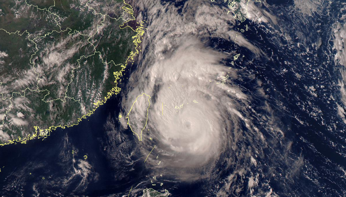
△ At 15:00 on September 11th, Fengyun No. 4 Satellite True color synthesis map. Source: National Satellite Meteorological Center
Typhoon "Plum Blossom" was originally prepared
Retart the old road of the typhoon
But its path is tuned to the west
It is possible to log in or wipe over the coast of Zhejiang
On the evening of September 11th
Central Meteorological Observatory continues to issue typhoon blue warnings
Typhoon No. 12 this year's "Plum Blossom" (strong typhoon level) center on the 11th on the 11 pm on the southeast of Taipei, Taiwan Province, on the southeast of Taiwan Province. The air pressure is 940 hundred Pache.
It is expected that "plum blossoms" will slowly move north at a rate of 5-10 kilometers per hour, and the strength changes are not large or slightly enhanced. Level or super typhoon). On the evening of the 12th, the intensity began to weaken slowly, and continued to move north to the west. After passing through the Ryukyu Islands, entered the southern sea surface of the East China Sea. It gradually approached the coast of the eastern part of Zhejiang.
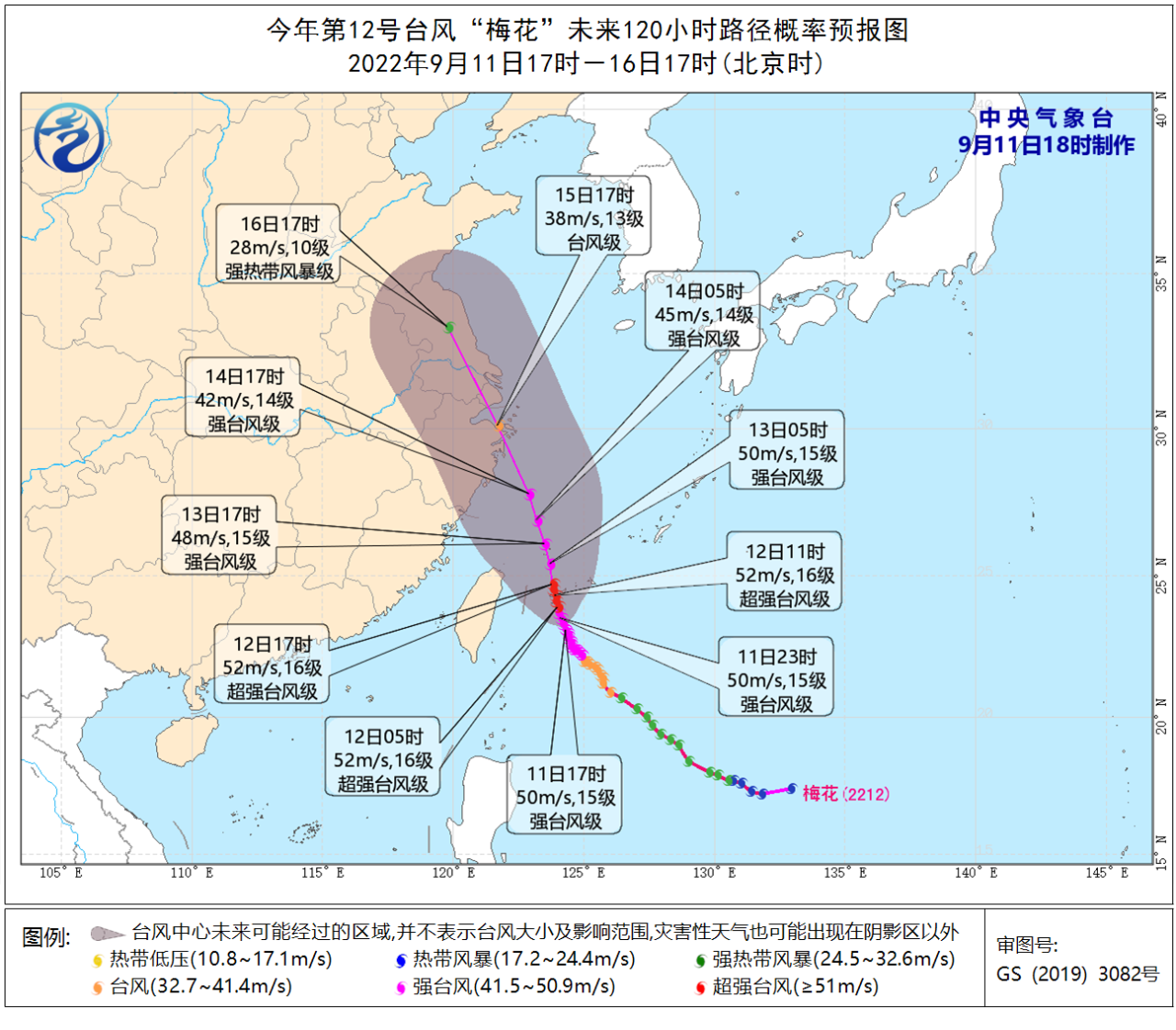
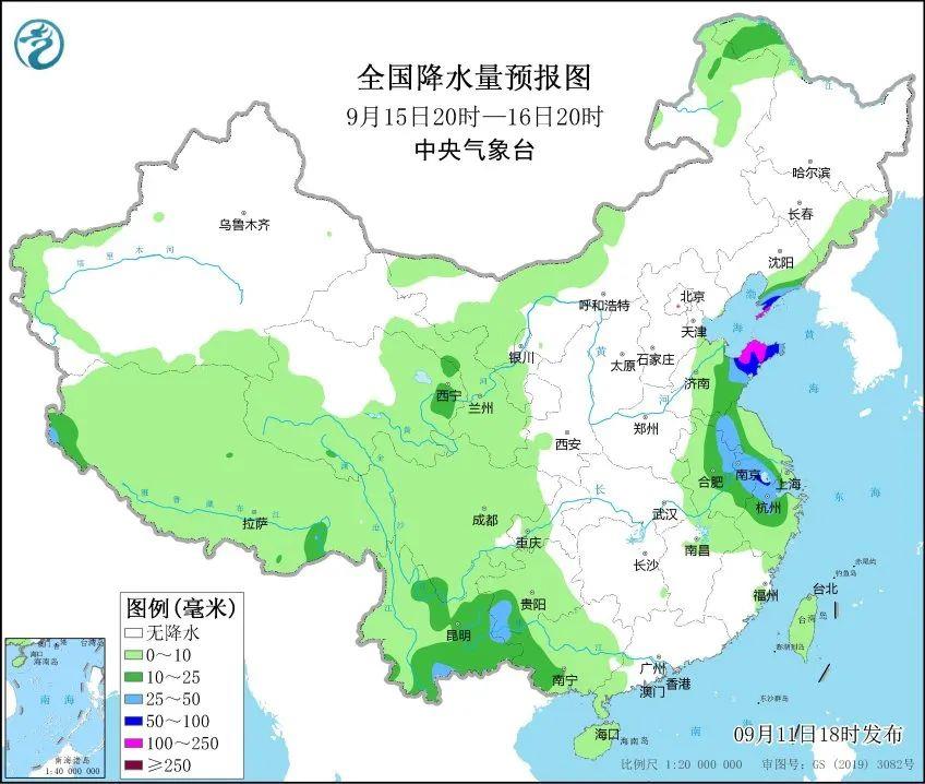
Dafeng forecast: 20:00 on September 11th to 20:00, the central and southern sea surface, the Taiwan Strait, the Taiwan Ocean, the bus strait, the coast of Taiwan, and the nearby waters near the Diaoyu Islands have 6-7 storms, and the gusts are 8-9 Grade; the southeast of the East China Sea and some waters east of Taiwan have 8-11 high winds. The wind and regions passed by the "Plum Blossom" center are 12-16, and the gusts can reach level 17.

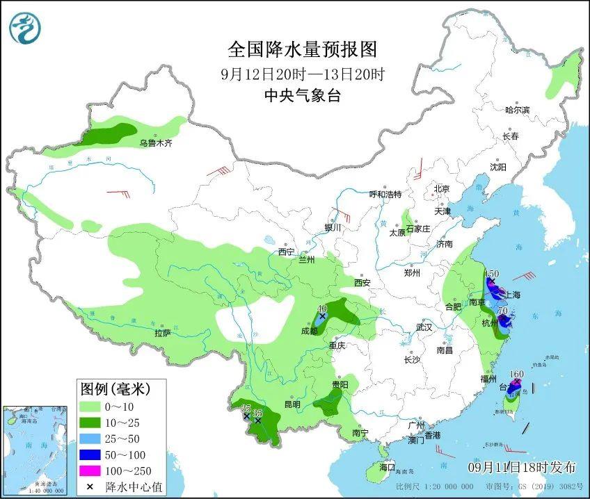
Precipitation forecast: From 20:00 on September 11th to 20:00, there are heavy rain or heavy rain (100-150 mm) in southeast Jiangsu, the northern part of Shanghai, the coast of the eastern part of Zhejiang, and the northern part of Taiwan.
For East China
The impact of precipitation begins to appear on the evening of the 12th
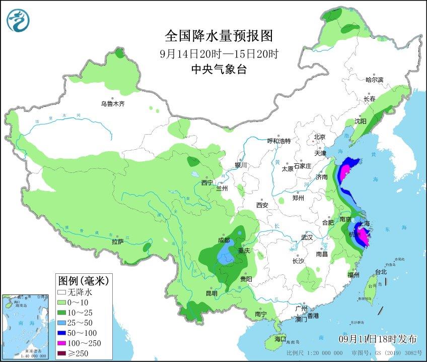
There will be heavy rains from northern Zhejiang to Shanghai from the 12th to 13th
The wind and rain started at night on the 14th
Zhejiang, Shanghai, Jiangsu, Shandong and other places will be as heavy as heavy rain
Land heavy rainstorm
At the same time, there are strong winds from the coast of East China from south to north
During this typhoon rainfall process
For Taihu, which has a lower drought water level, it is conducive to replenishing water levels
But this time the effect is more obvious than Xuan Lannuo before
East China needs to pay attention to the adverse effects that the strong wind and rain may cause
Although the typhoon brings abundant precipitation
But for the thirsty areas such as Jiangxi, Hunan, Hubei, etc.
Far water cannot be solved
In the future, there is still no obvious precipitation process in the above areas
Plus the autumn tiger sitting firmly in the south
The drought will continue to develop ...
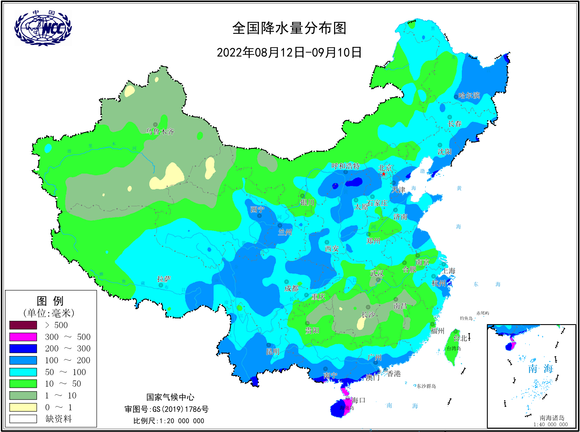
△ It can be seen that some places in Jiangxi, Hunan, have been the same as that of the Tarim Basin in Xinjiang in the past month. Source: National Climate Center
In addition, pay attention to rainy weather in the southwest
Especially the new round of precipitation intensity began on the 13th is stronger
Western Sichuan Basin, southeast of Gansu
There are middle to heavy rain in southwestern Shaanxi and other places
- END -
On -site survey ideas to consider the rejuvenation of the project

In order to conscientiously implement the decision -making and deployment of indus...
Centennial operation 丨 Nineteenth year of family seeking relatives failed, Shenzhen public security love for reunion
The Shenzhen Public Security began to adhere to the fundamental position of people -centered. EssenceFirst of all, thank you very much for the help of the Shenzhen Police Force for our family! Espe