China Meteorological Administration launched a third -level emergency response!Typhoon "Plum Blossom" may land in East China
Author:China Meteorological Administr Time:2022.09.12
On September 12, Typhoon "Plum Blossoms" on the 12th of this year went north, and the China Meteorological Administration launched a third -level emergency response.
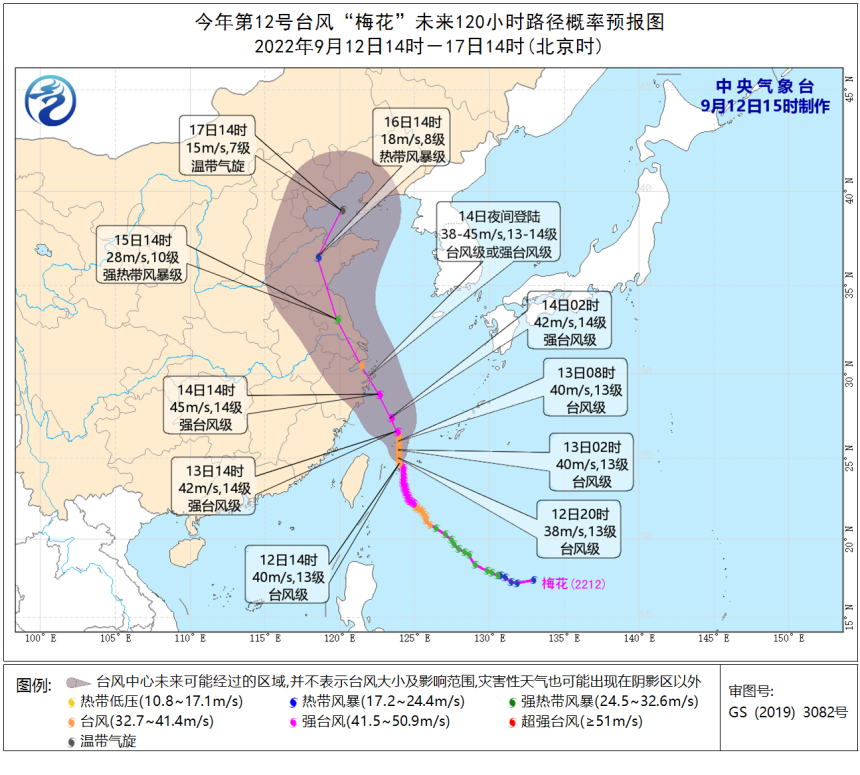
The Central Meteorological Observatory will continue to issue a typhoon warning: It is expected that "plum blossoms" will enter the south of the East China Sea after passing through the Ryukyu Islands from the night of the 12th to the early morning of the 13th, and gradually approach the coast of northeast Zhejiang. It may be on the night of the 14th to the 15th, and the above coastal areas may also be on the north of East China.
In terms of strong wind: Affected by "plum blossoms", from 14:00 on September 12th to 14:00, the southern waters of the Yellow Sea, most of the East China Sea, Taiwan Straits, Taiwan Straits, Basilica Straits, Taiwan Provinces coast, the waters near the Diaoyu Islands, Hangzhou, Hangzhou, Hangzhou Bay, Zhejiang coast, Fujian coast, Shanghai coast, and southeast of Jiangsu have 6-7 garage, gusts 8-9 levels; the southern seas of the East China Sea and some waters east of Taiwan have 8-11 large winds. There are 12-14 levels of wind and regions nearby, and gusts can reach level 15-16.

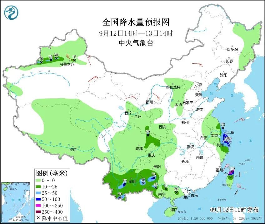
In terms of precipitation: From 14:00 on September 12th to 14:00 on the 13th, there were heavy rains in southeast Jiangsu, Shanghai, northeast of Zhejiang, northern Taiwan Island, and heavy rain in some areas (100-150 mm).

Xu Yinglong, chief forecast at the Central Meteorological Observatory: At present, the "plum blossom" affects the system complex, and there is still greater uncertainty in the movement path and later movement speed. class. "Plum Blossoms" may become the first typhoon to land on the coast of East China this year.
Although the intensity of "plum blossoms" is less than Typhoon Xuan Lannuo No. 11 this year, because it is closer to the coastal coastal of Zhejiang, Shanghai and Jiangsu, the impact of typhoon "plum blossoms" will be greater than "Xuanlan Lan Lan promise".
Expert tips
As the typhoon path continues to adjust the west, the possibility of "plum blossoms" on my country is increasing, and the impact of wind and rain has begun to reveal. Port -avoiding wind, strengthening port facilities, preventing ships from anchoring, stranding and collision; stopping outdoor dangerous operations such as large -scale rally and high -altitude indoor and outdoor; public attention to typhoon forecasting early warning information in a timely manner, and preventive measures in advance.
at last
Send it for everyone
Typhoon Defense Guide
What is a typhoon landing point?
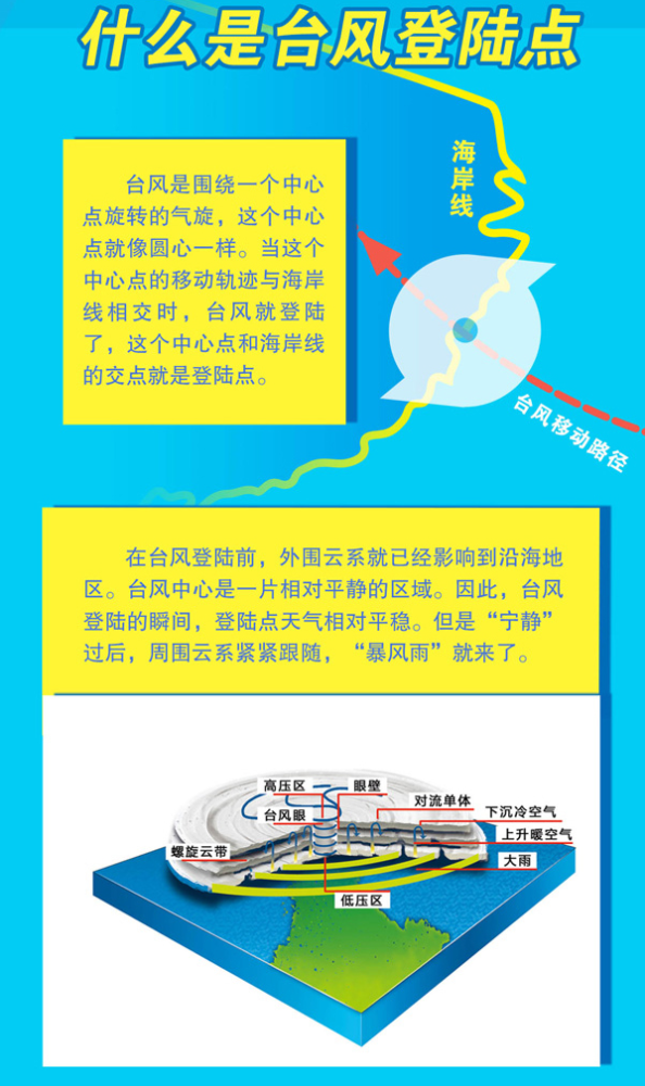
Typhoon landing point
Will it be the worst disaster?

How to avoid the typhoon?

We always follow
Your shade and cold and warm
Produced by China Meteorological Administration Xuanke Center (China Meteorological News Agency)
Author: China Meteorological News all -media reporter Wu Hui
Edit: woody
Review: Wang Chen
- END -
Dingxi Zhang County: Xiaoxiao Mengwa "entering the Red Gate" is educational in Lexue Fire

In order to deeply popularize the knowledge of fire safety, comprehensively enhanc...
Yuncheng Salt Insurance Center launched the Salt Lake Water System Survey on Day 327
At noon. When we saw Mi Huarong, she was standing in front of her door to eat ice ...