Shandong released important weather forecast
Author:Weifang Media Network Official Time:2022.09.12
Typhoon No. 12 "Plum Blossom" news and sea windy yellow warning at sea

Typhoon News: This year's Typhoon "Plum Blossom" (Typhoon "(Typhoon Level) at 14:00 on the 12th, the center was about 610 kilometers southeast of Zhoushan City, Zhejiang Province, and the maximum wind power near the center of the center, with a central air pressure of 960 hundred Pache.
It is expected that "plum blossoms" will move northwest at a rate of 5 to 10 kilometers per hour, and gradually approach the coast of the northeast of Zhejiang. From the night of the 14th to 15th, it will log in or wipe the above coastal areas during the day and weaken the north. Enter our province on the 16th. Affected by the periphery and ontology of the "plum blossoms", there were obvious windy weather in the sea areas of our province on the night of the 13th to 16th; from the night of the 14th to 16th, there was a heavy rainstorm in the peninsula area.
At 16:10 on September 12th, Shandong Provincial Meteorological Observatory issued a large yellow warning at sea: Affected by Typhoon No. 12 "Plum Blossom" and cold air. Grade 7 to 8 gusts 9 in the north of the Yellow Sea.
The "plum blossom" is far from our province. The later path and the impact on our province are still uncertain. The meteorological department will closely monitor the changes in weather, strengthen tracking and judgment, and scroll time to issue forecast early warning information.
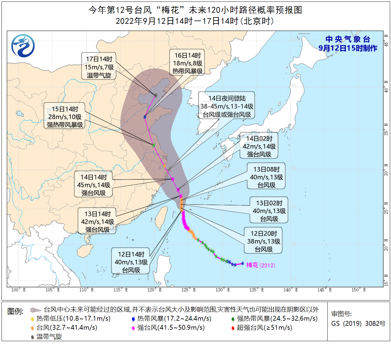
Figure 1 Typhoon "Plum Blossom" mobile path forecast chart
- END -
The prototype of "Kapok Boys" in Guangzhou Baiyun Station appears!Steel structure "pe

A beautiful KapokIt is about to bloom on the Guangzhou Baiyun Station projectBleak...
Notice!This main road in Kunming City has changed →

2022Urban traffic unobstructed and improved operationYouth Road and Dongfeng East ...