Is the "autumn tiger" in the northern cold air in the northern cold air?
Author:Sichuan Observation Time:2022.09.18
Typhoon "Plum Blossom" has been stopped
On the 17th, its impact on the Northeast China also ended
Most weather in the Northeast is temporarily returning to calm
However, the typhoon just sent away
The northeast region is immediately ushered in a cold air
On the 17th, the influence of cold air has gradually begun
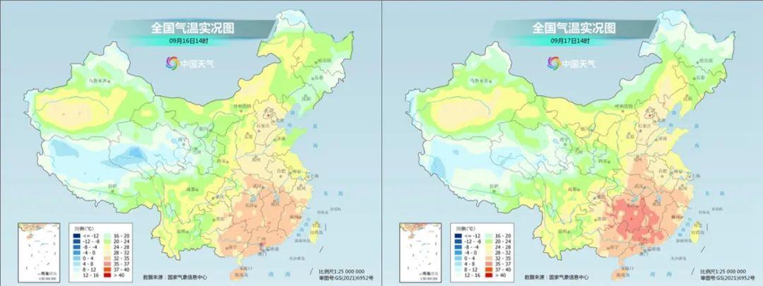
Compared to the 16th at the same time on the 16th
17:00 on 17:00
The central and east of Inner Mongolia and the east are northern and other places
A significant cooling has appeared
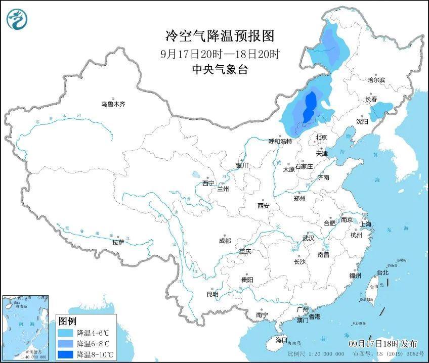
The Central Meteorological Observatory predicts that from the night of the 17th to the 19th
There are 4-8 ° C to cool down in eastern Inner Mongolia, northeast regions and other places
Cooling in the east in the northeast can reach up to 10 ° C or more
After the cooling, Harbin, Changchun, Shenyang
The highest and lowest temperature will be refreshed new lows after the beginning of autumn
Among them, Harbin, Changchun
Night on the 19th to the morning of the 20th
The minimum temperature may be only about 4 ° C
It's the feeling of late autumn
This cold air will not only affect the Northeast
It will also affect North China and Huanghuai early next week
And the middle and lower reaches of the Yangtze River
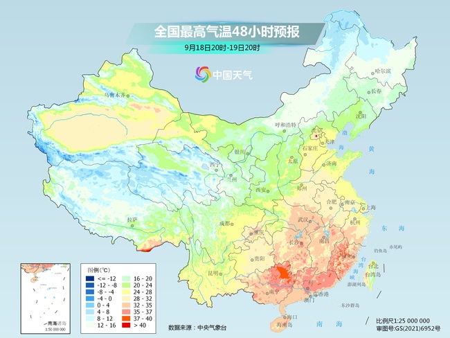
On the 20th, the highest temperature in North China
It will decrease from 30 ° C to 20 ° C in the past two days
The Huanghuai area will be reduced from 30 ° C to about 25 ° C
And some areas in the middle and lower reaches of the Yangtze River still appear at high temperature this weekend
But it will also drop to 30 ° C or below next week
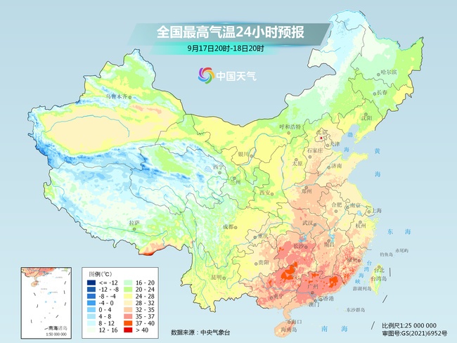
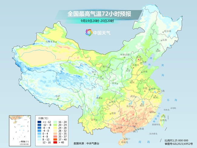
The hottest is South China
In the next few days, it is controlled by the mainland heating and high pressure
There are still "autumn tigers" in many parts of South China
Judging from the latest urban forecast
The highest temperature in Fuzhou in the next two days can still reach 36 ℃
It is expected to increase the maximum high temperature daily record of 67 days to 69 days
Guangzhou will also be continuous high temperatures in the next three days
Nanning high -temperature weather will also "open"
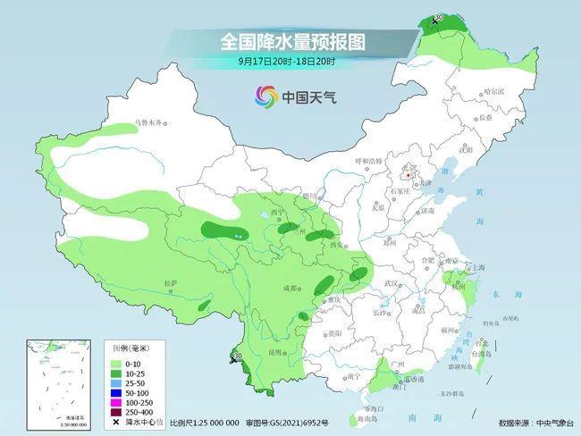
Precipitation
The next few days
The focus of my country's precipitation is mainly in the western region
Central Meteorological Observatory predicts that from 18th to 20th
East, Sichuan Basin and other places in the northwest region
There are medium to heavy rain in some areas, and heavy rain in the local area
There are rain and snow in the high altitude area of the Qinghai -Tibet Plateau
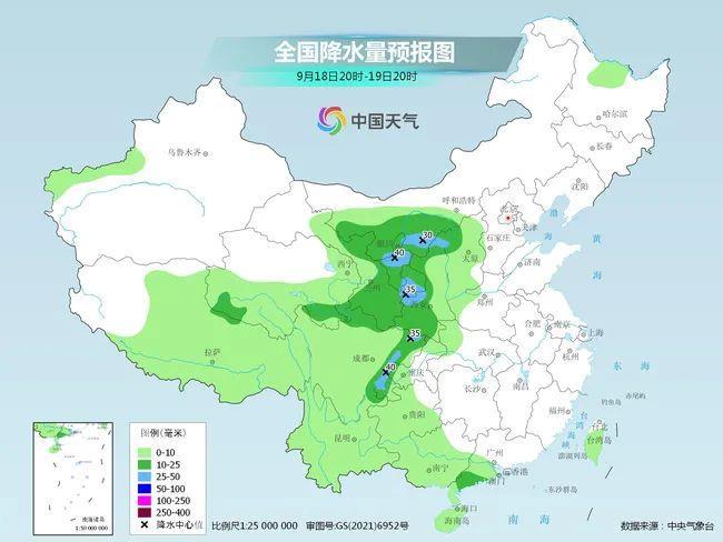
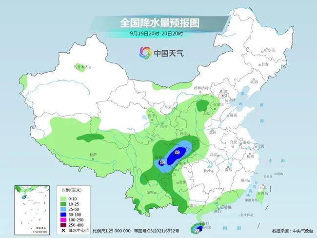
Among them, Sichuan Basin, eastern Gansu
And southern Shaanxi and other places
It is necessary to pay special attention to the secondary disaster caused by heavy rainfall
After the autumn typhoon is built, it is generated
At present, the typhoon of the maritime event is only the 14th "Nanma Metropolis"
During the day on the 17th, "Nanma Capital" still maintains a super typhoon level
Looking at the satellite cloud map at 15:00
"Nanma Metropolis" is clear and clear, and its body shape is huge
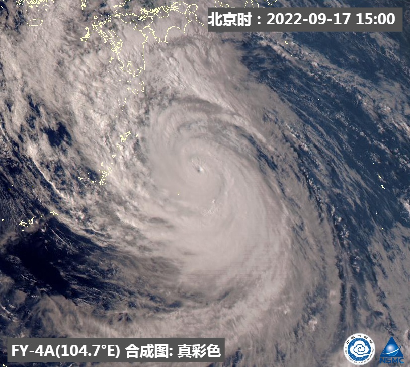
Although it will not land in my country
But under the joint influence of it and cold air
Night from the 17th to the 20th day of the day
Some waters in the eastern part of the East China Sea can reach level 9 ~ 11
Gust 12 ~ 13 level
Related personnel and operation ship industry, etc.
Still pay attention to strengthen prevention
- END -
Beijing Radio and Television Bureau went to Kuaishou Technology to investigate

On the afternoon of September 16, Wang Jiequn, the party secretary and director of...
270 meters high -altitude experience the "pulse" of the Guangdong -Hong Kong -Macao Greater Bay Area

Xinhua News Agency, Guangzhou, June 16th.Xinhua News Agency reporter Tian Jianchua...