Loess Plateau, World Heritage Scraped by the wind
Author:Writer Wen Digao News Agency Time:2022.09.18
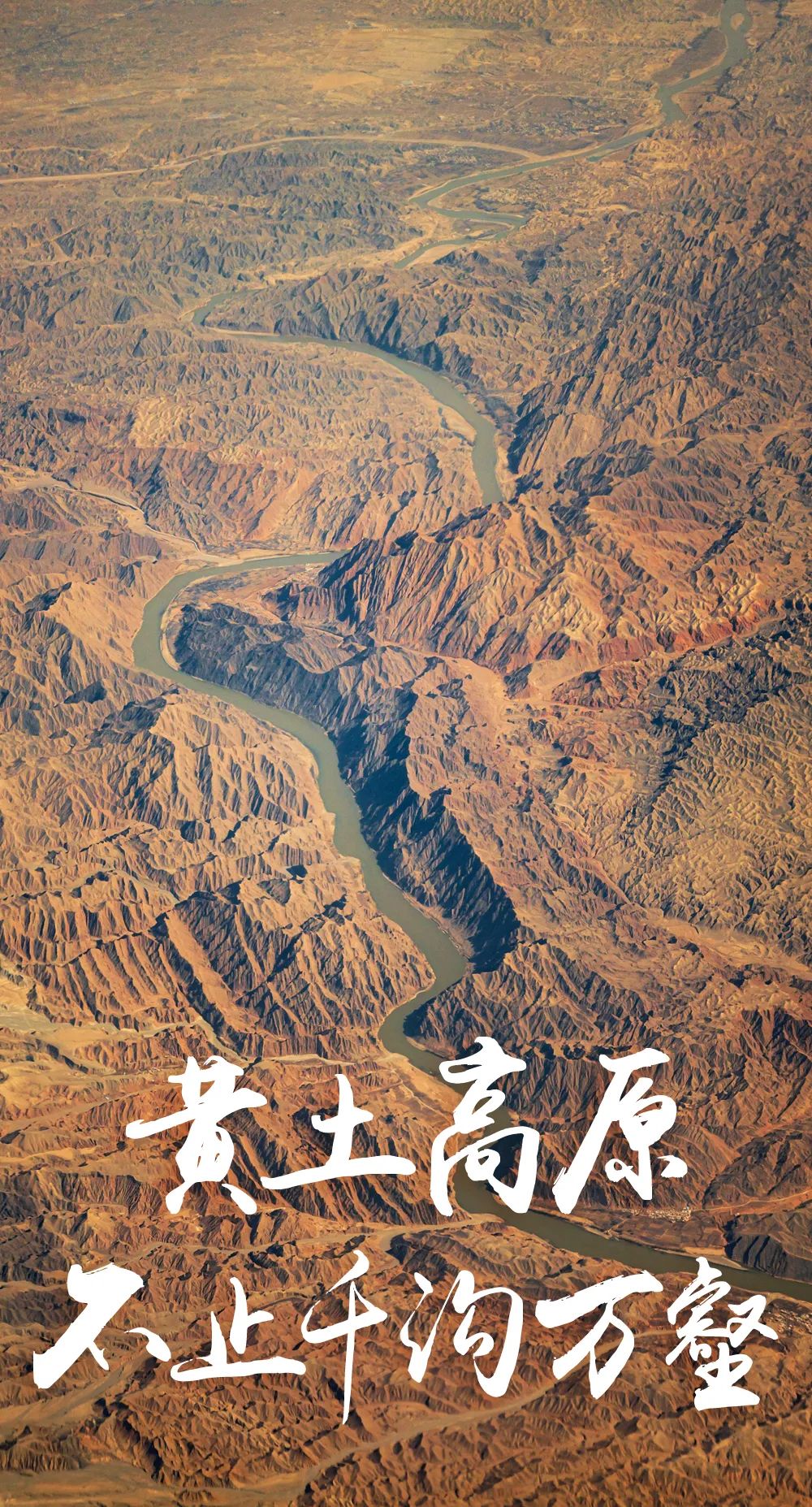
When it comes to the Loess Plateau, people think of gully, loess, and Yellow River. It does not have the richness of the northeast of "white mountains and black water", no gentleness in Jiangnan water village, nor the mystery of Tibet. This vast area stretches thousands of miles, across Qinghai, Gansu, Sichuan, Ningxia, Inner Mongolia, Shaanxi, Shanxi, Henan and Shandong. Why do such spectacular Loess Plateau develop only here? Why can it be the cradle of bred Chinese civilization?

How did the Loess Plateau come?
The loess area of the Chinese loess plateau covers an area of 440,000 square kilometers. The thickness of the loess is generally 50 to 200m (the thickness of the loess accumulation of Jiuzhou Thailand in Lanzhou, Gansu reached 336m). It is the most widely distributed loess in the world. With such a huge loess plateau, such a huge loess layer is deposited, it is difficult for the entire earth to find a rival.
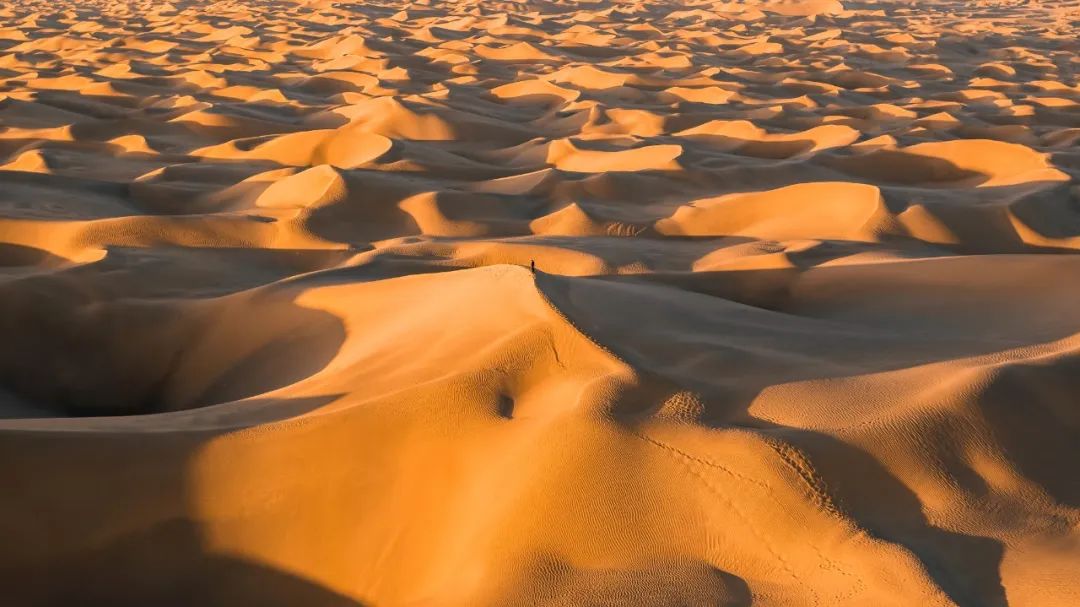
10,000 -meter high alternate shot Gannan Loess Plateau
Regarding how to come from the Loess Plateau, the academic people have argued for more than 100 years. The "new style of becoming" founded by Mr. Liu Dongsheng, a senior academician of the Chinese Academy of Sciences, who is known as the "Father of the Loess", has basically become a consensus. Xinfeng Cheng believes that the formation of the Loess Plateau is a "super infrastructure" that rely on wind power to carry thousands of kilometers away.
Swipe left and right to view more
The source of the formation of the Loess Plateau: "China National Geographic" October 2017
Foundation: Ordos plot
If you want to make such a scale (wide area and thick soil), there is no solid and flat foundation. After all, the strong flowing water may have been washed away. Fortunately, the magical work of nature has already cast a stable and tough base for it -Ordos plot.

During the 3.5 million to 2.6 million years ago, the Qinghai-Tibet Plateau on the southwest side of the plot was a period of dramatic and rising. The violent mountain building moved to the earth, countless land could not carry pressure, and the mountains rose. The Ordos plot is like a rock (originally a rock) to calmly rise and uniformly increased. Although there are slight ups and downs, the overall state is still flat, and the best "foundation" of the loess is stable.
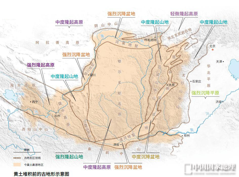
There are severe raising pictures on the southwest side of Ordos plot: "National Geographic" October 2017
Architectural material: Where does the loess come from?
If the foundation is done, it should be cement and brick tiles. The Loess Plateau is so wide and huge, and the material of the buildings must be controlled. So where should the building materials be prepared? When we looked at the northwest, the large desert and Gobi came into view. Isn't this just in line with the material supplement of the loess? Everything is the best arrangement of God.
Yangguan Gobi Beach, Gansu Province
The Qinghai -Tibet Plateau on the southwest side of the Loess Plateau has been rising upward, and now it has become a well -deserved roof of the world. Because the plateau intercepted the warm and humid Indian ocean water vapor, from 3 million years ago, drought and rain, heavy temperature differences, and strong physical weathering effects on the surface of Central Asia. Come.
Taklamagan Desert
Architect: Great Wind
If you want to start flat, there is no shortage of bricks! That's right, I want to get up the Loess Plateau, and I have no choice of workers -the hard work of the wind, and the vast loess wants to wait for the natural and calm accumulation. It's been a long time).

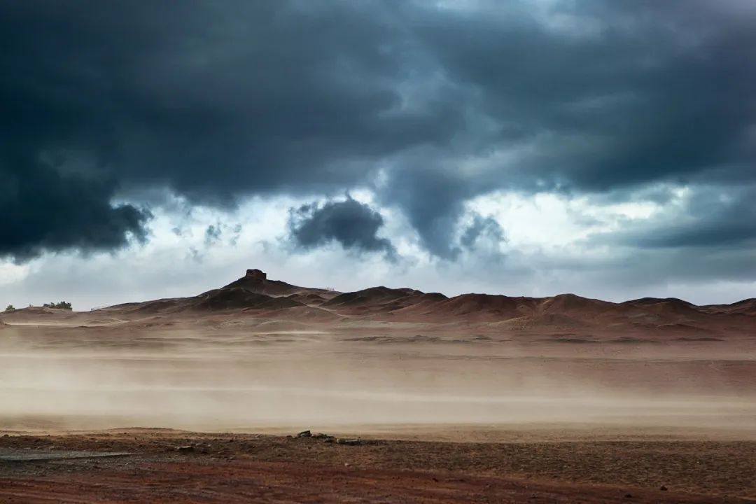
We all know that due to the unevenness of the earth's rotation and the solar radiation on the earth, a large wind speed will be formed in the mid -latitude region of the north and south hemisphere. The average altitude of the Qinghai -Tibet Plateau reached more than 4000 meters after the strong bulge, and the width was one -third of the western wind band of the northern hemisphere, and the western band was "split".

A branch of the north blows away along the north edge of the Qinghai -Tibet Plateau. First, come to the arid area. Here, the particles on the ground will continue to swim forward. The ground wind and the western wind on the ground complement each other, and the thick and thin particles are taken away. After coming to the today's Loess Plateau, the wind gradually weakened, and the wind started to unload the work here.

On August 17, 2022, the dust of Jiuquan in Gansu was struck, such as a huge "sand wall" slowly moved
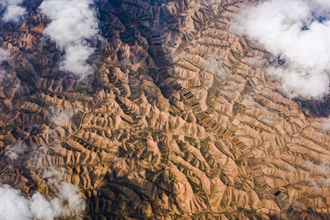
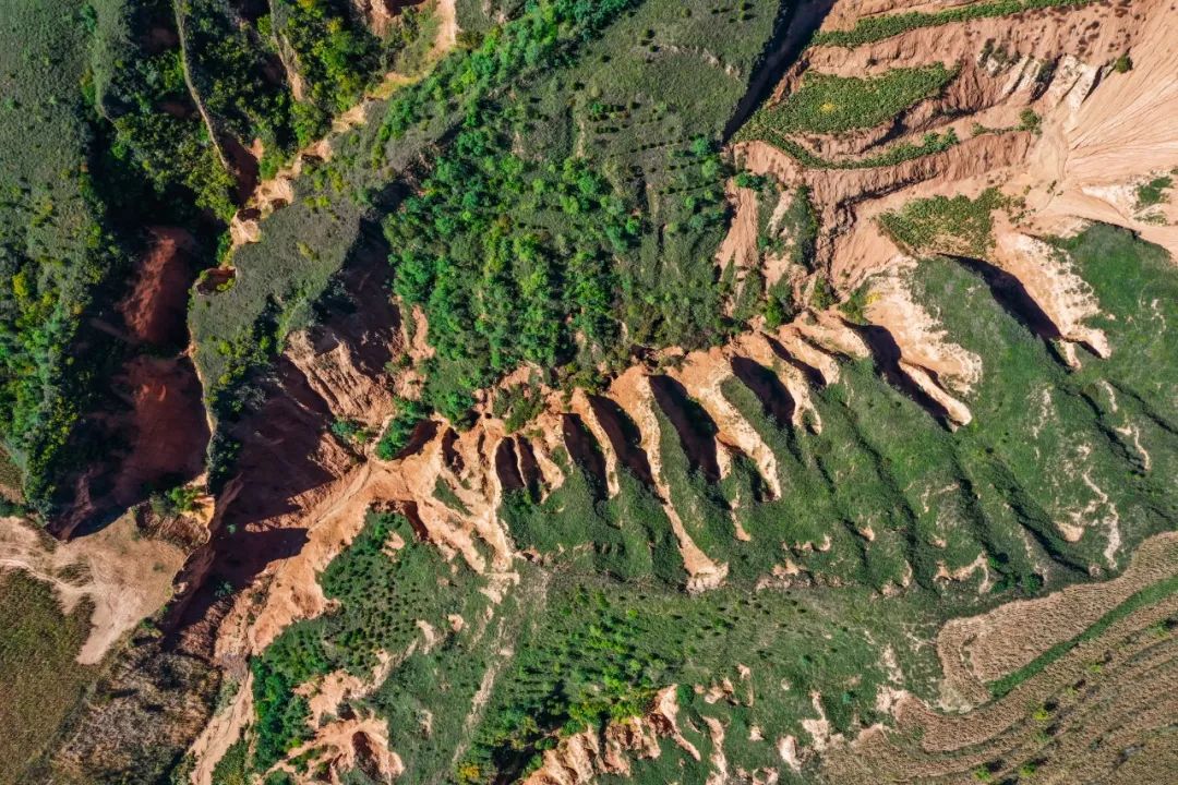
The landform of the Loess Plateau is also a highlight. When the particles land on a flat and wide high ground, it will slowly pile up to form a typical highland of the Yellow River, which is flat and cut around the river valley. A loessy is formed on the beam -shaped hills, and if it landed on a separate hill, a loess is eventually formed.
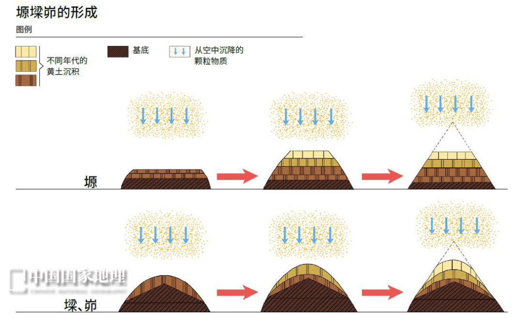
Picture source: "China National Geographic" October 2017
Loess
Forming framework: blocking of Dashan
The wind continued to blow, and the loess continued to accumulate. But the strange thing is that the Loess Plateau now stops east of Taihang Mountain and stops south to Qinling. These towering mountains are like the framework of infrastructure, which limits most of the loess to the inside of the mountain. Without the enclosure of tall mountains such as Qinling and Taihang Mountain, the loess will not accumulate as deep in one place. Only the loess layer is thick enough to be afraid of the destruction of that year.
West of Luliang Mountain, Lu Liang accumulated a huge loess
In addition to the guardian of the mountain, the role of Dashan has also successfully blocked the bad sand and dust to continue to be a demon. Turn south to Qinling to the Sichuan Basin. The city here is looming in the water vapor surrounded by water vapor, and the landscape depends on each other. Imagine that if there is no Qinling, the kingdom of Tianfu surrounded by mountains may be covered with loess. Chengdu, where water vapor is lingering in the Sichuan Basin of the southern foot of Qinling Mountains

Why is the Loess Plateau the birthplace of Chinese civilization?

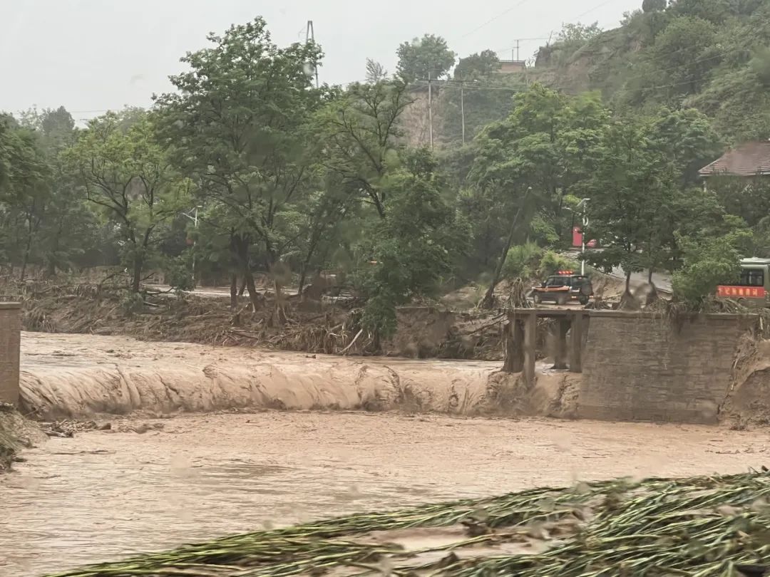
The Loess Plateau is actually not a pleasant climate. Mainland seasonal climate makes it cold and dry here in winter and spring. Earthquake, landslides, landslides, floods, droughts, wind and sand disasters, hail disasters, frost disasters, insect disasters, etc.
On July 15, 2022, the floods in Qingyang City, Gansu Province were destroyed by the embankment trees
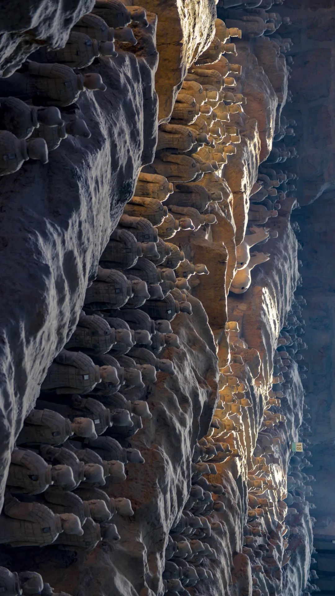
Human activities on the Loess Plateau have been traced back to more than 2 million years ago. From Paleolithic to the new era, from the state of the state to the kingdom to the empire. Why is this seemingly barren loess plateau, why is it the cradle of the Chinese civilization?
Terracotta Warriors and Horses
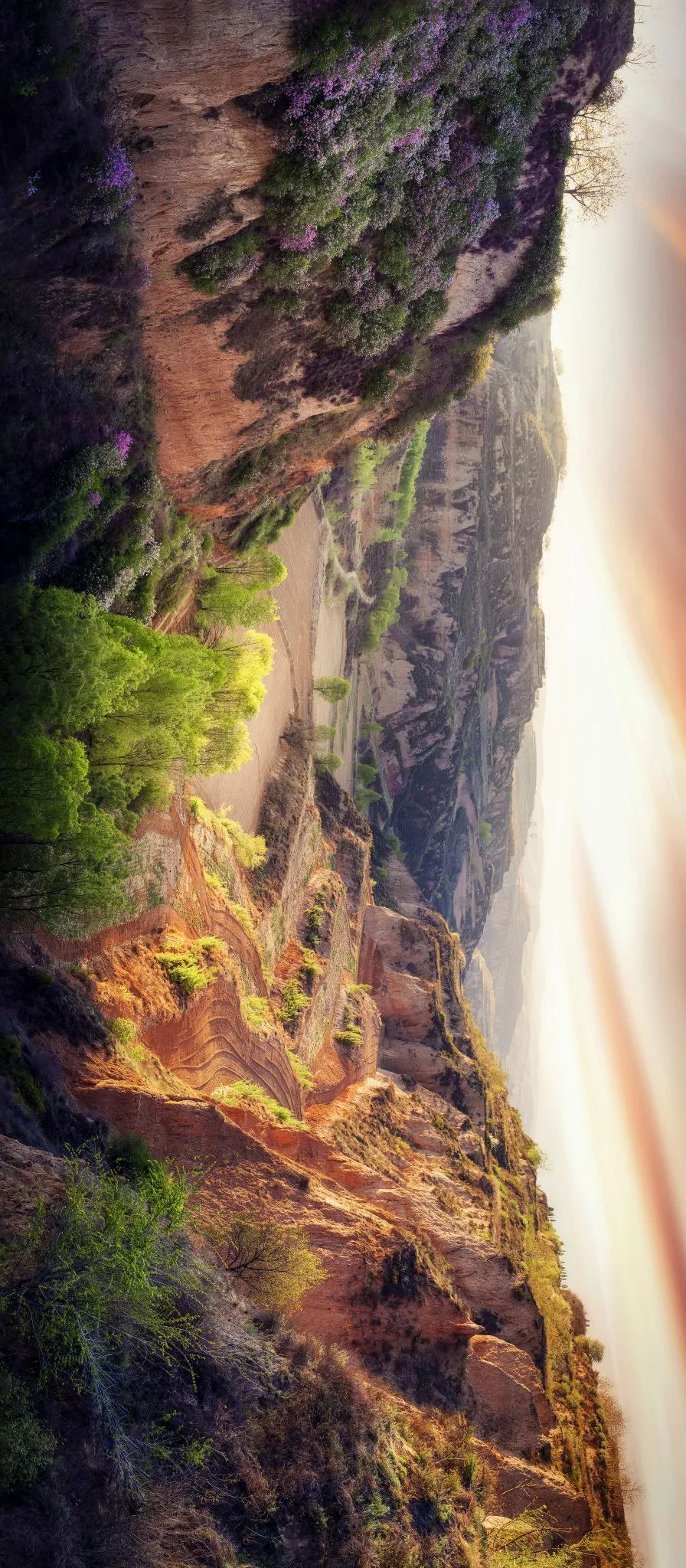
Although the climate is not pleasant here, it is not so harsh that it cannot survive. Although the wind is cold and cold in winter and spring, the vertical and loose loess is conducive to the excavation, and the unique cava lifestyle on the Loess Plateau is born. The cave caves on the Loess Plateau ditch, so that ancient humans here can successfully avoid the severe cold and beast attacks.
Cave Caves Building in Shan District, Yan'an City, Shaanxi Province, China

In the same period of rain and heat in summer, it just meets the water and sufficient light heat that the plants need. Secondly, the agricultural technology was not mature in ancient times, and the tools and technology were relatively backward. Some of the characteristics of the loess also helped humans very busy.
Ancient Chinese wooden agricultural tools
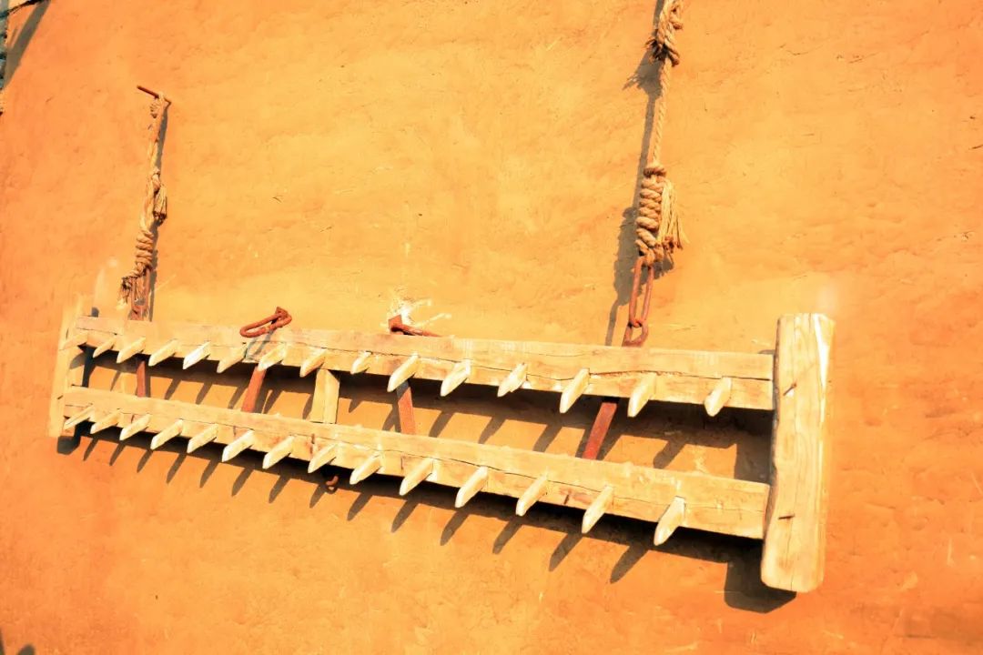
Easy cultivation: The loess is the accumulation of the wind. The particles are small, the structure is loose, and the simple wood, bone or stone tools can easily open the loess for cultivation. In contrast to the cultivation of the loess is in stark comparison, the red soil covered by most parts of the southern my country. Because of the high temperature and heavy rainfall, the soil layer is very serious. A large amount of iron in the red soil makes the ground very hard, and early humans can not be applied. Therefore, the origin of agriculture can only happen on such a loess that is easy to cultivate.
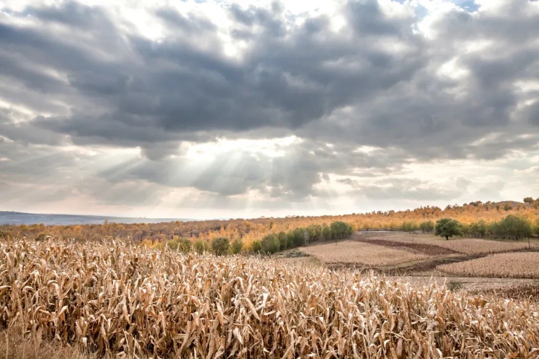
Mature crops on the Loess Plateau
Self -fertilizer: The loess pine is conducive to the hair to absorb nutrients. Simply put, it is like a porous sponge's water absorption. It can increase the inorganic substances contained in deep soil to the top layer and take it in crops. In addition, the monsoon scraped every year will be sent to the earth. This kind of "self -fertilizer" basically does not have to worry about the problem that the nutrients cannot continue to cultivate.
In this way, the Loess Plateau solves the problem of people's food and clothing, and civilization can continue to develop and become an important birthplace of Chinese civilization.
How to defend the Loess Plateau?

Starting from Yangshao Culture, the Loess Plateau has nourished the Huaxia people for seven thousand years. In modern times, with the increase of population, wind and sand, and the loss of soil and soil, the fragile ecosystem of the Loess Plateau is facing unprecedented pressure.
Aerospace loess high -slope water loss
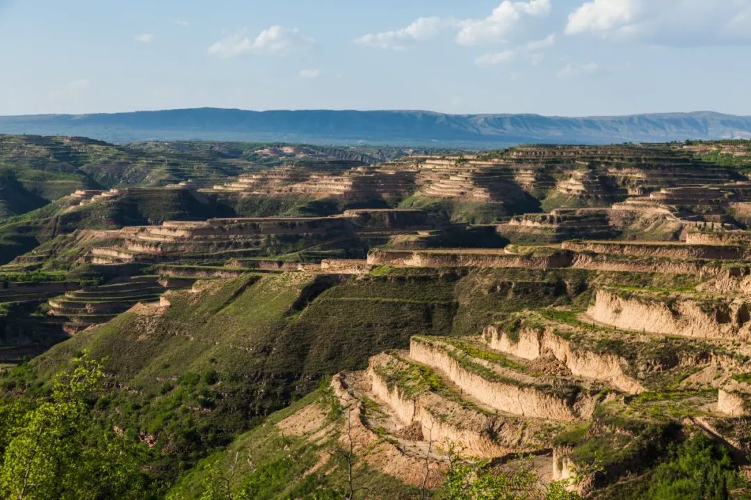
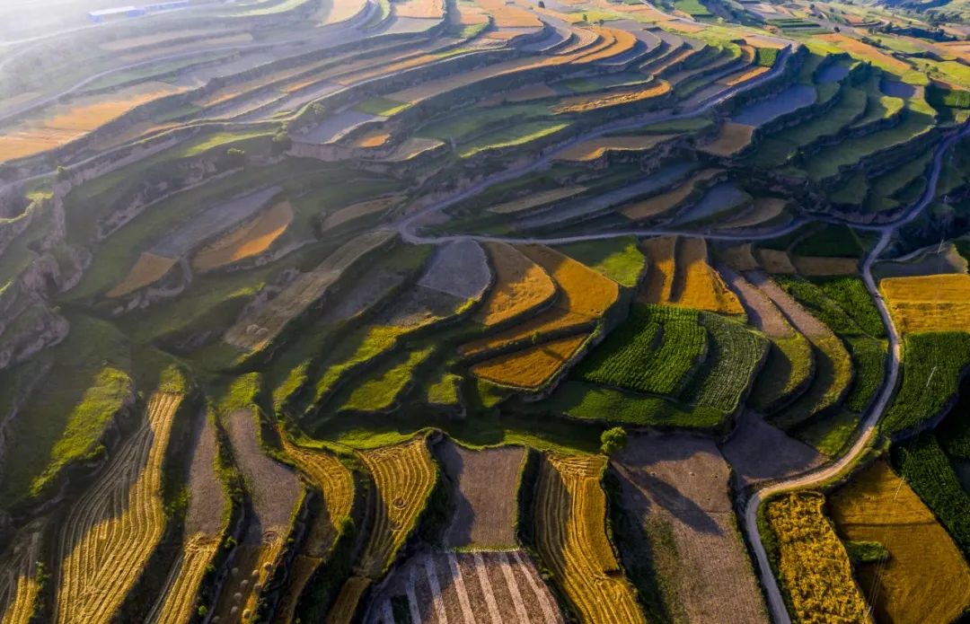
The construction of terraces has become the main method of scientific governance of the soil and soil loss of the Loess Plateau. The drought -making terraces planted on the Loess Plateau are different from the abundant terraces in the south. It is both a farmland and an efficient soil and water protection project.
Gansu Tianshui and Drought Terraces
Early Loess Plateau wind erosion desertification was severe, mainly distributed in the area along Ningxia, Inner Mongolia and the Great Wall of Northern Shaanxi. In order to fix the flow sand, this includes the laying grid and the use of terrain to set up barrier, etc., which is a successful experience in preventing desertification.
Ningxia central defender govern the desert-wheat grass square grid

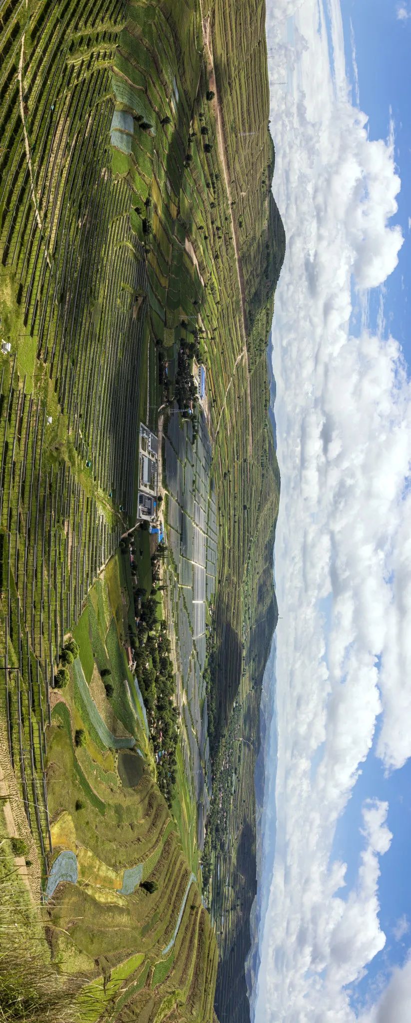
After several generations of unremitting efforts, the terraces are built, tree dams are used to plant tree forests and vegetation, and vegetation has naturally recovered. Now the Loess Plateau has undergone tremendous changes. Statistics show that before 1999, the vegetation coverage of the Loess Plateau was about 31.6%. In 2019, the vegetation coverage of the Loess Plateau reached approximately 63.6%, doubled.
New Scenery of the Loess Plateau: turning green
In fact, in the academic world, the hidden loess is still a "Tianshu" recorded in ancient climate change. It has already existed from the fourth period, witnessing the appearance of human beings and evolution to the current historical process. Such a world -only "loess" plateau, its birth, development, and changes have always been the focus.
[References] [1] Why is the Yellow River cleared and the loess plateau is green? The answer is not unexpected. The Central Committee of the Communist Youth League, December 2019. [2] Cang on the Loess Plateau is a "stage" made of Chinese specialized. China National Geographic, October 2017. [3] How big is China? Museum, December 2006. [4] Defend the loess and rebuild the ecology of the Loess Plateau. China National Geographic, October 2017.
Source: China National Geographic
Editor -in -chief: Nala
Council: Wei Wei
Trial: Kong Ping
Recommended books
- END -
On the 22nd National Defense Education Day, 151 communities in Baoshan carried out air defense evacuation drills

On Saturday, September 3rd September each year, the National Defense Education Day...
Strictly beating and strictly!Jingshan Street launches a special rectification operation of "Three None" ships

In order to strengthen the safety management of ships in the jurisdiction, Jingsha...