The super typhoon "Olysu" is here!It will seriously affect the coast of the South my country Sea and South China in China
Author:China Meteorological Administr Time:2022.09.25

The Central Meteorological Observatory issued a typhoon blue warning
Typhoon "Olympic" No. 16 this year
On the afternoon of September 23
On the evening of the 24th to night
Rapid from strong tropical storm level to super typhoon level
At 17:00 on the 25th (super typhoon level)
Located north of the east part of Manila, Philippines
About 135 kilometers of northwest Pacific Ocean
The largest wind near the center is level 16 (55 meters/second)
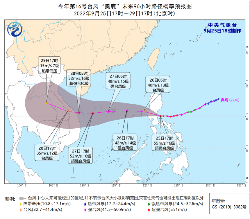
It is expected that "Olympic" will land on the coast of the eastern coast of Luzon Island, Philippines tonight (48-55 meters/s, 15-16 levels, strong typhoon or super typhoon). It weakened, and entered the waters of the central and eastern parts of the South China Sea on the morning of the 26th to the morning of the South China Sea, and then moved towards the west. It gradually approached the coast of the eastern part of Vietnam and the intensity will be strengthened. Mi/second, 15-16 levels, strong typhoon or super strong typhoon), the intensity is weakened rapidly after landing.
Georgian forecast
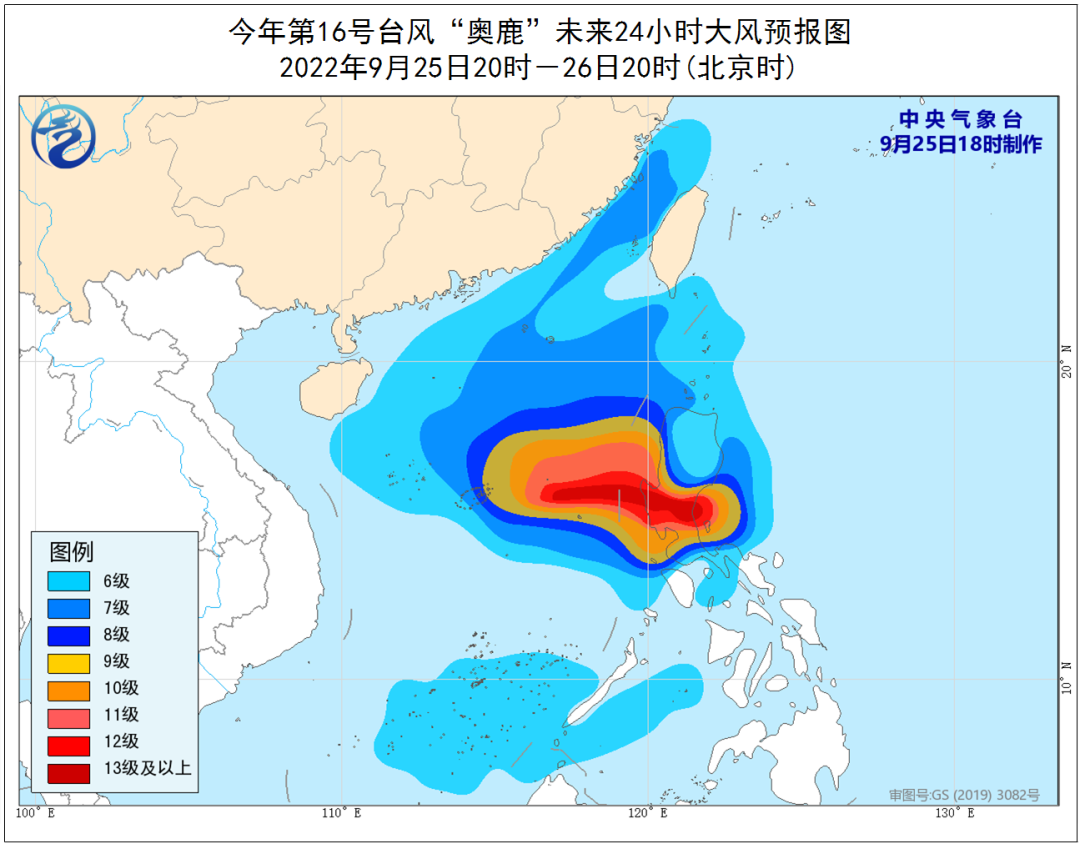
Affected by the cold air and "Olympic", from the night of the 25th to 14:00 on the 28th, the western coast of Taiwan, the coast of Fujian, the coast of Guangdong, the coast of Hainan Island, and the Taiwan Strait, the South China Sea, the Beibu Gulf, Qiongzhou There are levels of 6 to 8 in the waters near the Straits and Sansha Islands, and the gusts are 9-10. Among them, the wind power of the central part of the South China Sea, the Xisha Islands, and the Zhongsha Islands can reach level 9-13, the gusts are 14-15, the typhoon center, the typhoon center, the typhoon center There are 14-16 levels of wind and regional winds and regions that passed by, and the gusts are 17 or above.
Rainfall forecast
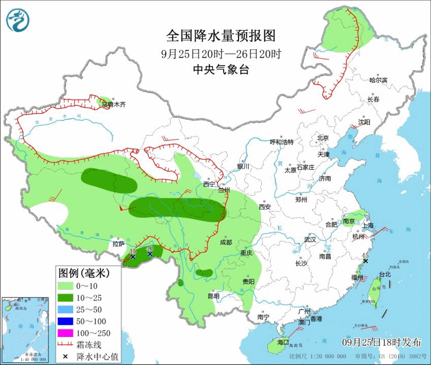
From the 26th to 28th, there are heavy rain and heavy rain in Hainan Island, Sanzha Islands and other places; the cumulative precipitation in the above areas can reach 80 to 120 mm, and the area of more than 200 mm; the largest hourly rainfall is 30 to 50 mm.
Meteorological disaster risk forecast
From the 26th to 28th, the risk of floods and geological disasters in the eastern part of Hainan Island and other places, and some small and medium rivers have a meteorological risk close to the alert water level.
Reminder
Typhoon "Olysu" moves fast, strong strength
When affecting the coast of the South my country Sea and South China
The strongest can reach strong typhoon or super strong typhoon level
Strong wind and wind
In the central part of the South China Sea, the Xisha Islands
Voyage ships and personnel near the sea area near Zhongsha Islands
Need to evacuate in time
Ship near South China coast returns to Hong Kong to avoid wind in time
In addition, Hainan Island has continued to rain since September 20
Especially the soil water saturation in the eastern part of Hainan Island
Affected by the heavy rainfall of typhoon
Mountain floods, geological disasters, and small and medium rivers are high risk of floods
Need to strengthen prevention
Low -lying farmland needs to clear the ditch in advance
To prevent waterlogging disasters
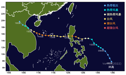
History similar typhoon case
In recent years, the typhoon, which has been similar to Typhoon "Olympic Deer" in recent years, is Typhoon "Butterfly" No. 21 in 2013 and Typhoon "High" of Typhoon 22 of 2020. details as follows:
(1) Typhoon "Butterfly" was generated in the east of the central part of the South China Sea on the afternoon of September 27, 2013. It landed on the coast of Vietnam (typhoon grade) from east to west of the South China Sea. During this period, it brought strong wind and rain to the South my country Sea and Hainan.
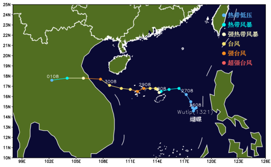
(2) Typhoon "ring height" was generated on the east of the Philippines on the afternoon of November 9, 2020, and passed through the sea of the South China Sea after landing on the Philippines (strong typhoon level), and then landed on the Vietnam coast (strong tropical storm).
Typhoon
Please pay attention to the latest forecast early warning information
Do a good job of preventing
Produced by China Meteorological Administration Xuanke Center (China Meteorological News Agency)
Source: Central Meteorological Observatory
Edit: Jiang Hong
Review: Hu Ya

- END -
Yu Yanhong attended the opening ceremony of Wang Qi College of Beijing University of Traditional Chinese Medicine and delivered a speech

Content source: China Traditional Chinese Medicine News Reporter: Li NaOn August 2...
The epidemic situation is severe!Citizens should pay attention to these matters, Ningbo released ...
At present, Jinhua Yiwu and other places such as a new round of new crown virus pneumonia epidemic situation is severe, summer personnel flow is large, and the risk of epidemic dissemination is high.