Notice!The super typhoon "Olympic" will seriously affect the coast of the South my country Sea and South China in China
Author:Changjiang Daily Time:2022.09.25
According to the Central Meteorological Observatory, Typhoon No. 16 this year, "Okulu", was generated on the southern ocean on the Filipino on the afternoon of September 23. On the evening of the 24th to the night, it was rapidly enhanced from a strong tropical storm to a super typhoon. At 17:00 on the 25th, the center (super typhoon) is located on the northwestern Pacific Ocean, which is about 135 kilometers north of Manila, Philippines. The maximum wind near the center is 16 (55 meters/s).
It is expected that the "Olympic" will move north to north at a speed of about 25 kilometers per hour. It will land on the eastern coast of the eastern part of Luzon Island, Philippines (48-55 meters/s, level 15-16, strong typhoon level Or super -strong typhoon), passing through Luzon Island today, the intensity weakened. On the morning of the 26th to the morning of the South China Sea, it moved to the west. Strengthen, land on the coast of the eastern part of Vietnam from the morning of the 28th to the morning (48-52 meters/s, 15-16 levels, strong typhoon or super typhoon). The Central Meteorological Observatory issued a typhoon blue warning on the morning of September 25.
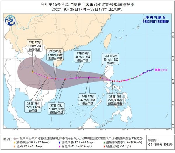
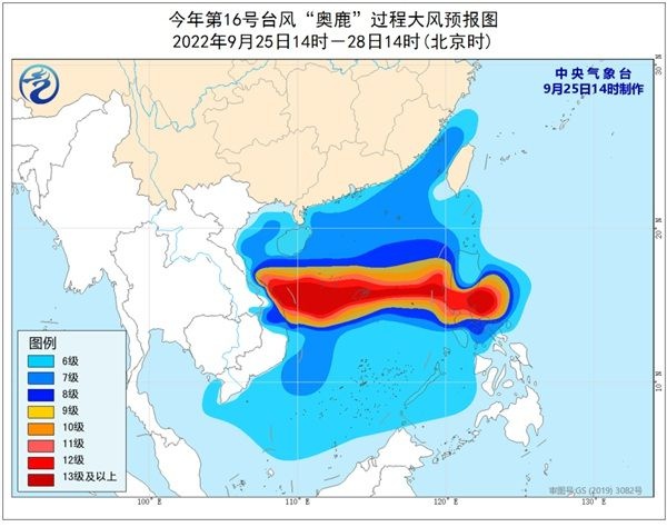
Great Wind Forecast: Affected by the common cold air and "Olympic", from the night of the 25th to 14:00 on the 28th, the western coast of Taiwan, the coast of Fujian, the coast of Guangdong, the coast of Hainan Island, and the Taiwan Strait, the South China Sea, the north, the north, and the north The waters near the Gulf, Qiongzhou Strait, and Sansha Islands have 6 to 8 gale, and gusts are 9-10. Among them, the wind power of the waters of the central South China Sea, the Xisha Islands, and the Neighborhood Islands can reach level 9 to 13, and the gusts are 14-15 The nearby waters and regions passed by the Typhoon Center are 14-16 levels of wind and level 17 and above.
Rainfall forecast: From the 26th to 28th, there are heavy rains in Hainan Island, Sansha Islands and other places, and heavy rainstorms; the cumulative precipitation in the above areas can reach 80-120 mm, and the area of the area is more than 200 mm; 50 mm.
Meteorological disaster risk forecast: From the 26th to 28th, the risks of floods and geological disasters in eastern Hainan Island and other places are high, and some small and medium rivers have meteorological risks close to the alert water level.
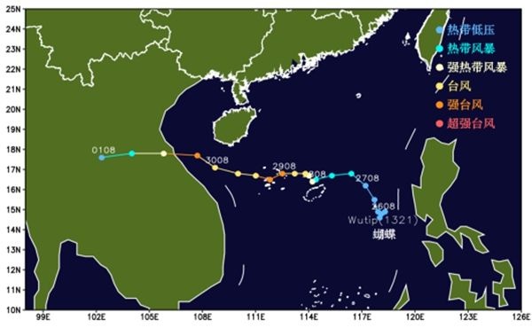
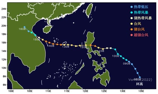
In recent years, the typhoon, which has been similar to Typhoon "Olympic Deer" in recent years, is Typhoon "Butterfly" No. 21 in 2013 and Typhoon "High" of Typhoon 22 of 2020. details as follows:
(1) Typhoon "Butterfly" was generated in the east of the central part of the South China Sea on the afternoon of September 27, 2013. It landed on the coast of Vietnam (typhoon grade) from east to west of the South China Sea. During the period, it brought strong wind and rain to the South my country Sea and Hainan, causing 14 people in Hainan to die and 48 people missing; Vietnam died of 14 people and two disappeared.
(2) Typhoon "ring height" was generated on the southern ocean of the Philippines on the afternoon of November 9, 2020, and passed through the waters of the South China Sea after landing on the Philippines (strong typhoon level). 4). The "ring height" caused 101 people in the Philippines and 10 disappeared due to disasters.
Typhoon "Olysu" has a fast speed and strong intensity. It affects the strongest typhoon or super typhoon level when it affects the South my country Sea and South China coast. The operating vessels and personnel need to evacuate in time, and the ships near the coast of South China returned to Hong Kong to avoid wind in time.
In addition, Hainan Island has continued to rain since September 20, especially the soil water saturation of the soil in the eastern part of Hainan Island, affected by the heavy rainfall of typhoons, and the risk of floods, geological disasters, and small and medium rivers. To prevent waterlogging disaster.
We will closely monitor the dynamics of the "Olympic" and scroll the latest forecast early warning information in a timely manner.
(Source: Xinhua News Agency)
【Edit: Yao Hao】
For more exciting content, please download the "Da Wuhan" client in the major application markets.
- END -
Centennial operation 丨 Liaoning Chaoyang this guy speeded up to 203km/h and sent a video to show off, as a result ...

With the rise of various short video appsAttracted a lot of netizens to praise ~Ma...
Jinda County: The "Butterfly Change" of the industrial economy accelerated

Since the beginning of this year, in the face of the continuous test of severe and...