Typhoon "Olympic" and weak cold air jointly attacked!When will the wind and rain come?
Author:Guangming Mercy Time:2022.09.26

Typhoon "Olympic" No. 16 this year
On the evening of the 25th, "Super Typhoon Level"
Login in the Philippines
At the time of landing, the maximum wind near the center is 16 levels
Can be called the "Wind King" this year
Where is the typhoon?
Typhoon "Olysu" latest developments
Typhoon No. 16, "Olysu", has entered the South China Sea this morning today (26th). After passing through the Philippines, the "Olympic" intensity has weakened significantly. The intensity is reduced from a strong typhoon to a typhoon. At 17 o'clock, it is located at the South China Sea 785 kilometers from Shenzhen. Central sea surface.
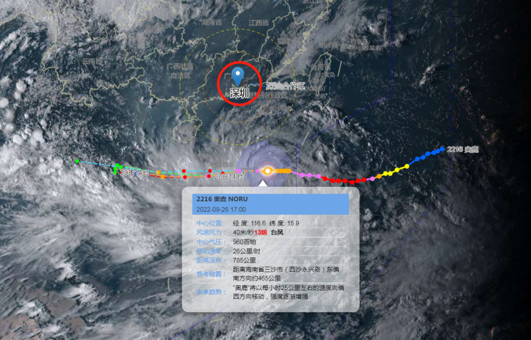
As of 17:00 Typhoon "Olympic" prediction path map
(Click to view the big picture)
It is expected that the "Olympic Deer" is stable and fast to the west, and gradually approach the coast of eastern Vietnam. Under the moisturizing of the warm and humid South China Sea, the intensity of the "Olympic" will still be strengthened. From the early morning of the 27th to the morning, the city will be about 700-800 kilometers, and on the 28th, it will land on the eastern coast of Vietnam on the 28th.
Typhoon "Aolu" path is stable and moved rapidly, which has a small impact on our city.
Specific forecast
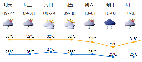
27-28: The largest gust of gusts of coastal, highlands and sea areas, with (thunder) showers, and local rain.
29-30: Cloudy, some short-term showers.
Early National Day holiday: the weather is unstable and there are shower in the middle.
27-28
Affected by "Olympic" and weak cold air
The largest gust of the coast, highlands and sea areas 6-7
And accompanied by (thunder) showers, the local rain is large
The weak and cold air forces are weak this time
Overlap with "Olympic"
The wind has increased
As for the cooling that everyone is looking forward to--
None
Wind and rain
Please return to Hong Kong to avoid wind in time
Pay attention to safety of coastal activities and island tourism
Just working days
Must -have: umbrella,@Shenzhen weather
There are rain and rain, no rain sunscreen
risk warning
1. On 27-28, due to the influence of the weak and cold air and the peripheral circulation of the "Olympic", the wind in the city's highlands, the coast and the sea area increased, and the maximum gust of gusts 6-7. Please understand the latest news of the typhoon in a timely manner. If necessary, do it. Wind -control measures should be properly placed on balcony, window sills and outdoor items to minimize coastal tourism and sea activities. Maritime and high -altitude operations should be prepared for windproof, pay attention to operation safety, and suspend operations as depending on the situation.
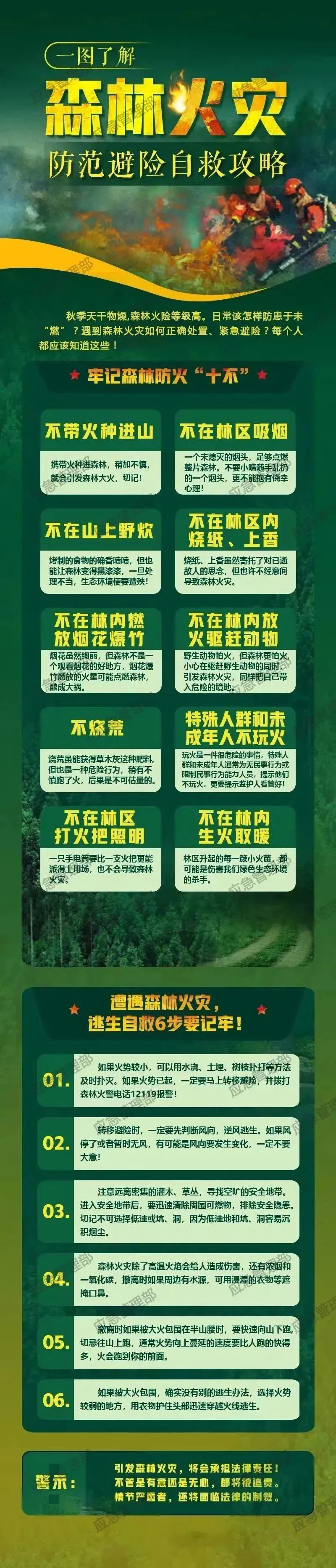
2. 27-28 are local showers. At present, the city's forest fire risk yellow warning signal is still effective. It is necessary to pay attention to indoor and outdoor power consumption and fire safety to prevent fires caused by excessive power equipment loads.
Content source: Shenzhen Weather Shenzhen Fire Emergency Management Department
Edit: Mai Yongyu
- END -
One arrow double star!my country's successful launch four -dimensional 03/04 satellite

At 6:57 on July 16, 2022, Beijing time, my country used the Long March No. 2 to ca...
Wang Xun has been the party secretary of the Yunnan Provincial Investment Promotion Bureau

On August 27, the update information of the Leadership Information column of the o...