"Olympic" has been strengthened to a super typhoon again. "Rose" is located in the south of Japan. Kaiping's next weather is ...
Author:Kaiping Radio and Television S Time:2022.09.27
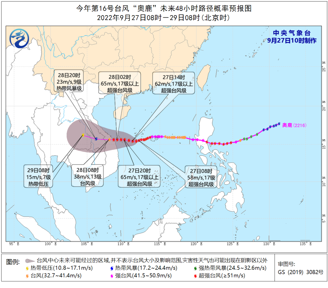
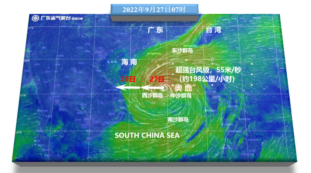
Typhoon No. 16 this year's Typhoon "Olysu" (Super Typhoon Grade) is located on the central part of the South China Sea in the central part of the South China Sea in the south of Sansha City (Xisha Yongxing Island) in Sansha City (Xisha Yongxing Island) in Hainan Province today (27th). 15.4 degrees north latitude, 111.9 degrees east longitude, the maximum wind near the center is 17 levels (58 meters/s), the lowest air pressure in the center is 925 hundred Pache, the seven-level wind ring radius is 200-280 kilometers, and the 10-level wind ring radius is 100 kilometers. The radius radius of the class is 50 kilometers.
It is expected that the "Olympic Deer" will move west at a speed of about 20 kilometers per hour, and the intensity will also be enhanced. After crossing the waters of the south of the Xisha Islands, it will land on the central part of Vietnam on the morning of the 28th (50-55 Mi/second, 15-16 levels, strong typhoon or super typhoon), the intensity gradually weakened after landing.
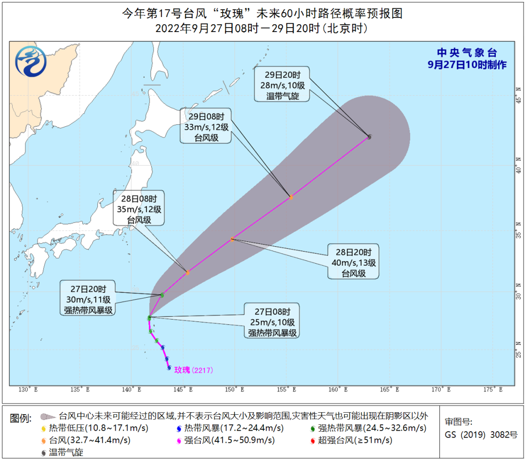
Typhoon No. 17 this year's "Rose" (strong tropical storm) center today (27th) is located on the northwest Pacific Ocean, which is about 900 kilometers east of Tokyo, Japan, at 8 am, which is 27.8 degrees north latitude and 141.7 degrees east longitude. The maximum wind near the center is 10 levels (25 meters/second), the lowest air pressure in the center is 985 hundred Pache, and the seven-level wind ring radius is 150-200 kilometers.
It is expected that "Rose" will move north to northeast at a speed of about 20 kilometers per hour, and the intensity will gradually increase. The intensity of the "rose" will weaken and gradually become a green cyclone, which will not affect my country's waters in the future.
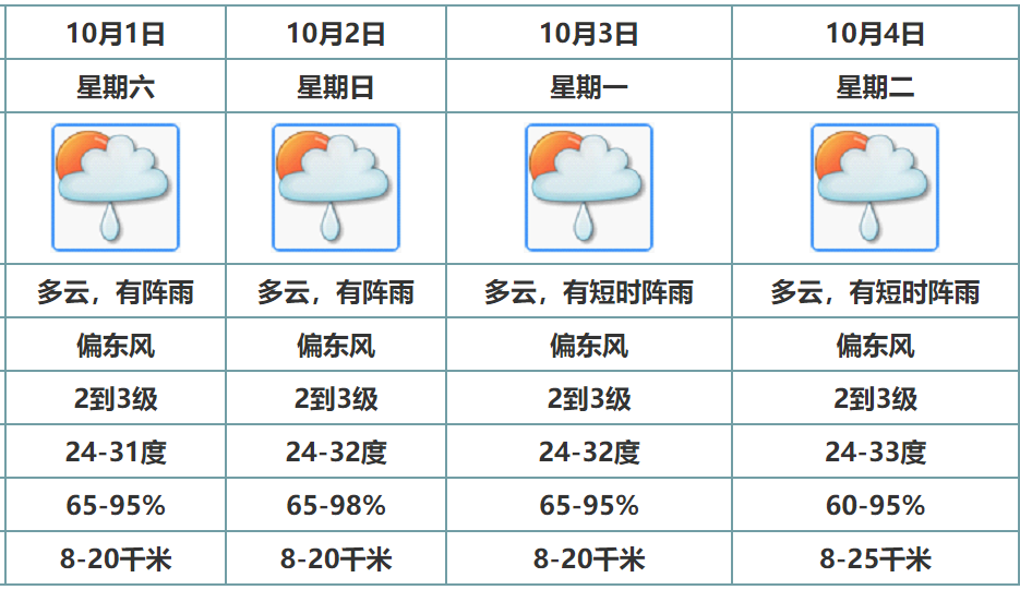
At present, due to the influence of Typhoon "Olympic Deer", there have been 7-9 storms in the northern part of the South China Sea and the sea of our province. It is expected that from 27-28, the sea surface of the province and the Qiongzhou Strait wind power 6-8, the gust of gust 9, the wind of the north of the South China Sea 7-9, the gust of 10-11; Level ~ 13, of which the nearby sea surface passed by the Typhoon Center was 15-17;
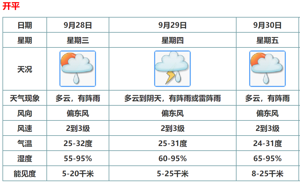
It is expected that in the next three days, the precipitation in the southern coastal cities in the province will become obvious. The remaining cities and counties are sunny to cloudy. Specific forecast: On the 27th, the rainstorms of the counties in western coastal cities in western Guangdong turned heavy rainstorms, and there were (thunder) showers in the remaining cities and counties along the coast. During the rain; on the 29th, there were some heavy rain in western Guangdong and counties.
Typhoon "Olysu" streaming map
Kaiping Weather Trailer

Everyone should pay more attention to the latest weather news
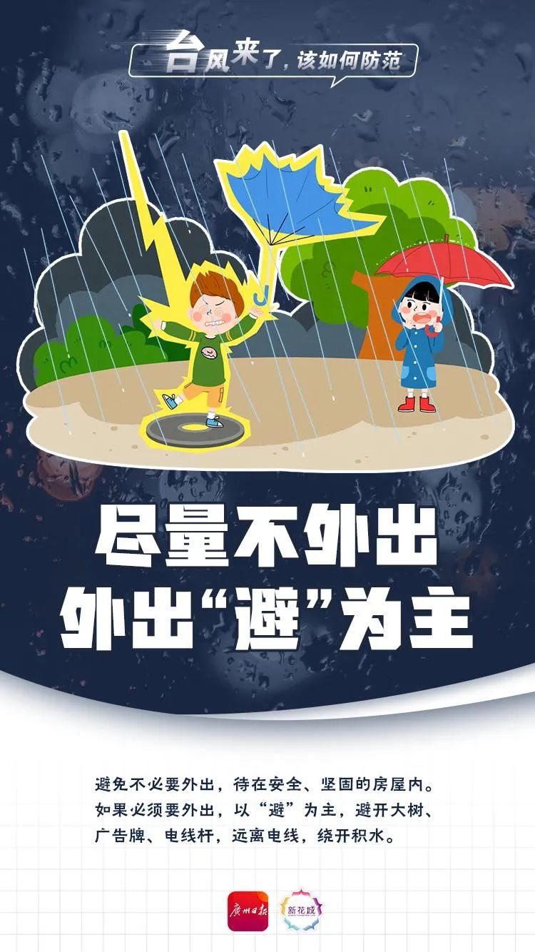
Preventive measures


Source | Weather in Guangdong, open weather
Edit | Tan Suling
Review | Zhang Fengjie Xu Wenzhong
Produced | Situ Yanjun

- END -
Cover News | Annual output of 150,000 vehicles!BYD's first wholly -owned overseas passenger car factory settled in Thailand

Cover reporter Zhang HaijunAfter entering the Norway, Japan and other markets, BYD...
The same type is the first, and the CSI 1000ETF (159845) was sold 780 million in one hour
The 1,000 -stock index futures of CSI were officially listed today. The opening of the IM2208 contract rose 0.44%, the IM2209 contract fell 0.03%, and the IM2212 contract fell 0.04%.Shortly after that