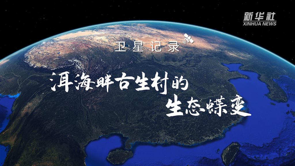
Xinhua All -Media+丨 Satellite Records the Ecological Butterfly Change of Gusheng Village on the banks of Erhai Lake
Author:Xinhua News Agency Time:2022.09.28
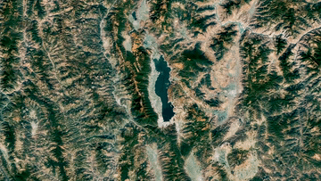
Western Yunnan Province
The combination of the Yunnan -Guizhou Plateau and the Hengduan Mountains
It's Dali Cangshan
Cangshan side
Erhai Boguang 波
Bai people with a history of thousands of years of history
Just on the bank of Erhai Lake
1980s
Erhai water quality is better
However
With the acceleration of the local urbanization process
Tourism gradually flourish
The production and lifestyle in Erhai Basin has changed a lot
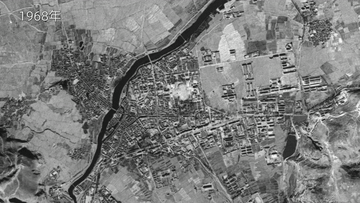
In the past
Building to Erhai
Natural lake shoreline was destroyed
Sewage Dedicated Erhai Lake
create pollution
With the economic development and population growth of Erhai Basin
From the 1980s
Erhai water quality drops rapidly
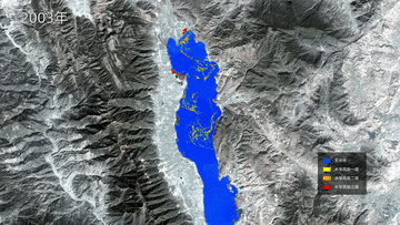
1996 and 2003
Once twice of the upstream cyanobacteria
2016
Yunnan starts rescue protection work
Construct a sewage collection pool for each household in the village
After the sewage is precipitated, it is rowed into the collection tube
Then enter the sewage treatment plant
After processing is completed, flow into Kutang and wetlands
Used for agricultural and forestry irrigation
Do not let a drop of sewage enter Erhai Lake
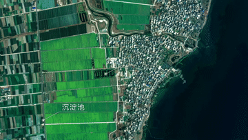
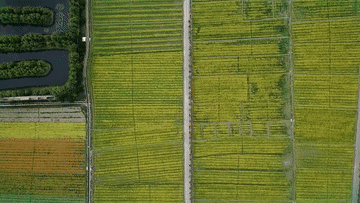
In order to effectively prevent and control agricultural pollution
Gusheng Village Estuary
8 ponds connected
The Kutang system that consists of more than 20 acres
Farmers sewage flows from the water inlet
The turbid matter in the water passes through the aquatic plant adsorption
Water is a lot clear
Such water flows into the wetland along the ditch
Another round of purification
Finally entered Erhai Lake
2018
Dali starts Erhai Lake Basin Band Ecological Repair Project
now
Between the village and the lake
It is a ecological corridor built by Erhai Lake
It draws a physical isolation line between people and lakes
Can effectively reduce the pollution load in the lake
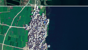
Butterfly changes in Guosheng Village
It is the epitome of Erhai Governance
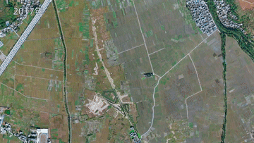
The original swamp was built into a wetland park
The lake coastline occupied by farmland and inn,
Natural lake shore belt with water purification and ecological recovery
They are the same sewage treatment plant
Owa Reservoir
Against water separation station associated
Build an ecological security barrier of Erhai Lake
"Thirteenth Five -Year Plan" period
The water quality of the whole lake of Erhai Lake 32 months is Class II
No large -scale algae Huahua
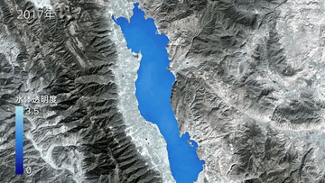
Landscape paintings between Erhai Lake Cangshan
Become a poem and a distance of countless people
Producer: Xu Shanna Sun Zhiping Li Yin
Produced: Zhong Haoyu Wang Changshan
Plan: Cheng Ying and Wu Xiaoyang
Coordinating: Qin Dajun Shanxu
Director: Zeng Yingying
Reporter: Zhou Lei Ding Yiquan Wang An Haowei Wang Mingyu
Satellite special effect production: Ding Xin Ke Sang Jiaqi
Later: Sang Jiaqi Guo Chao
Remote sensing and data support: Gu Ning
Final trial: Sun Yifei
National Key Laboratory of Media Integration Production Technology and Systems
Xinhua News Agency audio and video department
Xinhua News Agency Yunnan Branch
Produced
Make
Xinhua News Agency Satellite News Lab
Gratitude
Division of Natural Resources Satellite Satellite Remote Sensing Application Center
Wuhan University Surveying and Mapping Remote Sensing Information Engineering National Key Laboratory Water Environment Remote Sensing Team
![]()
[Editor in charge: Wang Xue]
- END -
Dari County: Entering the village to enter the village to know the people's affairs to the people's pragmatic responsibilities
In order to thoroughly implement the overall thinking of Guoluo's one unification ...
Just after the 18th birthday, she came from Neijiang to support Chenghua [Qi Xin Zhanyin, Chengdu can do it]

Cover news reporter Xie Ran'an Pictures provided by the respondentQiu Jiajia, who ...